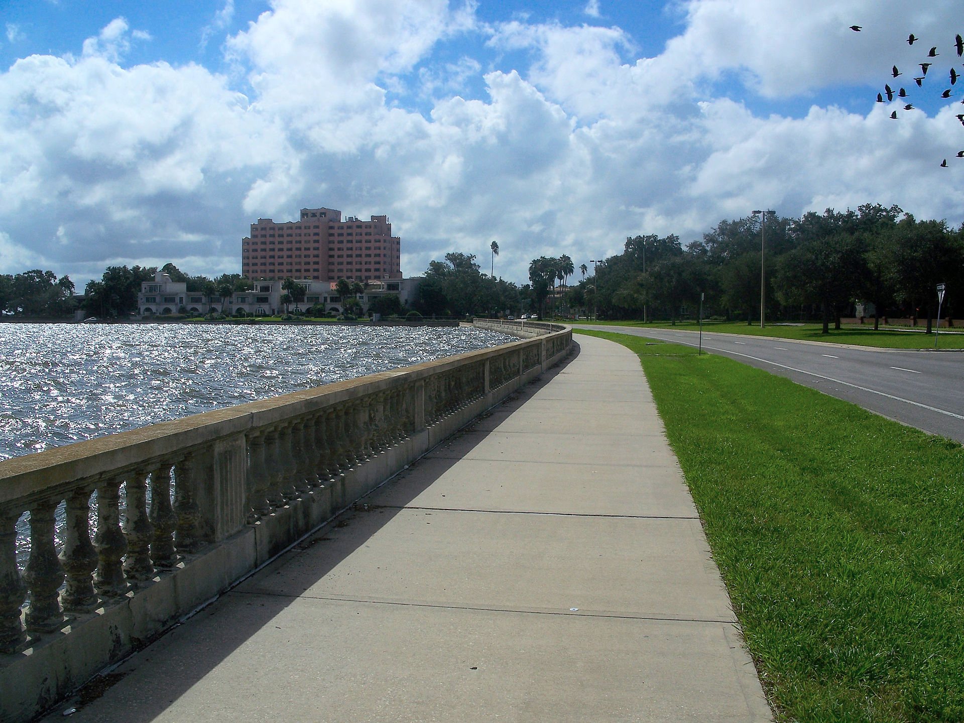
Live in Beach Park
The address most buyers mean when they say Westshore, and 6.9 feet of elevation behind it.
Beach Park is a 1920s land boom subdivision of oaks, curving streets and large lots on the water side of the Interbay peninsula, and it is the address most people are pointing at when they say Westshore. The two are not the same thing. Westshore is the office district north of Kennedy Boulevard, 12.2 million square feet of it, and Beach Park is the residential neighborhood that sits underneath it. The dates are contested: the neighborhood's own published history has the Beach Park Company platting it in 1924 and selling it as the suburb of beautiful homes, while other accounts trace an earlier Beach Park on the Bay subdivision back to 1911. What is not contested is what happened next, which was the collapse of the Florida land boom in late 1926 and a foreclosure rate the neighborhood's history puts at 85 percent through the Depression. It recovered after the war and it has been expensive ever since. The reference point measures 6.9 feet above sea level, Helene and Milton flooded houses here in 2024, and whether any given parcel sits inside a mapped special flood hazard area is a question FEMA's own map answers street by street. The question here is not whether the address is good. It is which side of that line the house is on.
The address people mean by Westshore, and the 6.9 feet under it
Kennedy Boulevard on the north, Beachway Drive on the south, Old Tampa Bay on the west and Lois Avenue on the east, with the Westshore business district immediately north across Kennedy.
When a buyer says Westshore they almost always mean here. Westshore itself is the office district on the other side of Kennedy Boulevard, 12.2 million square feet of it and around 105,000 people working in it, which makes it Tampa Bay's largest employment center and one of the reasons this neighborhood costs what it does. Beach Park is the residential half of that arrangement: oaks, curving streets, deep lots and a mix of 1920s Mediterranean houses with post-war ranches filled in between them, running down to Old Tampa Bay.
The founding date depends on who is telling it. The neighborhood's own published history has the Beach Park Company recording the plat in 1924 under T. Roy Young, William Trice and Wallace Stovall, and selling it as the suburb of beautiful homes; other accounts push an earlier Beach Park on the Bay subdivision back to 1911. The part nobody argues about is what came next. The Florida land boom collapsed late in 1926 with the neighborhood half built, and that history records an 85 percent foreclosure rate through the Depression, houses let for almost nothing by 1929 and streets that had gone back to scrub. It was the post-war boom that finished the place, which is why two houses on the same block can be twenty-five years apart in age and completely different in how they are built.
The reference point measures 6.9 feet above sea level, which is the lowest of the South Tampa guides on this site and about thirteen feet below Hyde Park's. A neighborhood average is not much use at that height, because the drop toward the bayous and the bay happens across a few hundred meters. Helene and Milton flooded houses here in September and October 2024, and Helene did it without coming anywhere near Tampa. Whether a specific parcel sits inside a mapped special flood hazard area is a question FEMA's map answers street by street, and it is a question with a mortgage attached, because a lender will require flood cover inside one.
A federal rule can turn a repair into a rebuild. Where the cost of repairing a structure exceeds half its value, it has to be brought up to current floodplain and building standards, which on a low 1920s house usually means lifting it. Tampa began working through substantial damage determinations for owners in its flood hazard areas in 2025, and the existence or absence of one on a particular house is a document you ask for by name rather than hope to find in a listing. So is the elevation certificate, and so is the claims history.
What you get for accepting all that is a genuinely rare combination in this metro: a canopied, low-density, expensive residential neighborhood roughly six kilometers from Tampa International Airport, three from the region's main shopping center, and inside the Grady, Coleman and Plant school sequence. The tax arithmetic is the ordinary Tampa one at 19.8428 mills. The insurance arithmetic is not, and it is the number that has been moving.
- Get the elevation certificate for this house, not a figure for Beach Park
- Ask whether the property has a substantial damage determination from the 2024 storms, and for the claims history
- Check the parcel on FEMA's flood map yourself, because the lender will
- Price flood and windstorm cover before you go under contract, not after
- The homeowners association's documents sit behind a members' portal, so ask the seller for the deed restrictions rather than assuming there are none
- Confirm the Grady and Coleman boundaries for the specific address; Hillsborough reviews them
How Beach Park got here
- 1911One account of the neighborhood's beginnings puts the first Beach Park on the Bay subdivision here, laid out with man-made canals and bayous.
- 1924The Beach Park Company, led by T. Roy Young with William Trice, Wallace Stovall and others, records the plat and advertises it as the suburb of beautiful homes.
- 1926The Florida land boom ends late in the year, with the neighborhood only part built.
- 1930sThe Depression takes most of it. The neighborhood's own history records an 85 percent foreclosure rate and houses standing empty in what had gone back to woodland.
- 1940sThe post-war boom finishes the neighborhood, adding ranch and mid-century houses among the 1920s Mediterranean stock.
- 2024Helene in September and Milton in October bring the largest storm surge on the bay's record. Houses near the water flood, and some are destroyed.
- 2025The City of Tampa starts posting substantial damage assessment letters to owners in its flood hazard areas, which is how a repair becomes a rebuild.

Cypress Point, Al Lopez, and the seawall on the other coast
Beach Park has very little public open space of its own: the water frontage here is private, and the bayous are somebody's back garden. The nearest real park is Cypress Point Park on Old Tampa Bay, with a beach, a mangrove boardwalk and a dog park. Al Lopez Park north east of the neighborhood has the trails and playing fields. For the walk everyone actually talks about, it is Bayshore Boulevard, which is on the far side of the peninsula and a drive rather than a stroll.
What the map does not show: the oak canopy is the amenity, and it is unevenly distributed. Streets that kept their trees are noticeably cooler in July than streets that were cleared and rebuilt, which is worth walking on a hot afternoon rather than judging from a listing photograph in February.
Elsewhere in Tampa, not Beach Park


22 places, with real drive times
Road-adjusted distance and drive time from the centre of the community to each destination, nearest first. Filter by category.
Showing 1–12 of 22 places, nearest first.
Method: distances and drive times are computed from the City of Tampa boundary's centroid, using straight-line distance multiplied by a road factor and a tiered speed model: honest ranges, not routed times. Beach Park has no rail and thin bus service, so every figure here assumes a car.
Every gym within reach
There is no municipal recreation center inside the neighborhood. What there is instead is a dense commercial market immediately north in Westshore, where a hundred thousand office workers support more studios and gyms than a residential district of this size ever would, plus Cypress Point Park and Al Lopez Park for anything outdoors.
- About four kilometers north west, on the bay side rather than the neighborhood side
- Al Lopez Park has the trails, the lake and the playing fields
- Bayshore Boulevard is the long flat run, across the peninsula
- The Westshore studio market is priced for an office district, which is to say not cheaply
| Facility | What it is | Drive |
|---|---|---|
| Cypress Point Park open | The nearest public open ground on the water, with a beach, a boardwalk and space to run. Free, and the honest answer for most people here. | 5–8 min |
| Al Lopez Park open | The large city park north east of the neighborhood, with trails, a lake and playing fields. | 11–16 min |
| Bayshore Boulevard open | Not a gym: four and a half miles of flat, lit seawall sidewalk on the other side of the peninsula, and the weekend run. | 8–12 min |
The free option is Cypress Point, and in winter it is the best hour in the neighborhood. In August it is exposed and it is a mosquito coast, so early or not at all.
Grady, Coleman and Plant, and the premium in the price
Most Beach Park addresses are assigned to Grady Elementary, then Coleman Middle and Plant High, a sequence among the most sought-after in Hillsborough County and one that is straightforwardly capitalised into what houses sell for inside it. Hillsborough also runs magnet, career and International Baccalaureate programs county-wide, and South Tampa has an unusually large independent sector alongside.
| School | Board | Note |
|---|---|---|
| Grady Elementary School | Hillsborough County Public Schools | The assigned public elementary for most Beach Park addresses. Hillsborough assigns by address and reviews its boundaries, so check the specific house rather than the neighborhood. |
| Coleman Middle School | Hillsborough County Public Schools | The assigned middle school, and one of the most sought-after in the county. The catchment premium is real and it is in the price of the houses inside it. |
| Plant High School | Hillsborough County Public Schools | The assigned high school for most of South Tampa, on the river. Its boundary is among the most closely watched in Hillsborough. |
| Hillsborough's choice program | Hillsborough County Public Schools | Magnet, career and International Baccalaureate programs run county-wide alongside assignment, applied for in the district's own window rather than bought with an address. |
| Independent schools | Independent | South Tampa has an unusually large independent sector for a city this size, and several long-established day schools are within a short drive of Beach Park. |
Because the premium is real, the boundary is the thing to verify rather than assume. Check the specific address in the district's boundary lookup before you pay for a catchment: Hillsborough reviews attendance boundaries, and a street can move.
Month by month, what living here looks like
Not a highlights reel: the actual annual rhythm, including the dates residents have to remember.
- Highs around 22 °C and lows in the low teens: the driest, mildest stretch of the year
- The oaks and the water make this the month the neighborhood is sold on
- Peak season, and the Westshore hotels north of Kennedy fill up
- The pirate parade takes over Bayshore Boulevard and much of the center for a weekend
- Still dry and mild, and the best month of the year to be outside
- Expect the drive east across the peninsula to be slow on parade day
- Warming into the high twenties, with humidity returning late in the month
- Spring training baseball across the bay area
- 1 March is the deadline to file for the homestead exemption in the year after you buy
- Warm, still mostly dry, and the last comfortable month before the air changes
- Insurance renewals cluster before hurricane season: get quotes now, not in June
- On a house this low, the elevation certificate is the document that sets the flood premium
- The rainy season begins, usually in the second half
- Afternoon thunderstorms become a daily fixture rather than an event
- Tampa Bay is among the most lightning-prone places in the United States
- Atlantic hurricane season runs 1 June to 30 November
- Most of the neighborhood evacuates early, because most of it is in a special flood hazard area
- Check the flood policy renewal date, the seawall and where the water went in 2024
- The hottest and one of the wettest months
- The oak canopy makes a genuine difference to the streets that have it
- Outdoor life moves to early morning and after dark
- Peak humidity and the start of the serious part of hurricane season
- King tides show on the low western streets with no storm involved
- Worth walking the block you are buying on at a high tide before you commit
- Statistically the peak of Atlantic hurricane activity, and the month Helene came in 2024
- Binding restrictions mean you often cannot buy a new policy with a named storm in the Gulf
- Ask what this street did in Helene, and whether the house has a substantial damage determination
- The rains taper off and the humidity finally breaks
- Still hurricane season: Milton arrived in October 2024, two weeks after Helene
- The best month on the water once the season goes quiet
- Hurricane season ends on 30 November and the dry season starts
- Comfortable enough to be outside all day again
- Snowbird traffic returns and Westshore gets busier
- Warm days, cool evenings and almost no rain
- Peak season proper begins
- The pay-off for August
15 more photographs of Tampa and the region
Drawn from the site's shared, freely licensed Tampa photo library, not photographs of Beach Park itself. Filter by category.


Showing 1–12 of 15 photographs.
About these photographs. Openly licensed images from the site's shared Tampa library, found on Wikimedia Commons and served from there with full attribution. None of them is presented as a photograph of Beach Park.