
Live in Ballast Point
The quiet end of the peninsula, where the pier is the neighborhood's center of gravity and MacDill is the fence at the bottom of it.
Ballast Point is named for what ships did here: deep-draft vessels reaching the shallows at the south end of the Interbay peninsula had to drop their ballast overboard before they could work their way up to Fort Brooke, and by the early 1820s the spot had a name. It became a destination in the 1890s, when Emelia Chapin, whose company ran the city's first electric streetcars, built a pavilion and a pier at the end of the line and called the place Jules Verne Park after the novelist who had chosen Tampa as his launch site. The pavilion is long gone, burned in the 1920s after a hurricane, a repair and a short-lived Ferris wheel. The pier is still there, rebuilt and reopened in 1925, closed since spring 2025 while the city repairs what Helene and Milton did to it. What surrounds it now is a low, quiet, mostly post-war residential neighborhood that Tampa took inside its limits in 1953 and MacDill Air Force Base filled with people. The reference point measures 8.1 feet above sea level, and the base is the southern boundary, which are the two facts that shape everything else here.
The end of the peninsula, and the two things that fix its price
Gandy Boulevard on the north, MacDill Air Force Base on the south, Hillsborough Bay on the east and South MacDill Avenue on the west, at the southern end of the Interbay peninsula.
The name is a description of work. Deep-draft ships coming into Hillsborough Bay hit the shallows at the south end of the Interbay peninsula and had to put their ballast over the side before they could reach Fort Brooke, and by the 1820s the spot was known for it. In October 1863 a Union landing party came ashore near what is now Gandy and Bayshore, walked inland and burned two blockade runners. The recreational version arrived in the 1890s, when Emelia Chapin, whose company ran Tampa's first electric streetcars, put a pavilion and a pier at the end of the line and named the grounds Jules Verne Park, because Verne had picked Tampa as his launch site. It became Ballast Point Park in 1903.
The pier is still the center of the neighborhood, and it is currently shut. The 1921 Tarpon Springs hurricane destroyed the first one; the replacement reopened in April 1925 and is what stands today, six hundred feet of it. Helene and Milton damaged it badly enough in 2024 that the city closed it, along with the Joe Abrahams Fitness Center in the same park, in spring 2025. The fitness center has reopened with new equipment. Restoration of the pier began in September 2025, and the city has published no completion date, so anyone buying here on the strength of a walk out over the water should treat that as a promise the calendar has not yet kept.
The other fixed fact is the fence at the bottom of the map. MacDill Air Force Base is the southern boundary, and it is why the neighborhood filled in through the 1950s after Tampa took it inside the city limits in 1953. That produces an unusual housing stock for South Tampa: modest post-war houses on generous lots, a fair number rebuilt or heavily enlarged, mixed with older waterfront places nearer the point. It also produces aircraft overhead. That is a matter of taste and tolerance rather than a defect, but it is one you establish by standing on the street rather than by reading about it.
The elevation is 8.1 feet at the reference point, and the ground falls toward the bay from there, so the useful question is again which parcel rather than which neighborhood. Flood cover is a separate policy from the homeowners figure, a lender will require it inside a mapped special flood hazard area, and the premium is rated on the building rather than the postcode, which is what makes the elevation certificate the first document to ask for on anything near the seawall.
What you get in exchange is the cheapest way into South Tampa's waterfront, a school sequence that is genuinely good but is not the Plant one that prices Tampa's northern peninsula, and a neighborhood where the shops are a 1950s plaza on Dale Mabry rather than anything you would put in a brochure. It is quieter than Hyde Park, further from everything, and costs accordingly.

- Visit on a weekday when aircraft are operating, not on a quiet Sunday
- Get the elevation certificate for the specific parcel, and the claims history with it
- Ask whether the property has a substantial damage determination from the 2024 storms
- Check the assigned schools for the address: this is Ballast Point, Madison and Robinson, not the Plant sequence
- Treat the pier as closed until the city says otherwise, because no completion date has been published
- Price flood and windstorm cover before you go under contract
How Ballast Point got here
- 1820sThe point takes its name from the ballast that deep-draft ships dropped here, at the edge of the shallows, before they could reach Fort Brooke.
- 1863A Union landing party comes ashore near what is now Gandy and Bayshore on 18 October, marches inland and burns two blockade runners, the Scottish Chief and the Kate Dale.
- 1890sEmelia Chapin, whose company ran Tampa's first electric streetcars, builds a pavilion and a pier and opens the grounds as Jules Verne Park. Accounts put the streetcar reaching the point in 1892 or 1893.
- 1903The grounds are renamed Ballast Point Park, for the maritime history rather than the novelist.
- 1921The Tarpon Springs hurricane destroys the pier and damages the pavilion. A Ferris wheel arrives in 1922 and is gone by 1924, and fire takes the pavilion soon after.
- 1925The rebuilt pier reopens in April, and it is the structure still standing a century later.
- 1953Ballast Point is brought inside the City of Tampa. Building through the following decade follows the growth of MacDill on the other side of the southern boundary.
- 2024Helene in September and Milton in October bring the largest storm surge on the bay's record. The pier and the park's fitness center close, and restoration of the pier starts in September 2025.
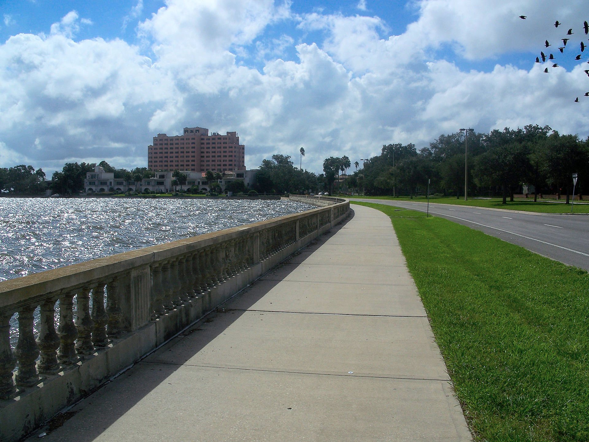
Ballast Point Park, Gadsden, and the greenway
Ballast Point Park at 5300 Interbay Boulevard is the neighborhood's front room: a boat ramp open around the clock, a splash pad, a playground, shelters, a gazebo and the pier. The park itself runs 6am to 8pm. West of here, Gadsden Park carries the ball diamonds, the dog park and the South Tampa Greenway, and across the peninsula Picnic Island Park has a beach and a dog beach past the port terminals.
What the map does not show: the pier has been closed since spring 2025 and the restoration started in September of that year with no published finish date. Everything people say about walking out over the water at sunrise is about a structure that is behind a barrier right now, so ask the city where the work has got to rather than assuming.
Elsewhere in Tampa, not Ballast Point


22 places, with real drive times
Road-adjusted distance and drive time from the centre of the community to each destination, nearest first. Filter by category.
Showing 1–12 of 22 places, nearest first.
Method: distances and drive times are computed from the City of Tampa boundary's centroid, using straight-line distance multiplied by a road factor and a tiered speed model: honest ranges, not routed times. Bayshore Boulevard is a corridor rather than a point, so its figure is measured to a mid-corridor location even though the seawall starts at the neighborhood's own northern edge.
Every gym within reach
This is one of the few Tampa neighborhoods with a municipal fitness center inside it. The Joe Abrahams Fitness Center sits in Ballast Point Park, closed in spring 2025 with hurricane damage and reopened since with new equipment. Beyond it, Gadsden Park has the fields and the greenway, and Bayshore Boulevard begins at Gandy for the long flat run.
- In Ballast Point Park, a few minutes from most of the neighborhood
- Reopened with updated equipment after the 2024 storm damage
- The pier beside it is still closed, so the sunrise walk is not currently available
- Gadsden Park and the South Tampa Greenway are the outdoor alternative
| Facility | What it is | Drive |
|---|---|---|
| Joe Abrahams Fitness Center open | The city fitness center at Ballast Point Park. It closed in spring 2025 with hurricane damage and has since reopened with new equipment. | 3–5 min |
| Gadsden Park open | Playing fields, a dog park and the South Tampa Greenway trail, west of the neighborhood. | 6–8 min |
| Bayshore Boulevard open | Not a gym: the seawall sidewalk begins at the neighborhood's northern edge and runs four and a half miles, flat and lit the whole way. | 9–13 min |
| Ballast Point pier closed | Closed since spring 2025 for repair of the damage Helene and Milton did. Restoration began in September 2025 and the city has not published a completion date. | 3–5 min |
The free option is Bayshore Boulevard, flat and lit for four and a half miles, and it starts at the top of this neighborhood rather than somewhere you have to drive to.
Ballast Point, Madison and Robinson, which is not the Plant sequence
Addresses here are assigned to Ballast Point Elementary, inside the neighborhood, then Madison Middle and Robinson High, which is an International Baccalaureate school. That is a strong sequence, and it is a different one from the Gorrie, Wilson and Plant run that sets prices four kilometers north. Hillsborough also operates magnet, career and IB programs county-wide, applied for in the district's window rather than bought with an address.
| School | Board | Note |
|---|---|---|
| Ballast Point Elementary School | Hillsborough County Public Schools | The assigned public elementary, inside the neighborhood. Hillsborough assigns by address and reviews its boundaries, so confirm the specific house. |
| Madison Middle School | Hillsborough County Public Schools | The assigned middle school for Ballast Point addresses, west of the neighborhood. |
| Robinson High School | Hillsborough County Public Schools | The assigned high school, and an International Baccalaureate school. Not Plant, which is the point worth making: the sequence here is Ballast Point, Madison and Robinson, and it is priced differently from the Hyde Park one. |
| Hillsborough's choice program | Hillsborough County Public Schools | Magnet, career and International Baccalaureate programs run county-wide alongside assignment, applied for in the district's own window rather than bought with an address. |
| Families posted to MacDill | Hillsborough County Public Schools | Assignment follows the address like anyone else's, and a posting is not a placement. If you are moving in on orders, run the district's boundary lookup against the actual rental or purchase before you sign. |
A posting to MacDill is not a school placement. Whether you are arriving on orders or buying outright, run the specific address through the district's boundary lookup before you sign, because Hillsborough reviews attendance boundaries and this end of the peninsula sits near the edge of several.
Month by month, what living here looks like
Not a highlights reel: the actual annual rhythm, including the dates residents have to remember.
- Highs around 22 °C and lows in the low teens: the driest, mildest stretch of the year
- Sunrise over Hillsborough Bay from the point, which is the reason people walk down there
- Peak season, and the quietest the neighborhood's streets get
- The pirate flotilla forms up off this end of the bay before it heads north to the parade
- Still dry and mild, and the best month of the year to be outside
- Bayshore Boulevard closes for the parade, which is the road out of here
- Warming into the high twenties, with humidity returning late in the month
- MacDill's air show falls in some springs, and the aircraft are directly overhead
- 1 March is the deadline to file for the homestead exemption in the year after you buy
- Warm, still mostly dry, and the last comfortable month before the air changes
- Insurance renewals cluster before hurricane season: get quotes now, not in June
- On a low house near the bay the elevation certificate is what sets the flood premium
- The rainy season begins, usually in the second half
- Afternoon thunderstorms become a daily fixture rather than an event
- Tampa Bay is among the most lightning-prone places in the United States
- Atlantic hurricane season runs 1 June to 30 November
- This end of the peninsula evacuates early, and there is one way north off it
- Check the flood policy renewal date and what the block did in 2024
- The hottest and one of the wettest months
- The bay breeze at the point is real and it is the reason people are on the seawall at 7am
- Outdoor life moves to early morning and after dark
- Peak humidity and the start of the serious part of hurricane season
- King tides show along the seawall with no storm involved
- Worth watching where the water stands on the street you are buying on
- Statistically the peak of Atlantic hurricane activity, and the month Helene came in 2024
- Helene and Milton closed the pier and the park's fitness center, which is what a surge does to public assets as well as houses
- Binding restrictions mean you often cannot buy a new policy with a named storm in the Gulf
- The rains taper off and the humidity finally breaks
- Still hurricane season: Milton arrived in October 2024, two weeks after Helene
- The best month on the water once the season goes quiet
- Hurricane season ends on 30 November and the dry season starts
- Comfortable enough to be outside all day again
- Snowbird traffic returns to Bayshore and Dale Mabry
- Warm days, cool evenings and almost no rain
- Peak season proper begins
- The pay-off for August
14 more photographs of Tampa and the region
Drawn from the site's shared, freely licensed Tampa photo library, not photographs of Ballast Point itself. Filter by category.


Showing 1–12 of 14 photographs.
About these photographs. Openly licensed images from the site's shared Tampa library, found on Wikimedia Commons and served from there with full attribution. None of them is presented as a photograph of Ballast Point.