
Live in Riverside Heights
Twenty feet of ground inside a bend of the Hillsborough River, two miles from downtown, on a 1920s grid that is being bought and rebuilt house by house.
Riverside Heights is a small grid of 1920s bungalows and masonry cottages held inside a bend of the Hillsborough River, between Martin Luther King Jr. Boulevard and Columbus Drive, about two miles north of downtown Tampa. The City of Tampa's neighborhoods layer gives it 446 acres, one registered civic association and the ZIP code 33603, and that is close to the whole of the official record: nothing at this scale is published by the Census Bureau, so any population or price figure you read about Riverside Heights comes from a listings site rather than from a count. What can be measured is the ground. The reference point stands at 20.6 feet above sea level on the USGS elevation model, which is low against Seminole Heights at 48.8 feet and high against almost everything south of downtown, and it sits beside a river that is tidal this far up. The water is not the main question here. The turnover is: the 1920s stock is coming down fast enough that a buyer is choosing between a cottage and the new house going up next door to it.
A river bend, a 1920s grid, and nothing protecting it
West Martin Luther King Jr. Boulevard on the north, West Columbus Drive on the south, North Boulevard on the east and the Hillsborough River on the west, as the City of Tampa's neighborhoods layer draws it.
Riverside Heights is 446 acres held inside a bend of the Hillsborough River, bounded by Martin Luther King Jr. Boulevard, Columbus Drive, North Boulevard and the water. It was platted and built out in the 1920s, in Craftsman bungalows and small masonry cottages, and it sits between two better known neighborhoods: Tampa Heights to the south and Seminole Heights to the north. The City lists one registered civic association here, meeting at the Franciscan Center on North Perry Avenue in even-numbered months, and the ZIP code 33603.
The measured ground is 20.6 feet above sea level at the reference point this guide uses. That is a middling number for Tampa and it is the right way round: against 48.8 feet in Seminole Heights it is low, and against 8.8 in the Channel District it is high. What it does not settle is flood, because the Hillsborough is tidal this far upstream and the west side of the grid runs down to it. Flood zone is set map panel by map panel and priced address by address, so the number that matters is the one on the elevation certificate for the specific house, not the one for the neighborhood.
Very little else about this place is actually published. The Census Bureau reports nothing at the scale of a named neighborhood, so the population and median price figures that circulate for Riverside Heights come from listings sites rather than from a count or an assessment roll. That is worth saying plainly rather than repeating: if you want a price signal here, pull the sold records for the specific blocks you are considering off the Property Appraiser, because the blocks differ from each other more than the neighborhood differs from its neighbors.
Nothing here protects the streetscape. Tampa has designated four local historic districts and this is not one of them: Ybor City, Hyde Park, Tampa Heights and Seminole Heights are, which is why their 1920s stock still reads as 1920s stock. Nothing reviews a façade in Riverside Heights. A 1926 cottage next to you can come down and a two-story house can go up on the lot, and that is happening street by street. Buy the bungalow if you want the bungalow, and understand that the block around it is not fixed.
The practical position is ordinary City of Tampa arithmetic: 19.8428 mills on the 2025 roll and about 1.77% of price for a homesteaded buyer once the exemption lands, which is the same figure carried on the Tampa hub. Insurance is where the age of the house shows up. Get a wind mitigation report before you make an offer, because on stock that predates the 1994 code the roof, the openings and the shutters move the premium more than the price does. There is no rail and no streetcar: this is a bus and car neighborhood two miles from the office towers.
- Riverside Heights is not one of Tampa's four local historic districts, so no commission passes on a façade or a demolition here
- Pull the elevation certificate and the FEMA panel for the specific address: the west of the grid runs down to a tidal river
- Get a wind mitigation report before offering; on pre-1994 stock it moves the premium more than anything else
- Ask the Property Appraiser for sold records block by block. No published series covers a neighborhood this small
- The City lists stormwater drainage improvements and street resurfacing as active projects here, so expect works
- Walk the block in a summer downpour if you can. Rain, not tide, is what puts water on these streets most years
How Riverside Heights got here
- 1920sThe grid west of North Boulevard is platted and built out through the Florida land boom, in Craftsman bungalows and masonry vernacular cottages.
- 1926The land boom collapses. Building here stops and then restarts slowly, which is why the stock reads as one decade with a long tail.
- 1960sThe interstate goes through Tampa Heights immediately east and postwar money moves north and west. The inner neighborhoods lose value for thirty years.
- 2018Armature Works opens in the converted streetcar barn on the river a mile and a half south, and the river corridor becomes somewhere people drive to.
- 2020sTeardowns and two-story new construction arrive street by street. There is no local historic district here and no design review, so the pace is set by what a lot is worth.
- 2024Helene and Milton reprice elevation across the metro. Nothing in this neighborhood is oceanfront, but the Hillsborough River is tidal here and the storms made that a question buyers now ask.
- 2026The City lists stormwater drainage improvements and street resurfacing as active capital projects in Riverside Heights, and the civic association as registered and active.

Duran, Plymouth and the Hillsborough
The open space here is domestic rather than grand. Duran Park on North Perry Avenue and Plymouth Park are neighborhood parks with oaks, shade and playgrounds, and they are walkable from most of the grid, which is the part that matters. The bigger public space is the river itself: Rivercrest Park upstream, Julian B. Lane Riverfront Park and its boathouse opposite downtown, and the Tampa Riverwalk two miles down the same water.
What the map does not show: the oak canopy is the reason these streets are tolerable in August and the reason tree work is a standing cost. A large oak over a 1920s roof is a maintenance commitment, and limbs come down every summer.
Elsewhere in Tampa, not Riverside Heights


20 places, with real drive times
Road-adjusted distance and drive time from the centre of the community to each destination, nearest first. Filter by category.
Showing 1–12 of 20 places, nearest first.
Method: distances and drive times are computed from a representative point in the neighborhood, using straight-line distance multiplied by a road factor and a tiered speed model: honest ranges, not routed times. There is no rail and no streetcar stop here, so the drive column is the honest one, and Armature Works at two kilometers is the nearest thing to a high street.
Every gym within reach
There is no public recreation center inside the neighborhood. Duran Park and Plymouth Park carry the local provision, Julian B. Lane Riverfront Park has the community center, courts and rowing on the Hillsborough, and the flat shaded grid is the practical running route for most of the year.
- Duran Park is the walkable one: oaks, open ground and a playground on North Perry Avenue
- Plymouth Park is smaller and shaded, and reads as a playground rather than a destination
- Rivercrest Park upstream has courts and room to run
- Rowing on the Hillsborough runs out of the Julian B. Lane boathouse, three kilometers south
| Facility | What it is | Drive |
|---|---|---|
| Duran Park open | The neighborhood park on North Perry Avenue: oaks, a playground and open ground. Walkable from most of the grid, which is the point. | 2–4 min |
| Plymouth Park open | The smaller of the two neighborhood parks, shaded, with a playground. | 2–3 min |
| Rivercrest Park open | The nearest park with courts and room to run, upstream on the river. | 5–8 min |
| Julian B. Lane Riverfront Park open | The rebuilt riverfront park opposite downtown, with a community center, courts and a boathouse for rowing on the Hillsborough. | 5–8 min |
The free option is the grid itself. It is flat, shaded and short on through traffic, which is worth more here from June to September than any membership.
Zoned to a magnet and to an IB school
For 2026-27 the district zones this point to Graham Elementary on North Massachusetts Avenue inside the neighborhood, Stewart Middle Magnet on West Spruce Street, and Hillsborough High in Seminole Heights, the 1928 building that runs one of the most contested International Baccalaureate programs in the county.
| School | Board | Note |
|---|---|---|
| Graham Elementary School | Hillsborough County Public Schools | The assigned elementary school for this point in the district's 2026-27 zones, on North Massachusetts Avenue inside the neighborhood. Zones are drawn address by address, so check the specific house. |
| Stewart Middle Magnet School | Hillsborough County Public Schools | The assigned middle school for 2026-27. It is also a magnet, which means part of its intake applies from across the county and the zoned place is the one you are buying. |
| Hillsborough High School | Hillsborough County Public Schools | The assigned high school for 2026-27: the 1928 building in Seminole Heights, one of the oldest in Florida, and an International Baccalaureate school whose IB places draw applicants from well outside the zone. |
| Hillsborough's choice program | Hillsborough County Public Schools | Magnet, career and IB programs run county-wide alongside assignment. Applications open in a fixed window, and living in the zone helps for the school but decides nothing about the program. |
| Private and parochial schools | Independent | A modest independent sector serves this part of the city, mostly parochial and mostly a short drive south or north. |
Hillsborough County Public Schools assigns by address and runs magnet, career and IB programs county-wide alongside. Check the specific address in the district's zone locator rather than trusting a neighborhood name, and apply in the choice window: a zoned seat at Hillsborough High is not a seat in its IB program.
Month by month, what living here looks like
Not a highlights reel: the actual annual rhythm, including the dates residents have to remember.
- Highs around 22 °C and lows in the low teens: the driest, mildest stretch of the year
- The month the 1920s porches on this grid were designed for
- Peak season for visitors, and the easiest month to walk the river parks
- The Gasparilla pirate invasion and parade close the waterfront and much of the center
- Still dry, still mild, and the best month for anything outdoors
- Two miles from the parade route is close enough to hear it and far enough to park
- Warming into the high twenties, with humidity returning late in the month
- Spring training baseball across the bay area
- Strawberry season in Plant City, forty kilometers east
- Warm, still mostly dry, and the last month before the air changes
- Insurance renewals cluster before hurricane season: get quotes now, not in June
- On a 1920s roof a wind mitigation report moves the premium more than the price does
- The rainy season begins, usually in the second half of the month
- Afternoon thunderstorms become a daily fixture rather than an event
- Tampa Bay is among the most lightning-prone places in the United States
- Atlantic hurricane season runs 1 June to 30 November
- Daily storms and high thirties with humidity
- Oak limbs come down in summer storms, and the tree work on this grid is not optional
- The hottest and one of the wettest months
- Outdoor life moves to early morning and after dark
- The river breeze on the west side of the neighborhood is a real and small advantage
- Peak humidity and the start of the serious part of hurricane season
- Rain, not tide, is what puts water on streets here: watch how the block drains in a downpour
- The quietest month for restaurants across the river corridor
- Statistically the peak of Atlantic hurricane activity, and the month Helene came in 2024
- Binding restrictions mean you often cannot buy a new policy with a named storm in the Gulf
- The Hillsborough is tidal this far up, so a surge event is a river question here, not a beach one
- The rains taper off and the humidity finally breaks
- Still hurricane season: Milton arrived in October 2024, two weeks after Helene
- The best month of the year to be on the river
- Hurricane season ends on 30 November and the dry season starts
- Comfortable enough to be outside all day again
- The civic association meets in even-numbered months, so November is not one of them
- Warm days, cool evenings and almost no rain
- Peak season proper begins
- The pay-off for August
14 more photographs of Tampa and the region
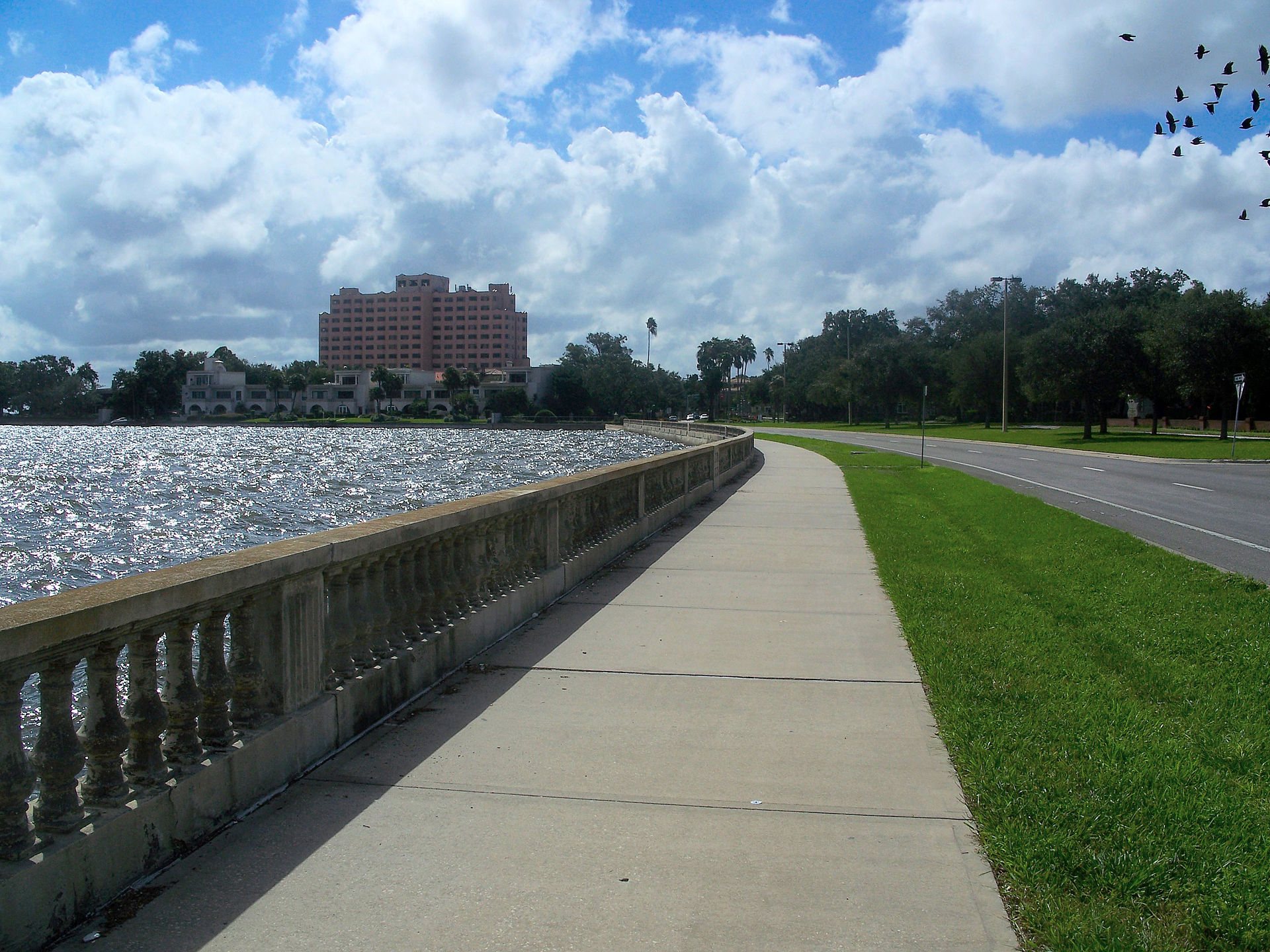
Drawn from the site's shared, freely licensed Tampa photo library, not photographs of Riverside Heights itself. Filter by category.



Showing 1–12 of 14 photographs.
About these photographs. Openly licensed images from the site's shared Tampa library, found on Wikimedia Commons and served from there with full attribution. None of them is presented as a photograph of Riverside Heights.