
Live in Davis Islands
Ground that did not exist before 1924, the lowest reference point in this set of guides at 5.2 feet, and one bridge on and off it.
Davis Islands is made ground. In 1924 D. P. Davis dredged the bottom of Hillsborough Bay onto two mangrove keys called Little Grassy and Big Grassy, laid out a Mediterranean Revival resort suburb on the fill, and sold the first lots on opening day for $1,683,582. He was dead within two years, lost overboard on an Atlantic crossing in October 1926, and the boom he had sold into went with him. What he left is one of the most sought-after addresses in Tampa and, at a USGS-measured 5.2 feet above sea level, the lowest ground any guide in this set is written from. That number is the argument. It is below the Channel District, eleven feet below Ybor City, and more than forty feet below Seminole Heights, and it sits on an island reached by a single bridge. In September 2024 Hurricane Helene passed offshore without making landfall anywhere near Tampa and put surge across the islands: the airfield at the south end was covered, its runway lighting and hangars ruined, and police were taking residents off the islands by bus. None of that makes Davis Islands a bad place to live. It makes it a place where the flood policy, the elevation certificate and the evacuation plan are not paperwork around the purchase, they are the purchase.
Ground that was pumped out of the bay, and sold the same year
Two dredged islands in Hillsborough Bay off the south end of the downtown peninsula, reached from the mainland over the Davis Islands bridge at the north end of Davis Boulevard, with Tampa General Hospital on the north tip and Peter O. Knight Airport at the south.
Nothing here is natural except the two mangrove keys underneath it. In 1924 D. P. Davis bought Little Grassy and Big Grassy off the south end of the downtown peninsula, pumped the bottom of Hillsborough Bay on top of them, and laid a Mediterranean Revival resort suburb out on the fill. The first lots went on sale in October and took $1,683,582 in a day. Two years later Davis had sold his interest, the Florida land boom had broken, and he was lost overboard from a liner bound for Europe. Other people finished the islands, slowly, and the result is now one of the most expensive addresses in the city.
The deciding number is 5.2 feet. That is the USGS 3DEP measurement at the reference point every distance on this page is taken from, and it is the lowest ground any Tampa guide in this set is written from: below the Channel District, eleven feet below Ybor City, more than forty feet below Seminole Heights. The islands are also reached by one road, over the bridge at the north end of Davis Boulevard. In September 2024 Helene passed offshore without landfall anywhere near Tampa and still pushed surge across the fill. Peter O. Knight Airport at the south end went under, its runway lighting and hangars ruined, and residents were taken off by bus. Milton followed two weeks later. Tampa General, on the north tip, stayed open behind a demountable barrier rated to hold water to roughly fifteen feet, which tells you what the hospital makes of the ground it shares with the houses.
What is not here is design review. The Mediterranean Revival buildings of Davis Islands reached the National Register in 1989, but as a multiple property listing covering individual buildings rather than as a historic district. So unlike Ybor City or Hyde Park, no commission decides what you may do to a facade here. Buyers sometimes read the National Register line in a listing as protection of the streetscape. It is not, and the newer houses on the older lots are the evidence. One thing is genuinely unknown at this scale: the Census Bureau publishes no separate estimate for Davis Islands, so any population or income figure quoted for the islands alone was assembled by someone rather than measured.
The practical position. This is a City of Tampa address, so the tax figures on the Tampa hub apply: 19.8428 total mills for the 2025 tax year, and about 1.77 percent of price for a homesteaded buyer after Florida's exemption. Downtown is a little over two kilometers up the boulevard, closer than almost anywhere else in the city. The assigned schools are Gorrie, Wilson and Plant, three of the most closely watched catchments in Hillsborough County, and buying that catchment at this elevation is a large part of why people accept the water. The rest of the deal is a hospital, an airfield, a dog beach and a yacht basin, all inside about a mile and a half of each other, on ground that did not exist a hundred and two years ago.

- Get the property's elevation certificate and its finished floor height. The neighborhood figure is 5.2 feet; your lot is its own number
- Look the address up twice. The county's evacuation zone lookup and FEMA's flood map answer different questions, and the county redrew its zones for the 2026 season
- Ask the seller what this address did in Helene in September 2024 and in Milton two weeks later, not what the islands did on average
- Price flood cover as a separate policy from homeowners, and get the quote before the offer
- Drive the one bridge at a weekday peak, then work out what it does when the whole island leaves at once
- The 1989 National Register listing carries no design review, so nothing stops the house next door being replaced
How Davis Islands got here
- 1924D. P. Davis pumps bay bottom onto Little Grassy and Big Grassy keys and opens the first lots for sale in October. They take $1,683,582 on the day.
- 1926Davis sells his interest in August as the Florida land boom breaks, and is lost overboard from a liner bound for Europe in October. Build-out slows for a decade.
- 1927The city hospital opens on the northern tip of the islands. It becomes Tampa General, and eventually the region's only Level I trauma center.
- 1935Peter O. Knight Airport opens at the south end as a Works Progress Administration project. It serves as Tampa's main airport until 1945 and is still a working general aviation field.
- 1989The Mediterranean Revival buildings of Davis Islands are entered on the National Register. The listing covers individual buildings under a multiple property submission, not a district, so no design review comes with it.
- 2023Tampa General puts a demountable flood barrier around its campus, rated to hold water to roughly 15 feet above sea level, because the hospital stands on the same fill as the houses.
- 2024Helene passes offshore in September and pushes surge across the islands. Peter O. Knight Airport is covered, its runway lighting and hangars ruined, and residents are taken off by bus. Milton follows two weeks later in October.
- 2026Hillsborough County redraws its hurricane evacuation zones for the season, expanding Zone A inland and asking every household to check its address again.

Marjorie Park, the yacht basin and the water at the south end
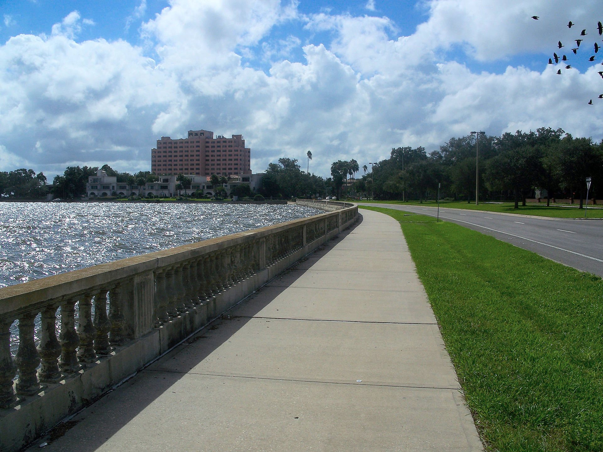
The islands' open space faces outward. Marjorie Park, named for Davis's wife, sits on the waterfront beside the yacht basin, and the city's off-leash Davis Islands Dog Beach is at the south end past the airfield, which is the reason a lot of people first drive out here at all. Roy Jenkins Pool and the Sandra W. Freedman Tennis Complex are municipal and on the islands. For distance rather than provision, Bayshore Boulevard starts just past the bridge and runs four and a half miles of balustraded seawall.

What the map does not show: the same water that sells the house is the water that floods it. King tides show along the low seawall edges in August without any storm at all, and that is worth seeing before you buy rather than after, because it is the clearest free indication of how much freeboard a given block actually has.
Elsewhere in Tampa, not Davis Islands


20 places, with real drive times
Road-adjusted distance and drive time from the centre of the community to each destination, nearest first. Filter by category.
Showing 1–12 of 20 places, nearest first.
Method: distances and drive times are computed from a representative point on the islands, using straight-line distance multiplied by a road factor and a tiered speed model: honest ranges, not routed times. Every one of them crosses the same bridge, so they understate a Friday evening badly.
Every gym within reach
For an address this expensive the islands have almost no private fitness industry. What they have is municipal: an outdoor city pool, a city tennis center, and the seawall over the bridge.
- Roy Jenkins Pool is the only municipal swimming provision here; check its seasonal hours before you rely on it
- The Sandra W. Freedman Tennis Complex runs public courts and programs and is the largest facility out here
- Fitness on the islands is studio scale. Full gyms are over the bridge, which makes the bridge part of the routine
- If you are buying into a building, ask what the amenity provision is and how it fared in 2024
| Facility | What it is | Drive |
|---|---|---|
| Roy Jenkins Pool open | The City of Tampa outdoor pool on the islands, and the only municipal swimming provision here. Distance hand-estimated from the reference point. | 2–3 min |
| Sandra W. Freedman Tennis Complex open | The city tennis center on the islands, with public courts and programs. Distance hand-estimated from the reference point. | 2–4 min |
| Davis Islands Village open | Studio-scale fitness rather than a full gym. The islands have no large private club of their own and the nearest are over the bridge. | 3–4 min |
| Bayshore Boulevard open | The seawall sidewalk past the bridge is what most residents actually use, and it costs nothing. | 7–11 min |
The free option is Bayshore Boulevard, which begins a few minutes past the bridge and gives you four and a half miles of continuous flat sidewalk along the seawall at no cost at all.
Three catchments people move here for
Davis Islands addresses are assigned within Hillsborough County Public Schools to Gorrie Elementary in Hyde Park, Wilson Middle and Plant High School, and that trio is priced into the houses as plainly as the water view is. Hillsborough also runs magnet, career and International Baccalaureate programs county-wide alongside assignment, and South Tampa carries a large independent sector for a city this size, several of them a short drive over the bridge.
| School | Board | Note |
|---|---|---|
| Gorrie Elementary School | Hillsborough County Public Schools | The assigned elementary for the islands, in Hyde Park over the bridge, and one of the most sought-after in the county. That is priced into the houses here. |
| Wilson Middle School | Hillsborough County Public Schools | The assigned middle school for the islands and much of South Tampa. |
| Plant High School | Hillsborough County Public Schools | The assigned high school. Davis Islands buys into the Plant catchment at a lower elevation than most of the rest of it, which is a real part of why buyers accept the water risk. |
| Hillsborough's choice program | Hillsborough County Public Schools | Magnet, career and International Baccalaureate programs run county-wide alongside assignment. Apply in the district's window rather than assuming the catchment settles it. |
| Independent schools | Independent | South Tampa has a large independent sector for a city this size, and several long-established day schools are a short drive over the bridge. |
Catchment boundaries in South Tampa move, and the Plant line is one of the most closely watched in the county. Check the specific address in the district's own boundary lookup rather than trusting a listing, and apply in the choice window if a magnet or IB place matters more to you than the assignment does.
Month by month, what living here looks like
Not a highlights reel: the actual annual rhythm, including the dates residents have to remember.
- Highs around 22 °C and lows in the low teens: the driest, mildest stretch of the year
- The dog beach and the marina are at their most usable
- Hurricane season is six months off and insurance quotes are easiest to get
- The pirate invasion comes up Hillsborough Bay past the islands and lands downtown
- Bayshore and the bridge approach close for the parade; plan to be in or out, not both
- Still dry, still mild, and the best month for anything outdoors
- Warming into the high twenties, with humidity back late in the month
- Spring training baseball across the bay area
- The last comfortable month for exterior work before the rain
- Warm, mostly dry, and the last month before the air changes
- Get flood and wind quotes now. On this ground they are most of the carrying cost
- Boat yards and lifts book out ahead of the season
- The rainy season begins, usually in the second half
- Afternoon thunderstorms become a daily fixture rather than an event
- Tampa Bay is among the most lightning-prone places in the United States
- Atlantic hurricane season runs 1 June to 30 November
- Check the county's evacuation zone lookup for your own address; the zones were redrawn for 2026
- Work out now how long the one bridge takes when everyone leaves at once
- The hottest and one of the wettest months
- Outdoor life moves to early morning and after dark
- The bay is warm enough to swim in and warm enough to feed a storm
- Peak humidity and the start of the serious part of hurricane season
- King tides show along the low seawall edges without any storm at all
- Quietest month on the islands and the easiest to get a table
- Statistically the peak of Atlantic hurricane activity, and the month Helene came in 2024
- Binding restrictions mean you often cannot buy a new policy with a named storm in the Gulf
- Ask the seller what this specific address did in Helene, not what the islands did on average
- Milton arrived in October 2024, two weeks after Helene, while the islands were still drying out
- The rains taper off and the humidity finally breaks
- The best sailing of the year once the season goes quiet
- Hurricane season ends on 30 November and the dry season starts
- Comfortable enough to be outside all day again
- Snowbird traffic returns and the bridge slows at both peaks
- Warm days, cool evenings and almost no rain
- The boat parade runs up the channel past the islands
- The pay-off for August and September
7 more photographs of the community and its surroundings
All freely licensed, via Wikimedia Commons. Filter by category.


Showing 1–7 of 7 photographs.
About these photographs. Openly licensed images geotagged in or near Davis Islands, found on Wikimedia Commons and served from there with full attribution. Inline photos elsewhere on the page may still come from the site's shared Tampa library.