
Live in Sunset Heights
El Paso's first planned neighborhood, on the rocky hill between downtown and UTEP, where four in five residents live inside the City's historic district and 78% of the occupied homes are rented.
Sunset Heights began as the Satterthwaite Addition: J. Fisher Satterthwaite bought the rocky hills northwest of the town center in 1880, graded streets, laid water and gas lines and had built more than ninety houses by 1885, before financial reverses in the 1890s cost him the land. From the turn of the century to the Depression it was, in the City's words, the most fashionable neighborhood in El Paso, and during the Mexican Revolution affluent exiles from across the river settled here. This guide takes the City of El Paso's Sunset Heights neighborhood as its boundary, 235 acres between Interstate 10 and West Schuster Avenue, where the 2020 census counted 2,867 residents, 2,333 of them inside the City's historic district, and owners lived in only 22% of the occupied homes. Zillow's typical value for ZIP code 79902, which holds every resident, was $285,266 in August 2026, but the ZIP held seven times as many people in 2020 and is not a Sunset Heights price.
The city's first planned neighborhood, divided into apartments and then protected as it stood
The City of El Paso's Sunset Heights neighborhood (FID 125 on the Community and Human Development department's Neighborhood Boundaries layer), about 235 acres, traced against the Census Bureau's road file: Interstate 10 on the south and west, from Wyoming Avenue around to Sun Bowl Drive; North Oregon Street on the east, from the freeway to West Schuster Avenue; and West Schuster Avenue on the north. The City's Sunset Heights historic district covers 147 acres of it, 62% of the ground, with 2,333 of the 2,867 residents; the National Register district listed in 1988 is about 170 acres, roughly bounded by Heisig Avenue, River Avenue, North El Paso Street and Interstate 10. UTEP's campus, just beyond the northwest corner, is in no City neighborhood. All of it is in El Paso County, El Paso ISD and City Council District 8.
Sunset Heights is where El Paso first planned a neighborhood. J. Fisher Satterthwaite bought the rocky hills northwest of the town center in 1880, graded streets, laid water and gas lines and had built more than ninety houses by 1885, before financial reverses in the 1890s took the land from him. The name won an El Paso Herald contest, in 1899 by the Handbook of Texas and 1901 by Wikipedia. Until the Depression it was, in the City's words, the most fashionable neighborhood in El Paso. Henry Trost finished his own house on West Yandell Drive in 1909, and during the Mexican Revolution affluent exiles settled here; a house Trost designed for Joseph and Nancy Williams was the scene of a secret meeting between Pancho Villa and General Hugh Scott.
Most of Sunset Heights is rented. By the 1970s, the City says, spacious homes were being altered into apartments. This guide takes the City's Sunset Heights neighborhood as its boundary, 235 acres between Interstate 10, North Oregon Street and West Schuster Avenue, where the 2020 census counted 2,867 residents, down from 3,092 on about the same ground in 2010. Owners lived in 294 of the 1,335 occupied homes, 22%; 1,041 were rented. With UTEP just beyond the northwest corner and downtown across the freeway, a buyer who means to live in the house is the exception on the block.
The historic district is the condition of buying most houses here. The City Council made Sunset Heights a local historic district on 5 June 1984 to reverse that decline, and the National Register listed it in 1988. The local district covers 147 acres, 62% of the neighborhood, and 2,333 of its residents. Inside it the City's Historic Preservation Office reviews exterior changes, windows, roofing, fencing and driveways among them; staff approve many minor ones, but work the design guidelines do not cover that alters a building's character or form needs a certificate of appropriateness from the Historic Landmark Commission before a building permit, about a month from application. Interiors are not reviewed unless designated. The "H" overlay on the zoning map settles which side of the line a lot is on.
No price index follows the neighborhood's line. Every block is in ZIP code 79902, where Zillow's typical value was $285,266 in August 2026, up 1.0% on the year, but the ZIP held seven times as many people. The five taxing units on a City and El Paso ISD address add to 2.643693 per $100 for 2025, and two of them, the college and the hospital district, take nothing off a homestead. A homestead at the ZIP's figure owes about $5,968 a year; the same house held by a landlord, without the exemption, about $7,542. At El Paso County's $280,615 median sale price a homestead owes about $5,845. The arithmetic is on the El Paso page.
FEMA's maps show no flood zone here, and one of them is not digital. The effective map from February 2006 exists for this part of the city only as scanned panels at FEMA's Map Service Center, and the preliminary countywide map of August 2025, not yet in force, puts none of the neighborhood in its 1% or 0.2% zones. El Paso floods from summer storms in arroyos and streets that neither map draws; in 2006 the city had a year's rain in two days, and the sources read here neither say whether that water reached these streets nor name the arroyo or drain that carries their runoff. Downtown is a walk, and the free El Paso Streetcar and Mesa Brio both stop on Oregon Street at the eastern edge.

- Ask the City's Historic Preservation Office whether the lot carries the H overlay, and read the design guidelines
- File for the homestead exemption with the El Paso Central Appraisal District once you live there
- Read FEMA's scanned effective panel for the address, and the preliminary map beside it
- Confirm the zoned schools with El Paso ISD
How Sunset Heights got here
- 1880J. Fisher Satterthwaite buys the rocky hills northwest of the town center from Juan de Dios Ochoa, and spends $30,000 grading streets and laying water and gas lines.
- 1885More than ninety houses stand in the Satterthwaite Addition, the first planned residential development in El Paso, in the Handbook of Texas's account.
- 1899After Satterthwaite loses the land to financial reverses in the 1890s, the development is renamed Sunset Heights, the winner of an El Paso Herald naming contest; Wikipedia dates the contest to 1901.
- 1909Henry C. Trost completes his own house at 1013 West Yandell Drive, one of several he designs in the neighborhood between 1905 and 1912.
- 1910The Mexican Revolution begins, and affluent exiles settle in Sunset Heights; Pancho Villa owns property here in the 1910s, and a Trost house built for Joseph and Nancy Williams in 1905 is the scene of a secret meeting between Villa and General Hugh Scott.
- 1916Most of the houses that make up the historic district are built by about this year, on the City's account.
- 1970sSingle-family houses decline and large homes are altered into apartments, in the City's description of the neighborhood.
- 1984The City Council designates Sunset Heights a local historic district on 5 June.
- 1988The Sunset Heights historic district is listed on the National Register of Historic Places on 8 December.
- 2006A major storm brings El Paso a year's worth of rain in two days and city-wide flooding; the sources read here do not say whether it reached these streets.
- 2020The census counts 2,867 residents and 1,536 homes inside the City's line, against 3,092 residents in 2010; owners live in 294 of the 1,335 occupied homes.
- 2026El Paso ISD's board declares financial exigency on 4 June; Wiggs Middle, the neighborhood's zoned middle school, is rated A (90) in September.


Pocket parks inside the line, and the mountain a few minutes up the road
Inside the line the City keeps two small parks, John R. Karr Park on Stewart Court and Mundy Park on Porfirio Diaz Street, each about an acre and a third. The larger open space is uphill: Scenic Drive across the end of the Franklin Mountains, and Franklin Mountains State Park, almost 27,000 acres with more than 100 miles of trails.
What the map does not show: the heat and the wind. The normal brings about 117 days a year reaching 32 °C, and the dust season climaxes in March and April.
Elsewhere in El Paso, not Sunset Heights


20 places, with real drive times
Road-adjusted distance and drive time from the centre of the community to each destination, nearest first. Filter by category.
Showing 1–12 of 20 places, nearest first.
Method: distances are straight lines from OpenStreetMap's Sunset Heights place node, inside the neighborhood, multiplied by a road factor, with a tiered speed model for the drive: honest ranges, not routed times.
Every gym within reach
The nearest City recreation center is Pat O'Rourke on North Virginia Street, with a swimming pool and a weight room. Chihuahuita, south of downtown, is on the streetcar and open on weekdays. The nearest YMCA is the Westside Family YMCA on North Mesa Street, across the mountain.
- Pat O'Rourke Recreation Center: about 1.6 km, pool, closed Sunday
- Chihuahuita Recreation Center: about 2.1 km, weekdays only
- Westside Family YMCA: about 13 km, closed Sunday
| Facility | What it is | Drive |
|---|---|---|
| Pat O'Rourke Recreation Center open | The nearest City recreation center, at 901 North Virginia Street: a swimming pool, basketball court, dance studio, volleyball court and weight room. Open 9 a.m. to 8 p.m. Monday to Thursday and 9 a.m. to 2 p.m. Friday and Saturday. | 4–6 min |
| Chihuahuita Recreation Center open | The City's center at 417 Charles Road, south of downtown and on the streetcar's route, open 10 a.m. to 6 p.m. on weekdays. | 5–7 min |
| Westside Family YMCA open | One of the two branches the YMCA of El Paso lists, at 7145 North Mesa Street: open 5 a.m. to 8 p.m. Monday to Thursday, to 7 p.m. Friday and 8 a.m. to 4 p.m. Saturday; closed Sunday. | 14–21 min |
| Scenic Drive open | The free option: from October to March the City closes Scenic Drive to cars between Wheeling and Robinson from 7 a.m. to noon on Sundays, for walkers, runners and cyclists. | 6–10 min |
The free option is Scenic Drive on a Sunday morning, when the City closes it to cars between Wheeling and Robinson from 7 a.m. to noon, October to March.
One set of schools for every block, in a district cutting its budget
Every block is in the El Paso Independent School District, and its 2026-27 zone files send every resident to the same three schools: Mesita Elementary, rated C (79) for 2026 after B (87); Wiggs Middle, A (90); and El Paso High School, a few blocks east, B (86).
| School | Board | Note |
|---|---|---|
| Mesita Elementary School | El Paso Independent School District | 3307 North Stanton Street, prekindergarten to grade 5. On El Paso ISD's 2026-27 zone files every block of the neighborhood is in Mesita's zone. The Texas Education Agency rated it C, 79, for 2026 after B, 87, for 2025. The district's online address lookup answered 503 when this guide was written; confirm an address with the district. |
| Wiggs Middle School | El Paso Independent School District | 1300 Circle Drive, grades 6 to 8: the middle school zone for every block for 2026-27. Rated A, 90, for 2026 after B, 82, for 2025. |
| El Paso High School | El Paso Independent School District | 800 East Schuster Avenue, grades 9 to 12, a few blocks east of the neighborhood: the high school zone for every block for 2026-27. Rated B, 86, for 2026 after A, 90, for 2025. The board declared financial exigency on 4 June 2026; the reporting read here names no closure among these three schools, but ask before counting on one. |
Confirm your own address. The district's address lookup was down when this guide was written, so these zones come from its published zone files. The board declared financial exigency on 4 June 2026; the reporting read here names none of these schools for closure, but ask. Another campus means a transfer request.
Month by month, what living here looks like
Not a highlights reel: the actual annual rhythm, including the dates residents have to remember.
- The El Paso Central Appraisal District values every property as of 1 January; last year's tax bill is due by 31 January
- Highs near 15 °C and lows near 1 °C at El Paso International, with about 14 nights at or below freezing on the 1991 to 2020 normal
- High winds and blowing dust can start as early as January
- Penalty and interest start on unpaid tax bills on 1 February
- Highs near 18 °C and about 10 mm of rain
- The dust season typically climaxes from March to April, in the National Weather Service's account
- The City's Art and Farmers Market returns around San Jacinto Plaza on select Saturdays; in 2026 the first was 7 March, and the 2027 dates are not yet posted
- Highs near 22 °C and about 6 mm of rain
- Highs near 27 °C and about 4 mm of rain, the driest month on the normal
- Dust events can run on into June: El Paso counted 36 of them from February to June 2025
- 15 May, or 30 days after the appraisal notice is mailed if that is later, is the deadline to protest a value; the appraisal review board begins hearings around then
- Highs near 32 °C, with about 16 days reaching 32 °C (90 °F)
- Highs near 36 °C, the hottest afternoons on the normal, with about 11 days reaching 38 °C (100 °F)
- About 19 mm of rain as the first storms arrive
- The summer monsoon: about 40 mm of rain, and El Paso Water warns that a year's rain can fall within days in small areas
- Highs near 35 °C and lows near 23 °C, the warmest nights of the year
- About 42 mm of rain, the wettest month on the normal; a storm in 2006 brought a year's worth of rain in two days and city-wide flooding
- Highs near 34 °C
- About 39 mm of rain and highs near 31 °C
- The City's spray parks closed for the season on 13 September in 2026, and the Art and Farmers Market held its last 2026 Saturday on 19 September
- Chalk the Block, the City's free public arts festival, fills the Downtown Arts District on 3 and 4 October 2026
- The City's Día de los Muertos festival is on 24 October 2026
- Scenic Sundays move to the cool-season schedule: Scenic Drive closes to cars between Wheeling and Robinson from 7 a.m. to noon until March
- Highs near 26 °C
- Highs near 19 °C and lows near 6 °C, with about five nights at or below freezing
- About 11 mm of rain
- The 93rd Sun Bowl is played at noon on 31 December 2026 at Sun Bowl Stadium on UTEP's campus, just beyond the neighborhood
- Highs near 14 °C and about 14 freezing nights, with about 3 cm of snow on the normal
- The year's tax bill is due by 31 January
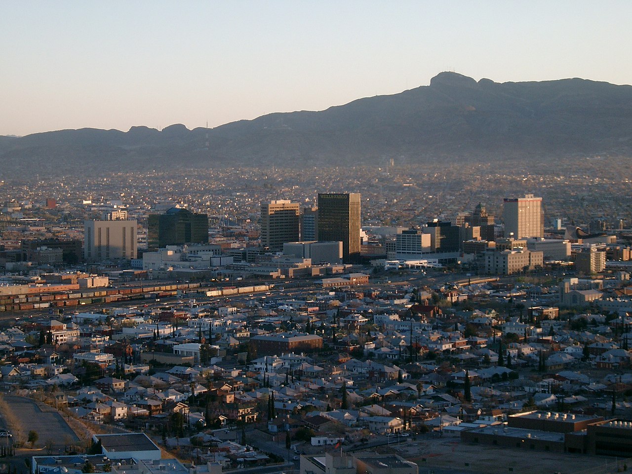
Every photograph in this guide's library is above
This library holds 4 photographs and the page has already printed all of them, each once. The credits are in the footer.
About these photographs. Openly licensed images geotagged in or near Sunset Heights, found on Wikimedia Commons and served from there with full attribution. Inline photos elsewhere on the page may still come from the site's shared El Paso library.