
Live in Mission Hills
A hillside of 1950s houses, three in four of them lived in by their owners, between Mesa Street and the Franklin Mountains, where the Thousand Steps trail into the state park starts at the top of Stanton Street and no historic district reviews what an owner builds.
Most of Mission Hills is one subdivision, the 240-acre Mission Hills plat the City of El Paso recorded on 3 January 1955, laid out on the slope that climbs from Mesa Street toward the Franklin Mountains north of UTEP; Camelot Heights added the streets at the top in 1968. This guide takes the City's Mission Hills North and Mission Hills South neighborhoods together as its boundary, 394 acres where the 2020 census counted 1,731 residents, up from 1,593 on about the same ground in 2010, and owners lived in 74% of the occupied homes. No City historic district reaches it, so exterior work needs only the ordinary permits. Zillow's typical value for ZIP code 79902, which holds every resident here, was $285,266 in August 2026, but the ZIP also takes in Kern Place, Sunset Heights and the blocks around UTEP, eleven times the people, and is not a Mission Hills price.
A 1955 subdivision on the mountain's slope, with the state park at the top of the street
The City of El Paso's Mission Hills South (FID 128, about 198 acres) and Mission Hills North (FID 129, about 196 acres) on its Neighborhood Boundaries layer, taken together, about 394 acres, traced against the Census Bureau's road file. Mission Hills South runs from Mesa Street on the southwest to Mesita Drive on the south, with its eastern edge on the slope behind Piedmont Drive, Hidden Hills Drive and Cerro de la Paz Street, and its northern edge along O'Keefe Drive, Wallington Drive, Brentwood Avenue and Krupp Drive. Mission Hills North runs up Stanton Street on the west to Brighton Lane and Excalibur Drive at the top, with its eastern edge behind Camelot, Santa Rita Street and Cerro Azul Drive. The eastern line comes within about 160 meters of Franklin Mountains State Park. The Mission Hills Association's filed area is larger, about 719 acres with 4,003 residents, and takes in blocks the City draws into its neighbors. All of it is in El Paso County, El Paso ISD and City Council District 8.
Mission Hills is mostly one piece of paper. The City of El Paso recorded the Mission Hills plat on 3 January 1955, about 240 acres on the slope that climbs from Mesa Street toward the Franklin Mountains north of UTEP; Piedmont Hills had been platted at its southeastern edge in 1953, and Camelot Heights filled in the top of the hill in 1968, which is why the streets up there are Camelot, Excalibur and Sir Gareth. This guide takes the City's Mission Hills North and Mission Hills South neighborhoods together, 394 acres where the 2020 census counted 1,731 residents, up from 1,593 on about the same ground in 2010. Owners lived in 519 of the 705 occupied homes, 74%. The Mission Hills Association files a larger area, about 4,003 residents, so a seller's “Mission Hills” may not be the City's.
The mountain is the neighborhood's back fence. The eastern line comes within about 160 meters of Franklin Mountains State Park, some 24,248 acres the Legislature protected in 1979 and opened in 1987, all inside the city limits. The Thousand Steps trailhead is inside the guide, a gravel lot at the end of North Stanton Street, and its trail climbs toward the overlook of a B-36 crash site. No historic district reaches Mission Hills either: the City's layer shows none overlapping it and no designated landmark inside, so exterior work needs the ordinary permits and nothing more, unlike Sunset Heights or Manhattan Heights.
No price index follows the neighborhood's line. Every resident is in ZIP code 79902, where Zillow's typical value was $285,266 in August 2026, up 1.0% on the year, but the ZIP also takes in Kern Place, Sunset Heights and the blocks around UTEP, more than eleven times the people, and is not a Mission Hills price. The five taxing units on a City and El Paso ISD address add to 2.643693 per $100 for 2025, the highest of the Texas cities on this site: a homestead valued at the 79902 figure owes about $5,968 a year, the same house without the exemption about $7,542, and a homestead at El Paso County's $280,615 median sale price about $5,845. The arithmetic is on the El Paso page. No management district, tax increment zone or utility district reaches the guide.
FEMA's effective flood map is not digital here. No City of El Paso panel in the National Flood Hazard Layer covers Mission Hills, so the zone in force has to be read on the scanned panel at FEMA's Map Service Center. FEMA's preliminary countywide map, issued on 8 August 2025 and not yet in force, puts 3.1% of the guide in the 1% annual chance zone, along Flow Path No. 21 and the Canterbury Channel as they come down the slope, and no resident's block in it. The water here comes off the mountain in the monsoon; in 2006 the city had a year's rain in two days, and this guide found no record of where it reached in Mission Hills. A homeowners policy does not cover flood.
The city is down the hill. Route 10 runs up Stanton Street about once an hour, Mesa Brio stops at Mesa and Executive, every 15 minutes at weekday peaks and 20 otherwise, and UTEP's campus is 140 meters past the southern edge.
- Look up the address in El Paso ISD's 2026-27 zones: 1,344 residents are zoned Mesita and 387 Green
- Read the scanned effective FEMA panel and the August 2025 preliminary map, and price a flood policy below any channel
- Ask the seller which association the house is in; the Mission Hills Association's area is larger than the City's line
- File for the homestead exemption with the El Paso Central Appraisal District once you live there
How Mission Hills got here
- 1953Piedmont Hills No. 1, about 32 acres, is recorded on 6 August, the earliest plat inside the line on the City's Subdivisions layer.
- 1955The Mission Hills plat is recorded on 3 January: about 240 acres, most of today's two City neighborhoods.
- 1968Camelot Heights is platted at the top of the slope, the streets named Camelot, Excalibur and Sir Gareth; a replat and Camelot Townhomes follow in 1978.
- 1979The Texas Legislature protects the Franklin Mountains as a state park; it opens to the public in 1987.
- 1992The Mission Hills Association starts on 1 September, by the date the City's registry records; it registers with the City on 6 January 2004.
- 2010The census counts 1,593 residents and 663 homes on the blocks inside today's line.
- 2020The census counts 1,731 residents and 767 homes; owners live in 519 of the 705 occupied homes.
- 2025FEMA issues its preliminary countywide flood map on 8 August: 3.1% of the guide falls in the 1% annual chance zone, along Flow Path No. 21 and the Canterbury Channel, and no resident's block does. It is not yet in force.
- 2026El Paso ISD declares financial exigency in June, and the Texas Education Agency rates Mesita Elementary C (79) after B (87) the year before.

A state park at the end of North Stanton Street
Inside the line, Mission Hills Park on O'Keefe Drive has ten acres of tennis, basketball and volleyball courts, a playground and picnic tables. At the top of the guide the Thousand Steps trailhead leads into Franklin Mountains State Park, and south toward Robinson Avenue the City keeps the 86-acre Billy Rogers Arroyo as open desert for hiking.

What the map does not show: the heat on an exposed trail. The 1991 to 2020 normal at El Paso International brings about 117 days a year reaching 32 °C, and June's afternoons average 36 °C, so the mountain is a morning place for half the year.
21 places, with real drive times
Road-adjusted distance and drive time from the centre of the community to each destination, nearest first. Filter by category.
Showing 1–12 of 21 places, nearest first.
Method: distances are straight lines from the population-weighted center of the guide's census blocks, multiplied by a road factor, with a tiered speed model for the drive: honest ranges, not routed times.
Every gym within reach
No City recreation center is inside the guide. The nearest are Galatzan Recreation Center in Mesa Hills, with two indoor pools, and Pat O'Rourke Recreation Center east of downtown, and the nearest YMCA is the Westside Family YMCA on North Mesa Street.
- Galatzan Recreation Center: about 4.5 km, closed Sunday
- Pat O'Rourke Recreation Center: about 4.5 km, indoor pool
- Westside Family YMCA: about 8.5 km
| Facility | What it is | Drive |
|---|---|---|
| Galatzan Recreation Center open | The City's Westside recreation center at 650 Wallenberg Drive, in Mesa Hills: large and small gyms, a weight room, a dance studio and courts for basketball, volleyball, badminton and pickleball. Open 9 a.m. to 8 p.m. Monday to Thursday and 9 a.m. to 2 p.m. on Friday and Saturday; closed Sunday. Two of the City's indoor pools, Leo Cancellare Memorial Pool and the Westside Natatorium, share the address. | 7–11 min |
| Pat O'Rourke Recreation Center open | The City's recreation center at 901 North Virginia Street, east of downtown, with an indoor pool, a weight room and a gym. Open 9 a.m. to 8 p.m. Monday to Thursday and 9 a.m. to 2 p.m. on Friday and Saturday. City pools charge $3 for adults and $2 for children and seniors. | 7–11 min |
| Westside Family YMCA open | The YMCA of El Paso's Westside branch at 7145 North Mesa Street: open 5 a.m. to 8 p.m. Monday to Thursday, to 7 p.m. on Friday and 8 a.m. to 4 p.m. on Saturday; closed Sunday. | 10–15 min |
| Thousand Steps Trailhead open | The free option, near enough: the state park's trails begin at the end of North Stanton Street, inside the guide. Texas Parks and Wildlife charged $5 an adult, and nothing to State Park Pass holders, for its guided hike from there. | 4–6 min |
The free option is the mountain: the Thousand Steps trailhead is inside the guide, and Mission Hills Park's courts are open to 11 p.m. in summer.
Two elementaries, then Wiggs and El Paso High for everyone
Every block is in the El Paso Independent School District. Its 2026-27 zones assign the reference point and 1,344 residents to Mesita Elementary, rated C (79) for 2026 after B (87), and the northern 387 to Dr. Green Elementary, C (75). The whole guide goes on to Wiggs Middle School, A (90), and El Paso High School, B (86).
| School | Board | Note |
|---|---|---|
| Mesita Elementary School | El Paso Independent School District | 3307 North Stanton Street, just south of the guide, prekindergarten to grade 5. El Paso ISD's 2026-27 attendance zones assign it the reference point and the blocks of 1,344 of the guide's 1,731 residents. The Texas Education Agency rated it C, 79, for 2026 after B, 87, for 2025. |
| Dr. Green Elementary School | El Paso Independent School District | 5430 Buckley Drive, prekindergarten to grade 5: the 2026-27 zone for the remaining 387 residents, at the north end of Mission Hills North. Rated C, 75, for 2026. Which of the two elementaries an address gets is the first thing to check. |
| Wiggs Middle School | El Paso Independent School District | 1300 Circle Drive, grades 6 to 8: the middle school zoned for the whole guide for 2026-27. Rated A, 90, for 2026 after B, 82, for 2025. |
| El Paso High School | El Paso Independent School District | 800 East Schuster Avenue, grades 9 to 12: the high school zoned for the whole guide for 2026-27. Rated B, 86, for 2026 after A, 90, for 2025. The district's address lookup was down when this was checked, so confirm an address with El Paso ISD; it declared financial exigency in June 2026, so ask about campus plans too. |
Run your own address. The district's address lookup was down when this was checked, so the zones here come from its 2026-27 boundary files; confirm with El Paso ISD. The district declared financial exigency in June 2026, so ask about campus plans before a school counts in the offer.
Month by month, what living here looks like
Not a highlights reel: the actual annual rhythm, including the dates residents have to remember.
- The El Paso Central Appraisal District values every property as of 1 January; last year's bill is due by 31 January
- Highs near 15 °C and lows near 1 °C at El Paso International, with about 14 nights at or below freezing on the 1991 to 2020 normal
- Penalty and interest start on unpaid tax bills on 1 February
- The dust season begins: a Texas Tech study of 21 years counted about 22 dust events a year in El Paso, most of them from February to June
- Highs near 18 °C and about 10 mm of rain
- Highs near 22 °C and about 6 mm of rain, with dust events rising toward June
- The trails above the Thousand Steps trailhead are at their most comfortable before the heat
- Highs near 27 °C and about 4 mm of rain, the driest month on the normal
- 15 May, or 30 days after the notice is mailed if that is later, is the deadline to protest a value; the appraisal review board begins hearings around then
- Highs near 32 °C, with about 16 days reaching 32 °C
- Highs near 36 °C, the hottest month's afternoons, with about 11 days reaching 38 °C (100 °F)
- About 19 mm of rain before the monsoon
- Highs near 35 °C and about 40 mm of rain as the monsoon storms arrive; July to September bring more than half the year's 223 mm
- Summer storm water runs down Flow Path No. 21 and the Canterbury Channel through the guide
- About 42 mm of rain, the wettest month on the normal, and highs near 34 °C
- Highs near 31 °C and about 39 mm of rain
- About 15 days still reach 32 °C
- Highs near 26 °C and about 15 mm of rain as the monsoon ends
- Nights near 12 °C
- Highs near 19 °C and lows near 6 °C, with about five freezing nights
- The 93rd Sun Bowl is played at Sun Bowl Stadium on the UTEP campus, below the guide, at noon on 31 December 2026
- Highs near 14 °C and lows near 1 °C, with about 14 freezing nights and most of the year's 7 cm of snow
5 more photographs of El Paso and the region
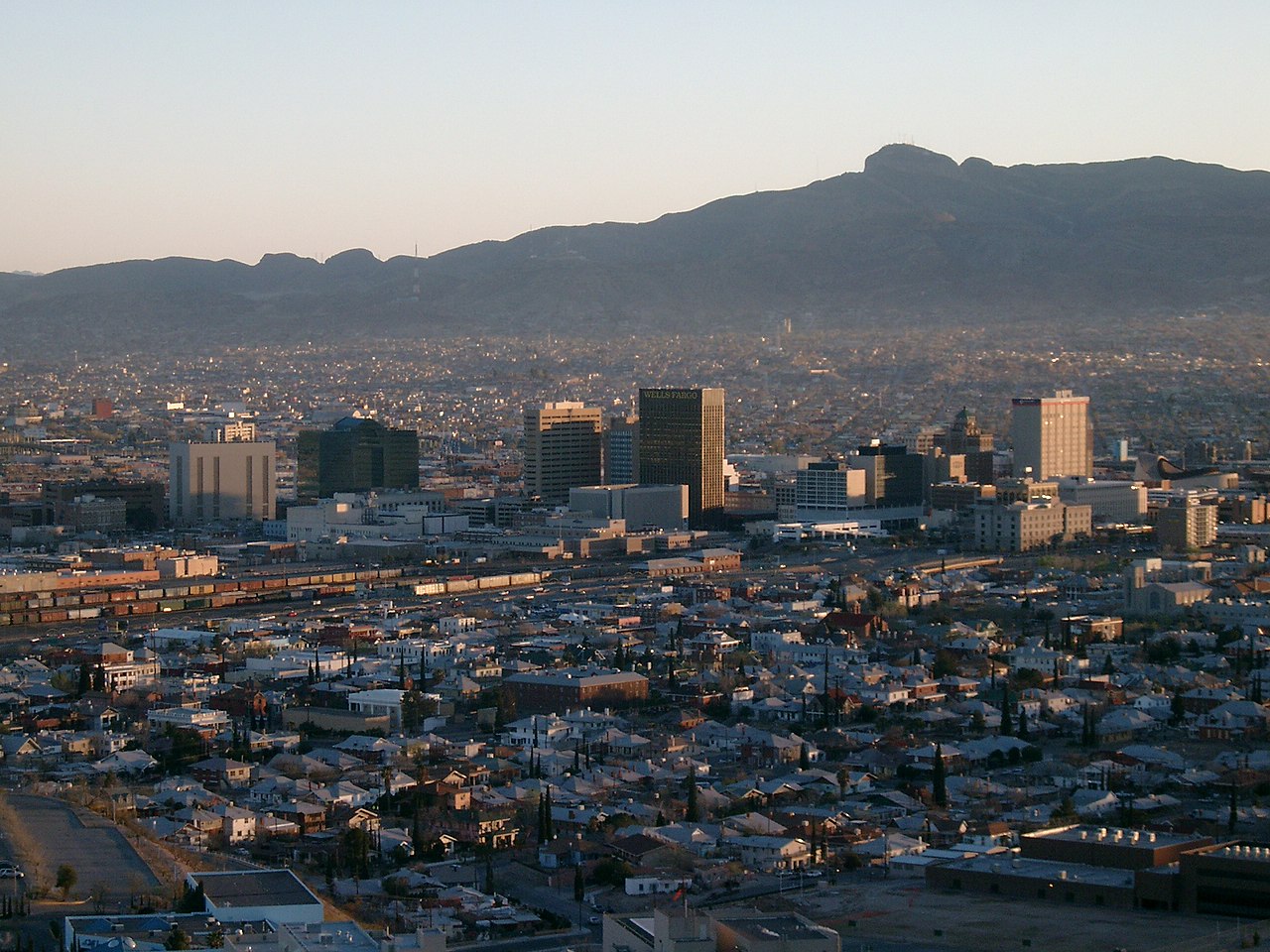
Drawn from the site's shared, freely licensed El Paso photo library, not photographs of Mission Hills itself. Filter by category.


Showing 1–5 of 5 photographs.
About these photographs. Openly licensed images from the site's shared El Paso library, found on Wikimedia Commons and served from there with full attribution. None of them is presented as a photograph of Mission Hills.