
Live in Kern Place
Peter Kern's garden suburb of 1914 on the slope east of Mesa Street, where owners live in 72% of the homes, the streetcar stops on Stanton Street and nothing on the City's historic layer reviews what an owner does to a house.
Peter E. Kern, who came to El Paso in 1881, began building Kern Place on 21 November 1914 and sold it as the city's first garden suburb, with curving streets, Madeline Park at its center, named for his daughter, and an iron gate at Kansas Street and Robinson Avenue that came down in 1954. This guide takes the City's Kern Place neighborhood as its boundary, 255 acres between Mesa Street and Piedmont Drive, just northeast of UTEP, where the 2020 census counted 1,809 residents, down from 1,905 on about the same ground in 2010, and owners lived in 72% of the occupied homes. Zillow's typical value for ZIP code 79902, which holds all of them, was $285,266 in August 2026, up 1.0% on the year, but the ZIP holds eleven times as many people and is not a Kern Place price. No City historic district or designated landmark falls inside the line.
A garden suburb sold on curving streets, still lived in by its owners and still unprotected
The City of El Paso's Kern Place neighborhood (FID 127) on its Neighborhood Boundaries layer, about 255 acres, traced against the Census Bureau's road file: Mesa Street, State Highway 20, on the west; Robinson Avenue on the southeast, from Mesa Street to Piedmont Drive; Piedmont Drive on the northeast; and Mesita Drive on the north. Wikipedia describes the same ground as bordered by Mesa Street, Boston and Robinson, Piedmont and Mesita. The Kern Place association's registered area is essentially the same, 265 acres with the same 1,809 residents. The southern corner, where Robinson Avenue meets Mesa Street, comes within 20 m of UTEP's campus. All of it is in El Paso County and El Paso ISD, and in City Council District 8.
Peter E. Kern, a jeweler and entrepreneur, came to El Paso in 1881 and bought land on the slope north of town from Juan and Guadalupe Ascarate; Wikipedia dates the purchase to 1886 and the neighborhood association to the early 1900s, and this guide could not settle which. Construction began on 21 November 1914, and Kern sold it as El Paso's first garden suburb, with curving streets and Madeline Park at its center, named for his daughter, planted with 500 trees in 1915 and given to the City that year. His iron and stone gate at Kansas Street and Robinson Avenue went up in 1916 and came down in a street widening in 1954. This guide takes the City's Kern Place neighborhood as its boundary, 255 acres between Mesa Street and Piedmont Drive, where the 2020 census counted 1,809 residents, about 1,800 people, against 1,905 on about the same ground in 2010.
Owners live here, and nothing reviews what they build. In 2020 owners lived in 602 of the 835 occupied homes, 72%, and only 46 homes stood empty. For a neighborhood a century old, it has no City historic district and no individually designated landmark on the City's layer, so exterior work needs no certificate of appropriateness and a house can be altered or replaced under ordinary zoning. That includes the two houses its histories single out: the Castle, Paul Luckett's turreted stone house at 1201 Cincinnati Avenue, and the Hoover House, deeded to UTEP in 1965 and now its president's residence.
The price is above the city's, and so is the bill. Zillow's typical value for ZIP code 79902, which holds every resident of the guide, was $285,266 in August 2026, up 1.0% on the year, against $238,475 for the city and close to the $280,615 county median sale price, but the ZIP holds eleven times as many people and is not a Kern Place price. The five taxing units on a City and El Paso ISD address add to 2.643693 per $100 for 2025. The school district takes the state's $140,000 off a homestead, the City and the County $5,000 each, and El Paso Community College and University Medical Center nothing, so a homestead at the 79902 figure owes about $5,968 a year and the same house without the exemption about $7,542. The arithmetic is on the El Paso page.
The arroyo is beside the line, not inside it. FEMA's effective map has no digital panel over Kern Place, so a lot's zone has to be read on the scanned panel at FEMA's Map Service Center. FEMA's preliminary countywide map, issued on 8 August 2025 and not yet in force, puts none of the guide in the 1% or the 0.2% zone. The nearest channel is the Billy Rogers Arroyo, across Robinson Avenue, which the preliminary study models as Flow Path No. 23 and shows contained in its structure even in the 0.2% storm. A preliminary map can change before it takes effect.
The university is the neighbor. The guide's southern corner comes within 20 m of UTEP's campus, and the free streetcar runs up Stanton Street with stops at Cincinnati Avenue and Baltimore Drive inside the line. Sun Metro says every 15 minutes; its own schedule data runs about every 18 at midday. The Mesa Brio on the western edge runs every 15 minutes only at weekday peaks and every 20 otherwise. Albertsons is across Mesa Street, Las Palmas Medical Center about 1.9 km by road.

- Ask the City what the lots around yours are zoned, and what could be built on them
- Read the address's FIRM panel at FEMA's Map Service Center, then the preliminary map
- Run your own address through El Paso ISD's zone maps
- File for the homestead exemption with the El Paso Central Appraisal District once you live there
How Kern Place got here
- 1881Peter E. Kern, a jeweler and entrepreneur, arrives in El Paso.
- 1886Kern buys land from Juan and Guadalupe Ascarate; the largest purchase, the McKelligon tract, becomes the Kern Place subdivision. The association's history dates the purchases to the early 1900s instead.
- 1913A paved road is laid on Mesa Avenue toward the land that becomes Kern Place.
- 1914Construction begins on 21 November.
- 1915Kern has 500 trees planted in Madeline Park, named for his daughter, and gives the park to the City the same year.
- 1916Kern puts up an iron and stone entrance gate at North Kansas Street and Robinson Avenue, at a cost of $2,500, lit by 444 electric globes.
- 1926On 4 May, Kern sells the land that made up Kern Place, after financial and legal trouble cost him control of it.
- 1954The gate is dismantled in a street-widening project.
- 1959Clinton and Hal Dean Jr. buy Kern Place property, the start of the Kern Village shopping center.
- 1965The Hoover House is deeded to the University of Texas at El Paso; it is now the UTEP president's residence.
- 2018The El Paso Streetcar opens on 9 November, with stops on Stanton Street at Cincinnati Avenue and Baltimore Drive inside the guide.
- 2020The census counts 1,809 residents and 881 homes inside the line, against 1,905 in 2010; owners live in 602 of the 835 occupied homes.
- 2025FEMA's preliminary countywide flood map, issued 8 August, puts none of the guide in a 1% or 0.2% zone; the Billy Rogers Arroyo beside it is modeled as Flow Path No. 23.

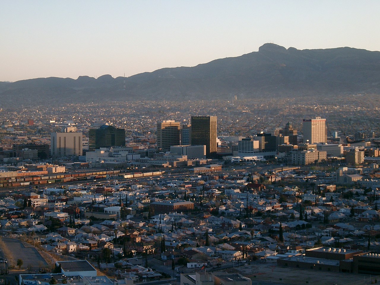
Kern's park at the center, and an arroyo kept as open ground
Madeline Park, 4.1 acres on Baltimore Drive, is the park Kern planted in 1915, and the association holds its movie nights, an Easter egg hunt and a Shakespeare production there. Alethea Park is 3.9 acres in the north of the guide, and across Robinson Avenue the City keeps the Billy Rogers Arroyo as an 86-acre park.

What the map does not show: the heat and the wind. The 1991 to 2020 normal at El Paso International brings about 117 days a year reaching 32 °C, and the windy season peaks in March and April; in 2025 the National Weather Service counted 12 dust storms.

24 places, with real drive times
Road-adjusted distance and drive time from the centre of the community to each destination, nearest first. Filter by category.
Showing 1–12 of 24 places, nearest first.
Method: distances are straight lines from the population-weighted center of the neighborhood's census blocks, multiplied by a road factor, with a tiered speed model for the drive: honest ranges, not routed times.
Every gym within reach
No City recreation center is inside the line. The nearest is the Pat O'Rourke Recreation Center on North Virginia Street, and the indoor Pat O'Rourke Aquatic Center beside it is open all year. The nearest YMCA is the Westside Family YMCA, out Mesa Street.
- Pat O'Rourke Recreation Center: about 2.8 km
- Pat O'Rourke Aquatic Center: about 2.8 km, 25-yard pool
- Westside Family YMCA: about 11.5 km, closed Sunday
| Facility | What it is | Drive |
|---|---|---|
| Pat O'Rourke Recreation Center open | The nearest City recreation center, at 901 North Virginia Street south of the guide: weight room, dance studio, game room, volleyball and an indoor pool. Open 9 a.m. to 8 p.m. Monday to Thursday and 9 a.m. to 2 p.m. on Friday and Saturday. | 6–9 min |
| Pat O'Rourke Aquatic Center open | The City's indoor 25-yard pool at the same address, open year-round: 6 a.m. to noon and 4 to 8 p.m. Monday to Thursday, mornings on Friday, 9 a.m. to 2 p.m. on Saturday, closed Sunday. $3 for adults, $2 for children and seniors. | 6–9 min |
| Westside Family YMCA open | The nearest YMCA of El Paso branch, at 7145 North Mesa Street, straight out Mesa: open 5 a.m. to 8 p.m. Monday to Thursday, to 7 p.m. on Friday, 8 a.m. to 4 p.m. on Saturday, and closed Sunday. | 12–18 min |
| Billy Rogers Arroyo Park open | The free option: the City's 86-acre arroyo park across Robinson Avenue, open ground on the slope between Kern Place and the mountain. | 3–4 min |
The free option is the open ground of the Billy Rogers Arroyo, across Robinson Avenue.
One zone for every block, and a middle school rated A
Every block is in the El Paso Independent School District, and its 2026-27 zone files send the whole guide to the same three schools: Mesita Elementary on Stanton Street, inside the line, rated C (79) for 2026 after B (87); Wiggs Middle School, A (90); and El Paso High School, B (86) after A (90).
| School | Board | Note |
|---|---|---|
| Mesita Elementary School | El Paso Independent School District | 3307 North Stanton Street, inside the guide, prekindergarten to grade 5. El Paso ISD's 2026-27 zone files put every block of the guide in its zone. The Texas Education Agency rated it C, 79, for 2026 after B, 87, for 2025. |
| Wiggs Middle School | El Paso Independent School District | 1300 Circle Drive, grades 6 to 8, zoned to every block for 2026-27. Rated A, 90, for 2026 after B, 82, for 2025. |
| El Paso High School | El Paso Independent School District | 800 East Schuster Avenue, grades 9 to 12, zoned to every block for 2026-27. Rated B, 86, for 2026 after A, 90, for 2025. The district declared financial exigency in June 2026; ask it whether any campus in this feeder pattern is under review before relying on it. |
Run your own address. The district's address lookup was down when this guide was researched, so the zones here are its published 2026-27 maps. It declared financial exigency in June 2026 over a $52.8 million shortfall; ask whether any campus in this feeder pattern is under review before you rely on it.
Month by month, what living here looks like
Not a highlights reel: the actual annual rhythm, including the dates residents have to remember.
- The El Paso Central Appraisal District values every property as of 1 January; last year's bill is due by 31 January
- Highs near 15 °C and lows near 1 °C at El Paso International, with about 14 nights at or below freezing on the 1991 to 2020 normal
- About 10 mm of rain and 20 mm of snow on the normal
- Penalty and interest start on unpaid tax bills on 1 February
- Highs near 18 °C and lows near 4 °C; dust events can start this early, the National Weather Service says
- The windy season climbs to its peak in March and April; 2025 brought 12 dust storms, by the National Weather Service's count
- Highs near 22 °C and 6 mm of rain
- The association's Easter egg hunt is in Madeline Park
- Highs near 27 °C and 4 mm of rain, the driest month on the normal
- 15 May, or 30 days after the appraisal notice is mailed if that is later, is the deadline to protest a value
- Highs near 32 °C, with about 16 days reaching 32 °C (90 °F)
- Highs near 36 °C, the hottest afternoons of the year, with about 11 days reaching 38 °C (100 °F)
- 18 mm of rain as the monsoon gathers
- The monsoon arrives: 40 mm of rain on the normal, falling in short, heavy storms that run down the arroyos off the mountain
- Highs near 35 °C and the warmest nights, near 23 °C
- 42 mm of rain, the wettest month; in 2006 a year's rain fell on the city in two days
- Highs near 34 °C
- The association staged Macbeth and a movie night in Madeline Park in September 2026
- 39 mm of rain as the monsoon ends, and highs near 31 °C
- Chalk the Block fills the Downtown Arts District on 3 and 4 October 2026, at the streetcar's downtown end
- Highs near 26 °C and 15 mm of rain
- Highs near 19 °C, lows near 6 °C and about five freezing nights
- 11 mm of rain
- The 93rd Sun Bowl game is at UTEP's Sun Bowl Stadium, across Mesa Street, at noon on 31 December 2026
- Highs near 14 °C and lows near 1 °C, with about 14 freezing nights and 33 mm of snow on the normal
Every photograph in this guide's library is above
This library holds 2 photographs and the page has already printed all of them, each once. The credits are in the footer.
About these photographs. Openly licensed images geotagged in or near Kern Place, found on Wikimedia Commons and served from there with full attribution. Inline photos elsewhere on the page may still come from the site's shared El Paso library.