
Live in Segundo Barrio
The City's Segundo Barrio neighborhood between downtown and the Rio Grande, where four in five residents live inside a National Register district that offers tax credits but brings no City design review, almost nine in ten occupied homes are rented, and the typical value in its ZIP code sits below the state's $140,000 school exemption.
The Segundo Barrio, the second ward, filled in south of downtown after the railroads reached El Paso in 1881, and its institutions date from then: Olives Villanueva Aoy's school of 1887, Sacred Heart Church, dedicated in 1893, and the Rose Gregory Houchen Settlement of 1912. By the 1950s it held, on one count, more than 12,000 substandard dwellings, and in 1967 women of the neighborhood started the clinic that became Centro de Salud Familiar La Fe inside a tenement known as Los Seis Infiernos. This guide takes the City's Segundo Barrio neighborhood, 290 acres where the 2020 census counted 5,581 residents, down from 6,156 on about the same ground in 2010, and 2,041 of the 2,305 occupied homes were rented. The Segundo Barrio Historic District, listed on the National Register in November 2021 with 686 buildings, covers about 73% of the ground and 4,650 of the residents.
The barrio of the tenements and the parish schools, listed nationally and reviewed by nobody local
The City of El Paso's Segundo Barrio neighborhood (FID 120 on the Neighborhood Boundaries layer of its Community and Human Development service), about 290 acres. Traced against the City's arterial and TxDOT road layers, it runs along Paisano Drive (US 62) on the north, from Santa Fe Street east to Cotton Street; down Cotton Street on the east; along the Cesar Chavez Memorial Highway beside the Rio Grande on the south and southeast; and up Santa Fe Street on the west, across which lies Chihuahuita, a City neighborhood and historic district of its own. Its western end, 21.8% of the area and 374 residents, is also inside the Downtown Management District, and 14.9%, with 956 residents, is in Tax Increment Reinvestment Zone 5; the Downtown El Paso guide stops at Paisano Drive and leaves these blocks to this one. All of it is in El Paso County, El Paso ISD, ZIP code 79901 and City Council District 8.
The Segundo Barrio, the second ward, filled in between the business district and the river after the railroad reached El Paso in 1881, and its institutions are nearly as old. Olives Villanueva Aoy opened a school at his own expense in 1887, teaching in Spanish and English; Sacred Heart Church was dedicated in 1893; the Rose Gregory Houchen Settlement opened in 1912, and Francisco Madero lived in houses here while he planned the campaign against Porfirio Díaz. By the 1950s surveys counted more than 12,000 substandard dwellings, with an average of seven families to a toilet, and in 1967 a tenement fire with no fire escapes killed three children. That year women of the neighborhood started, inside a tenement called Los Seis Infiernos, the clinic that became Centro de Salud Familiar La Fe, whose Central Clinic is still on Ochoa Street.
This guide takes the City's Segundo Barrio neighborhood, 290 acres from Paisano Drive south to the Cesar Chavez Memorial Highway along the Rio Grande, and from Santa Fe Street east to Cotton Street. The 2020 census counted 5,581 residents there, 575 fewer than on about the same ground in 2010, and 26% of them were under 18, against 6% in the downtown blocks across Paisano. Of the 2,305 homes occupied on census day, 2,041 were rented and 264, 11%, were lived in by their owners.
The historic district is a listing, not a review board. The National Park Service put the Segundo Barrio Historic District, 686 buildings, on the National Register in November 2021, five years after Preservation Texas named the barrio one of the most endangered places in the state. It covers about 73% of the neighborhood and 4,650 of its residents. A National Register listing opens tax credits for a qualifying rehabilitation, and the conditions attach only to an owner who takes them. It is not one of the City's nine local historic districts, so the certificate of appropriateness that Chihuahuita, across Santa Fe Street, and parts of downtown require does not apply here, except at the one individually designated site inside the line. The City does not review a new facade or a demolition here for its history.
The typical value here is below the school exemption. Zillow put the typical home in ZIP code 79901, which holds the whole barrio and downtown besides, at $135,191 in August 2026, up 4.1% on the year. That is under the state's $140,000 school homestead exemption, so a homestead at that value owes El Paso ISD nothing, and the five units on the bill, 2.643693 per $100 before exemptions, come to about $2,052 a year. A landlord on the same value owes about $3,574. The 374 residents at the western end, inside the Downtown Management District, pay its 12 cents too, about $162 on that value, and Tax Increment Reinvestment Zone 5 over the northwest corner adds no rate. The arithmetic is on the El Paso page.
The river is behind a levee and in a concrete channel. FEMA's digital flood layer leaves the barrio out, so the effective zone has to be read on the scanned 2006 panel. The preliminary countywide map of August 2025, not yet in force, shows none of it in the 1% or 0.2% zones but 29%, the reference point included, as reduced risk behind a levee along the Rio Grande. Rain is the other risk: the storms of 2006 damaged the Casitas del Norte apartments here, and El Paso Water says flooding happens where runoff outruns a channel. A homeowners policy does not cover rising water.

- Check whether the building contributes to the National Register district before counting on a rehabilitation credit
- Ask whether the lot is in the Downtown Management District, which adds 12 cents per $100
- Read the scanned FEMA panel and the preliminary map for the lot, and price a flood policy
- Find out which elementary the street is zoned to, since Hart and Aoy split the barrio
How the Segundo Barrio got here
- 1834Santiago Alvarado receives a Mexican land grant to farm the ground, its first recorded resident.
- 1881The railroad reaches El Paso, and the town's population grows quickly, much of it into the blocks south of the business district.
- 1887Olives Villanueva Aoy opens an escuelita at his own expense, teaching in Spanish and English; the school board takes it over the next year as the Mexican Preparatory School.
- 1893Sacred Heart Church is dedicated, a year after Father Carlos M. Pinto opens Sacred Heart School; the Wikipedia account calls it the mother church of the diocese.
- 1899The school board builds the six-room Aoy School, with 500 pupils enrolled by 1900.
- 1912The Rose Gregory Houchen Settlement is founded in the middle of the barrio, and by 1918 is teaching citizenship, cooking, carpentry and English.
- 1921The Methodist church builds the Freeman Clinic for well-baby exams and prenatal care; in 1937 it gives way to the 22-bed Newark Methodist Maternity Hospital.
- 1950Surveys in the 1950s count more than 12,000 substandard dwellings in the area, with an average of seven families to a toilet.
- 1964The Chamizal settlement moves the border; the land east of the barrio where Bowie High School now stands becomes American, and through the decade the City paves and lights the streets and the Rio Grande is put in a concrete channel.
- 1967A tenement fire in July with no fire escapes kills three children; the same year women of the neighborhood start the clinic that becomes Centro de Salud Familiar La Fe in 1973.
- 2006Flooding damages the Casitas del Norte apartments, built around 1910, and the City creates Tax Increment Reinvestment Zone 5 on 19 December over the barrio's northwest corner and downtown.
- 2016Preservation Texas puts El Segundo Barrio on its list of the most endangered places in Texas.
- 2020The census counts 5,581 residents, 575 fewer than in 2010 on about the same ground.
- 2021The National Park Service lists the Segundo Barrio Historic District, 686 buildings, on the National Register of Historic Places in November.


Two small parks inside, and the national memorial east along the river
Inside the line, Tula Irrobali Park on South Park Street has 1.6 acres with a playground, a skate area and courts, and Armijo Park, beside the recreation center and library on Seventh Avenue, has a playground and picnic tables. East toward Bowie High School, the Chamizal National Memorial marks the boundary settlement of 1963 and 1964 with paths across open grass.

What the map does not show: how little room there is. The two parks inside together cover under three acres for 5,581 people, and the mountains are a drive.
Elsewhere in El Paso, not Segundo Barrio

24 places, with real drive times
Road-adjusted distance and drive time from the centre of the community to each destination, nearest first. Filter by category.
Showing 1–12 of 24 places, nearest first.
Method: distances are straight lines from OpenStreetMap's El Segundo Barrio point, a few blocks from Armijo Park, multiplied by a road factor, with a tiered speed model for the drive: honest ranges, not routed times.
Every gym within reach
The City's Armijo Recreation Center on Seventh Avenue has a large gym, a boxing gym and a weight room, and the Armijo Aquatic Center around the corner on Ochoa Street has an indoor 25-yard pool open all year. The YMCA runs no branch nearby.
- Armijo Recreation Center: about 0.4 km
- Armijo Aquatic Center, $3 for adults: about 0.5 km
- Chihuahuita Recreation Center: about 1.7 km
| Facility | What it is | Drive |
|---|---|---|
| Armijo Recreation Center open | The City's recreation center at 700 East Seventh Avenue, inside the barrio: a large gym, a boxing gym, a weight room, a dance studio and pickleball and badminton courts. Open noon to 8 p.m. on weekdays. | 2–4 min |
| Armijo Aquatic Center open | The City's indoor pool at 911 South Ochoa Street, open year-round: a 25-yard competitive pool, a leisure pool and a slide, from 5 a.m. on weekdays with breaks for school practice, and 6 a.m. to noon on Saturday; closed Sunday. $3 for adults and $2 for children and those 60 and over. | 2–3 min |
| Chihuahuita Recreation Center open | The City's small center at 417 Charles Road in Chihuahuita, west of Santa Fe Street, open 10 a.m. to 6 p.m. on weekdays and on the streetcar line. | 4–6 min |
| Westside Family YMCA open | The nearer of the YMCA of El Paso's two branches, at 7145 North Mesa Street on the Westside: 5 a.m. to 8 p.m. Monday to Thursday, to 7 p.m. Friday and 8 a.m. to 4 p.m. Saturday. | 13–20 min |
The free option is the paths of the Chamizal National Memorial, east along the river.
Two elementary zones split the barrio, and one middle and high school take it all
Every block is in the El Paso Independent School District. Its 2026-27 zone files send the reference point to Hart Elementary on Park Street, rated B (82) for 2026, and the other half of the barrio to Aoy Elementary, B (81), the school that grew from Aoy's escuelita. Every block goes to Guillen Middle, B (84), in Bowie High School's first building, and to Bowie High School, C (73), beside the Chamizal.
| School | Board | Note |
|---|---|---|
| Hart Elementary School | El Paso Independent School District | 1110 Park Street, prekindergarten to grade 5, inside the barrio. On El Paso ISD's 2026-27 zone files it serves the reference point and the blocks where 2,898 of the 2020 residents lived. The Texas Education Agency rated it B, 82, for 2026 after C, 72, for 2025. |
| Aoy Elementary School | El Paso Independent School District | 901 South Campbell Street, prekindergarten to grade 5, inside the barrio: zoned for the blocks where the other 2,683 residents lived. Rated B, 81, for 2026 after B, 86, for 2025. The two zones split the neighborhood almost in half, so the elementary depends on the street. |
| Guillen Middle School | El Paso Independent School District | 900 South Cotton Street, grades 6 to 8, on the barrio's eastern edge in Bowie High School's first building: zoned for every block for 2026-27. Rated B, 84, for 2026 after F, 56, for 2025. |
| Bowie High School | El Paso Independent School District | 801 South San Marcial Street, grades 9 to 12, east of the barrio on land that became American in the Chamizal settlement: zoned for every block. Rated C, 73, for 2026 and C, 75, for 2025. El Paso ISD's online address lookup was out of service when this guide was checked, so confirm the zone for the exact address with the district. |
Run your own address with the district. Its address lookup was out of service when this guide was checked. El Paso ISD declared financial exigency in June 2026; neither Hart nor Aoy is on its closure list, but ask before you count on a campus.
Month by month, what living here looks like
Not a highlights reel: the actual annual rhythm, including the dates residents have to remember.
- The El Paso Central Appraisal District values every property as of 1 January, and last year's bill is due by 31 January
- Highs near 15 °C and lows near 1 °C at El Paso International, with about 15 nights at or below freezing on the 1991 to 2020 normal
- Penalty and interest start on unpaid tax bills on 1 February
- The dust season begins: a Texas Tech study counts 22 dust events a year on average
- The El Paso Marathon starts and finishes downtown on 28 February 2027
- Dust storms grow more frequent from March to June
- The City's artist and farmers market opens around San Jacinto Plaza on Saturdays; in 2026 it began on 7 March, and the 2027 dates are not yet posted
- Highs near 22 °C and about 6 mm of rain
- About 4 mm of rain, the least of any month on the normal, and highs near 27 °C
- 15 May, or 30 days after the appraisal district mails its notice if that is later, is the deadline to protest a value; the review board starts hearing protests around then
- Highs near 32 °C, with about 16 days reaching 32 °C (90 °F)
- Highs near 36 °C, with about 27 days reaching 32 °C and 11 reaching 38 °C (100 °F)
- The Armijo Aquatic Center, a few blocks away, is indoor and open all year
- The monsoon arrives: about 40 mm of rain, and July to September bring more than half the year's 223 mm
- Highs near 35 °C and the warmest nights, near 23 °C
- About 42 mm of rain, the most of any month, much of it in short storms
- In 2006 the rains of 27 July to 4 August flooded the city, the Casitas del Norte apartments here among the buildings damaged; the National Weather Service put the damage near $450 million
- About 39 mm of rain and highs near 31 °C, with about 15 days still reaching 32 °C
- Chalk the Block fills the Downtown Arts District north of Paisano Drive on 3 and 4 October 2026 and 9 and 10 October 2027
- The City's Día de los Muertos festival is on 24 October 2026
- Highs near 26 °C and about 15 mm of rain
- Highs near 19 °C and lows near 6 °C, with about five freezing nights
- The Sun Bowl Parade runs out Montana Avenue from Ochoa Street on Thanksgiving Day, 26 November 2026
- Highs near 14 °C and about 14 freezing nights; about 3 cm of snow, the most of any month
- The tax bill for the year is due by 31 January
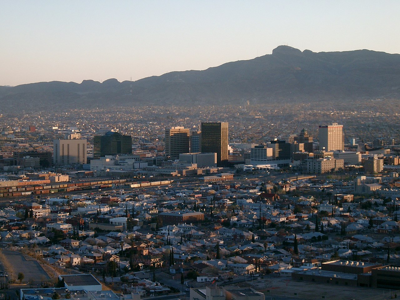
Every photograph in this guide's library is above
This library holds 5 photographs and the page has already printed all of them, each once. The credits are in the footer.
About these photographs. Openly licensed images geotagged in or near Segundo Barrio, found on Wikimedia Commons and served from there with full attribution. Inline photos elsewhere on the page may still come from the site's shared El Paso library.