
Live in Mesa Hills
A renters' neighborhood on Mesa Street, where five homes were rented for every one lived in by its owner in 2020, and where the City's Westside recreation center, two indoor pools and a PK-8 school opened in 2022 all sit inside the line.
Mesa Hills was platted piece by piece from 1960, when the first Fiesta Hills plat was recorded, through the Rubin Heights, Westside Park and Mesa Hills Plaza plats of the 1970s to the 1990s, between Mesa Street and Mesa Hills Drive a few blocks north of Interstate 10. This guide takes the City of El Paso's Mesa Hills neighborhood as its boundary, 467 acres where the 2020 census counted 4,553 residents and 2,284 homes, and renters lived in 1,638 of the 1,963 occupied ones, 83%. On about the same ground in 2010 the census had counted 4,889 residents but only 1,674 homes, so the homes rose by more than a third while the people fell, and this guide found nothing that says why. Zillow's typical value for ZIP code 79912, which holds every resident here, was $322,700 in August 2026, but the ZIP held 78,652 people in 2020, seventeen times the guide's, and reaches far up the Westside, so it is not a Mesa Hills price.
Five rented homes for every owned one, with the City's Westside center in the middle
The City of El Paso's Mesa Hills neighborhood (FID 135 on its Neighborhood Boundaries layer), about 467 acres, traced against the Census Bureau's road file: North Mesa Street, State Highway 20, on the northeast, from Vin Etienne Drive to Mesa Hills Drive; Mesa Hills Drive on the northwest, down to its interchange with Interstate 10; and on the south a line along Rubin, Pete Payan, Suncrest, Carousel, New Orleans and Vin Etienne drives, about 200 meters north of the interstate. Sunland Park Mall, now The Shoppes at Solana, is just outside to the west. Upper Mesa Hills, beside it, is a separate City neighborhood with its own association, though the Mesa Hills Neighborhood Association files the two together. All of it is in El Paso County, El Paso ISD and City Council District 8.
Mesa Hills filled in plat by plat. The first Fiesta Hills plat was recorded in 1960, Rubin Heights followed in 1972, Westside Park in 1976 and Mesa Hills Plaza in 1993, on the ground between Mesa Street and Mesa Hills Drive a few blocks north of Interstate 10. This guide takes the City of El Paso's Mesa Hills neighborhood as its boundary, 467 acres where the 2020 census counted 4,553 residents and 2,284 homes. Renters lived in 1,638 of the 1,963 occupied homes, 83%, five for every one an owner lived in, and 321 homes stood empty on census day. On about the same ground in 2010 the census had counted 4,889 residents in 1,674 homes, so the homes rose by more than a third while the people fell; this guide found nothing that says why. Upper Mesa Hills, beside it, is a separate City neighborhood, though one association files the two together.
Here the tax is mostly a landlord's, and it reaches the rent. A rented house or apartment gets no homestead exemption, so its owner pays the full 2.643693 per $100 that the five taxing units on a City and El Paso ISD address add to for 2025, the highest of the Texas cities on this site. Every resident is in ZIP code 79912, where Zillow's typical value was $322,700 in August 2026, up 2.2% on the year: at that value the full rate comes to about $8,531 a year, and an owner who lives in the house and files for the homestead exemption pays about $6,957. The ZIP held seventeen times the guide's people in 2020 and reaches far up the Westside, so it is not a Mesa Hills price. For a renter the citywide figures are the honest ones: Apartment List's median rents for El Paso were $941 for a one-bedroom and $1,126 for a two-bedroom in September 2026. The arithmetic is on the El Paso page. No management district, tax increment zone or historic district reaches the guide.
The City's Westside center is inside the line. At 650 Wallenberg Drive the Galatzan Recreation Center has two gyms, a weight room and courts for basketball, volleyball and pickleball; Leo Cancellare Memorial Pool and the Westside Natatorium are indoor and open all year; the Polly Harris Senior Center shares the address, and 18 acres of park surround them. Charles Q. Murphree PK-8 on Cabaret Drive took its first students in August 2022, replacing Johnson Elementary and Morehead Middle on a $36.3 million campus, and El Paso ISD zones every block of the guide to it through grade 8. The Texas Education Agency rated it B (81) for 2026, up from F (59) the year before.
FEMA's effective flood map is not digital here. No City of El Paso panel in the National Flood Hazard Layer covers Mesa Hills, so the zone in force for an address has to be read on the scanned panel at FEMA's Map Service Center. FEMA's preliminary countywide map, issued on 8 August 2025 and not yet in force, puts 6.9% of the guide in the 1% annual chance zone, along Arroyo 8 in the Mesa Hills Channel and the Paragon Channel, and no resident's block in it. The monsoon is what fills them: in 2006 the city had a year's rain in two days, and this guide found no record of where it reached in Mesa Hills. A homeowners or renters policy does not cover flood.
Mesa Street is the edge and the way out. Mesa Brio stops at Mesa and Festival, every 15 minutes at weekday peaks and 20 otherwise, on its way between the Westside Transit Center and downtown, and Route 14 runs through the guide past the recreation center every half hour at midday. Sunland Park Mall, renamed The Shoppes at Solana in 2023, is just west across Mesa Hills Drive.
- If you buy to live in, file for the homestead exemption with the El Paso Central Appraisal District
- If you rent, ask the landlord whether the rent has risen with the appraisal and what the lease says about increases
- Read the scanned effective FEMA panel and the August 2025 preliminary map, and price a flood policy near the channels
- Confirm the address with El Paso ISD; the zones here are its 2026-27 files
How Mesa Hills got here
- 1960Fiesta Hills No. 1 is recorded, the earliest plat inside the line on the City's Subdivisions layer; more Fiesta Hills units follow in 1962, 1971, 1978, 1983 and 1998.
- 1972The two Rubin Heights plats are recorded along what is now the guide's southern edge.
- 1976The Westside Park plat, about 26 acres, is recorded; the City's Galatzan Park and its recreation center stand on it and on its 2015 replat.
- 1988Sunland Park Mall opens on 31 August at Interstate 10 and Sunland Park Drive, just west of the guide.
- 1993The Mesa Hills Plaza plat, about 30 acres, is recorded.
- 2004The Mesa Hills Neighborhood Association starts on 11 May and registers with the City on 1 June.
- 2010The census counts 4,889 residents and 1,674 homes on the blocks inside today's line.
- 2018The Johnson PK-8 Phase One plat is recorded on 25 July; Murphree PK-8 stands on it.
- 2020The census counts 4,553 residents and 2,284 homes; renters live in 1,638 of the 1,963 occupied homes.
- 2022Charles Q. Murphree PK-8 takes its first students in August, replacing Johnson Elementary and Morehead Middle; El Paso ISD spent $36.3 million on the campus.
- 2023Sunland Park Mall is bought and renamed The Shoppes at Solana in July.
- 2025FEMA issues its preliminary countywide flood map on 8 August: 6.9% of the guide falls in the 1% annual chance zone, along Arroyo 8's Mesa Hills Channel and the Paragon Channel, and no resident's block does. It is not yet in force.
- 2026El Paso ISD declares financial exigency in June; the Texas Education Agency rates Murphree PK-8 B (81) after F (59) the year before.
Eighteen acres and two indoor pools on Wallenberg Drive
Galatzan Park wraps the recreation center: a playground, soccer and mountain biking, with parking for 185 cars. West across Interstate 10, Keystone Heritage Park keeps 39 acres by Doniphan Drive, and the nearest way onto Franklin Mountains State Park is the Thousand Steps trailhead at the top of North Stanton Street in Mission Hills.

What the map does not show: the heat. The 1991 to 2020 normal at El Paso International brings about 117 days a year reaching 32 °C, and the two indoor pools here stay open all year.

19 places, with real drive times
Road-adjusted distance and drive time from the centre of the community to each destination, nearest first. Filter by category.
Showing 1–12 of 19 places, nearest first.
Method: distances are straight lines from the population-weighted center of the guide's census blocks, multiplied by a road factor, with a tiered speed model for the drive: honest ranges, not routed times.
Every gym within reach
The City's Galatzan Recreation Center and its two indoor pools are about 0.6 km from the guide's center. The nearest YMCA is the Westside Family YMCA on North Mesa Street.
- Galatzan Recreation Center: about 0.8 km, closed Sunday
- Leo Cancellare Memorial Pool and Westside Natatorium: about 1 km, $3 for adults
- Westside Family YMCA: about 5 km
| Facility | What it is | Drive |
|---|---|---|
| Galatzan Recreation Center open | The City's Westside recreation center at 650 Wallenberg Drive, inside the guide: large and small gyms, a weight room, a dance studio and courts for basketball, volleyball, badminton and pickleball. Open 9 a.m. to 8 p.m. Monday to Thursday and 9 a.m. to 2 p.m. on Friday and Saturday; closed Sunday. | 3–4 min |
| Leo Cancellare Memorial Pool open | One of the City's two indoor pools at 650 Wallenberg Drive, open year-round: 5 a.m. to noon and 5 to 9 p.m. on weekdays. Admission is $3 for adults and $2 for children and seniors. | 3–4 min |
| Westside Natatorium open | The second indoor pool at the same address, on the same weekday hours and the same admission. | 3–4 min |
| Westside Family YMCA open | The YMCA of El Paso's Westside branch at 7145 North Mesa Street: open 5 a.m. to 8 p.m. Monday to Thursday, to 7 p.m. on Friday and 8 a.m. to 4 p.m. on Saturday; closed Sunday. | 8–11 min |
| Galatzan Park open | The free option: the City's 18-acre park around the recreation center, with soccer fields and mountain biking, open from 6 a.m. | 3–4 min |
The free option is Galatzan Park itself, open from 6 a.m.
One PK-8 for every block, then Coronado
Every block is in the El Paso Independent School District, and its 2026-27 zones send the whole guide to Charles Q. Murphree PK-8 on Cabaret Drive, inside the line, and then to Coronado High School on Champions Place, rated B (86) for 2026.
| School | Board | Note |
|---|---|---|
| Charles Q. Murphree PK-8 School | El Paso Independent School District | 499 Cabaret Drive, inside the guide, early education to grade 8. El Paso ISD's 2026-27 attendance zones assign it every block of the guide for both elementary and middle school. It opened in August 2022, consolidating Johnson Elementary and Morehead Middle on a $36.3 million campus, and is named for a former Coronado High School principal. The Texas Education Agency rated it B, 81, for 2026 after F, 59, for 2025. |
| Coronado High School | El Paso Independent School District | 100 Champions Place, grades 9 to 12, about 3 km northwest: the high school zoned for the whole guide for 2026-27. Rated B, 86, for both 2026 and 2025. The district's address lookup was down when this was checked, so confirm an address with El Paso ISD; it declared financial exigency in June 2026, so ask about campus plans too. |
Run your own address. The district's address lookup was down when this was checked, so the zones here come from its boundary files. It declared financial exigency in June 2026, so ask about campus plans before a school counts in the decision.
Month by month, what living here looks like
Not a highlights reel: the actual annual rhythm, including the dates residents have to remember.
- The El Paso Central Appraisal District values every property as of 1 January; last year's bill is due by 31 January
- Highs near 15 °C and lows near 1 °C at El Paso International, with about 14 nights at or below freezing on the 1991 to 2020 normal
- Penalty and interest start on unpaid tax bills on 1 February
- The dust season begins: a Texas Tech study of 21 years counted about 22 dust events a year in El Paso, most of them from February to June
- Highs near 18 °C and about 10 mm of rain
- Highs near 22 °C and about 6 mm of rain, with dust events rising toward June
- Highs near 27 °C and about 4 mm of rain, the driest month on the normal
- 15 May, or 30 days after the notice is mailed if that is later, is the deadline to protest a value; the appraisal review board begins hearings around then
- Highs near 32 °C, with about 16 days reaching 32 °C
- Highs near 36 °C, the hottest month's afternoons, with about 11 days reaching 38 °C (100 °F)
- The indoor pools at Galatzan stay open through the summer and the rest of the year
- Highs near 35 °C and about 40 mm of rain as the monsoon storms arrive; July to September bring more than half the year's 223 mm
- Storm water runs down Arroyo 8 in the Mesa Hills Channel and down the Paragon Channel through the guide
- About 42 mm of rain, the wettest month on the normal, and highs near 34 °C
- Highs near 31 °C and about 39 mm of rain
- Highs near 26 °C and about 15 mm of rain as the monsoon ends
- Nights near 12 °C
- Highs near 19 °C and lows near 6 °C, with about five freezing nights
- The 93rd Sun Bowl is played at Sun Bowl Stadium on the UTEP campus at noon on 31 December 2026
- Highs near 14 °C and lows near 1 °C, with about 14 freezing nights and most of the year's 7 cm of snow
5 more photographs of El Paso and the region
Drawn from the site's shared, freely licensed El Paso photo library, not photographs of Mesa Hills itself. Filter by category.


Showing 1–5 of 5 photographs.
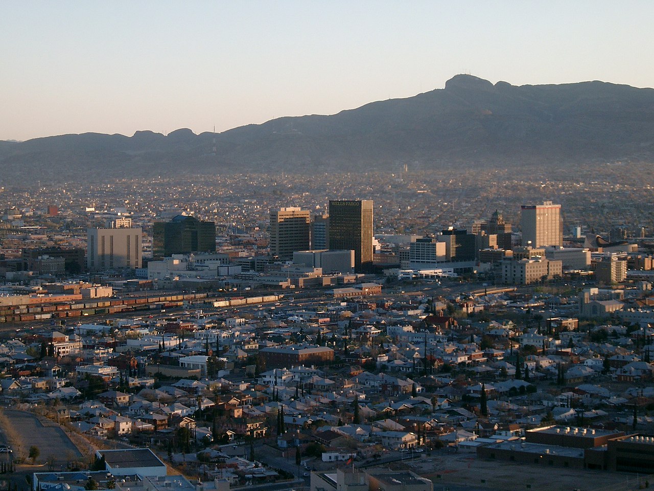
About these photographs. Openly licensed images from the site's shared El Paso library, found on Wikimedia Commons and served from there with full attribution. None of them is presented as a photograph of Mesa Hills.