
Live in Upper Valley
Irrigated river bottom on the Rio Grande's west bank, most of it platted since 2000, where 89% of homes are lived in by their owners and FEMA's preliminary map, not yet in force, puts 83% of the ground in the 1% flood zone behind a levee the federal government said in 2007 it could not certify.
The Upper Valley is farmland on the west bank of the Rio Grande that the City of El Paso annexed on 8 December 1987, and the houses came after: on the City's map of recorded plats, about two thirds of the platted ground inside the guide's line was filed from 2000 on. This guide takes the City's North Upper Valley and South Upper Valley neighborhoods together, about 1,650 acres where the 2020 census counted 7,849 residents, up from 5,972 on about the same ground in 2010, and owners lived in 89% of the occupied homes. The northern part, 4,961 of those residents, is in Canutillo ISD, which publishes no attendance zones that could be found, and the whole guide lies inside the irrigation district's outline. Zillow's typical value for ZIP code 79932 was $328,023 in August 2026, but the ZIP held nearly four times the guide's residents and is not an Upper Valley price.
Irrigated river bottom turned suburb, behind a levee its owner would not certify
The City of El Paso's South Upper Valley (FID 170) and North Upper Valley (FID 171) neighborhoods on its Neighborhood Boundaries layer, taken together, about 1,656 acres, traced against the City's Rio Grande and major arterials layers: the Rio Grande on the east, the whole way; Borderland Road at the north end; Country Club Road at the southern tip; and on the west a line that follows no single street, running near Westside Road. Upper Valley Road runs down the middle. All of it is in El Paso County and inside the outline of El Paso County Water Improvement District No. 1.
The Upper Valley was farmland before it was suburb. Elephant Butte Dam was finished upriver in 1916, the valley's canals and drains were built by 1925, and the irrigation district still waters cotton, alfalfa, pecans and chiles. The City annexed this stretch of the river's west bank on 8 December 1987. The houses came after: on the City's map of recorded plats, about two thirds of the platted ground inside the guide's line was filed from 2000 on. This guide takes the City's North and South Upper Valley neighborhoods together, about 1,650 acres on the river from Borderland Road to Country Club Road, where the 2020 census counted 7,849 residents, up 31% from 5,972 in 2010. Owners lived in 89% of the occupied homes.
The flood map is the decision here. FEMA's effective map for this ground is not in its digital layer at all, so an address has to be read on the scanned panel at FEMA's Map Service Center. Its preliminary countywide map, issued on 8 August 2025 and not yet in force, puts 82.9% of the guide and 7,306 of its residents in the 1% annual chance zone, zone AE at the reference point, and shows none of it as protected by a levee. In 2007 the federal boundary and water commission, which runs the river's levees, told FEMA it could not certify them to hold the 100-year flood with three feet to spare. Its contractors were reinforcing 2.8 miles of the west levee between Country Club and Borderland roads in 2020 and 2021. On 1 August 2006 nearly 10 inches of rain fell on the northwest of the city and the river reached its highest level since 1912.
Two bills come from outside the usual stack. The whole guide lies inside the outline of El Paso County Water Improvement District No. 1, which charged $30 an acre for 2025 on land that keeps a Rio Grande water right, plus $12 an acre-foot delivered and $20 per owner. A lot with a right owes it every year whether or not water is taken; which lots here carry one was not checked. The second is the school district. The North Upper Valley, 4,961 residents, is Canutillo ISD, and its five units add to 2.715493 per $100 for 2025 against 2.643693 in the El Paso ISD south.
No price index follows this line. Every block is in ZIP code 79932, where Zillow's typical value was $328,023 in August 2026, up 2.2% on the year, but the ZIP holds nearly four times the guide's residents. A Canutillo ISD homestead at that value owes about $7,233 a year, the same house without the exemption about $8,907, and an El Paso ISD homestead about $7,098, before any irrigation assessment. The county's median sale price was $280,615. The arithmetic is on the El Paso page.
It is a place to drive from. Route 16 is the only bus through the guide: five trips each way on weekdays, the last about 4:30 p.m. The nearest Brio stop is 6.1 km away in a straight line.
- Pull the scanned effective flood panel for the address and the preliminary panel beside it, and get a flood insurance quote
- Look the lot up in the irrigation district's Property Locator to see whether it carries a water right and an assessment
- Ask Canutillo ISD in writing which schools serve the address, if it is north of the district line
- File for the homestead exemption with the El Paso Central Appraisal District once you live there
How the Upper Valley got here
- 1905Congress extends the Reclamation Act to the Texas valley along the Rio Grande on 25 February, the start of the Rio Grande Project that still waters the valley's farms.
- 1916Elephant Butte Dam is completed in New Mexico; by 1925 the valley's canals and drains are built much as they are today.
- 1930sThe federal boundary and water commission builds the Rio Grande Canalization Project through the 1930s and 1940s, with flood control levees from Percha Dam, New Mexico, down to American Dam in El Paso, past the Upper Valley.
- 1972The earliest recorded plats inside today's line are filed: Suncrest in 1972, Haron in 1973 and Romer-Ray Estates in 1974.
- 1987The City annexes the ground on 8 December by ordinance 9234, in a 3,377-acre annexation.
- 1996El Paso County Water Improvement District No. 1, which took over running the project from the Bureau of Reclamation in 1980, accepts ownership of its canals, laterals and drains on 22 January.
- 2002The busiest years of building begin: plats covering about 31% of the guide's ground are filed from 2000 to 2009, among them nine River Park West units from 2002 to 2006.
- 2006On 1 August nearly 10 inches of rain fall on the northwestern part of the city, Canutillo to the north is badly damaged, and the Rio Grande reaches its highest level since 1912, forcing 1,200 residents of Sunland Park, across the state line, to evacuate.
- 2007The commission tells FEMA it cannot certify that the county's Rio Grande levees will hold the 100-year flood with three feet to spare, and finds 2 miles of possible overtopping in the Upper Valley and Canutillo area.
- 2010The census counts 5,972 residents on the blocks inside today's line.
- 2020The census counts 7,849 residents; in November the commission's contractors are placing clay on 2.8 miles of the west levee between Country Club Road and Borderland Road, due to finish in June 2021.
- 2025FEMA issues its preliminary countywide flood map on 8 August; it shows 82.9% of the guide in the 1% annual chance zone and is not yet in force.

A strip of park along the levee, and the mountains across the valley
The City's Step Towards a River Park, which its park map also calls Rio Grande Trail North, runs 27 acres along the river from Country Club Road to Borderland Road. Mary Frances Keisling Park on Gomez Road, 35 acres with a playground and a soccer field, is one of its access points. The Franklin Mountains State Park, almost 27,000 acres, is across the valley.
What the map does not show: the trail is on the commission's levee, and access points close during levee work, as they did in 2020.
Elsewhere in El Paso, not Upper Valley

24 places, with real drive times
Road-adjusted distance and drive time from the centre of the community to each destination, nearest first. Filter by category.
Showing 1–12 of 24 places, nearest first.
Method: distances are straight lines from the population-weighted center of the guide's census blocks, multiplied by a road factor, with a tiered speed model for the drive: honest ranges, not routed times.
Every gym within reach
Nothing is inside the line. The City's Don Haskins Recreation Center on High Ridge Drive is the nearest, about 4.9 km away in a straight line; the Westside Family YMCA is on North Mesa Street; and the nearest indoor pool is the Westside Natatorium on Wallenberg Drive.
- Don Haskins Recreation Center: about 6.5 km
- Westside Family YMCA: about 8.5 km
- Westside Natatorium: about 13 km, indoor, open all year
| Facility | What it is | Drive |
|---|---|---|
| Don Haskins Recreation Center open | The nearest of the 20 recreation centers the City's Parks and Recreation Department manages, at 7400 High Ridge Drive. | 9–14 min |
| Westside Family YMCA open | One of the YMCA of El Paso's two branches, at 7145 North Mesa Street: open 5 a.m. to 8 p.m. Monday to Thursday, with shorter hours Friday and Saturday; closed Sunday. | 10–15 min |
| Westside Natatorium open | One of the City's 12 indoor pools open all year, at 650 Wallenberg Drive: $3 for adults and $2 for children and seniors. | 14–21 min |
| Galatzan Recreation Center open | The City's recreation center beside the natatorium at 650 Wallenberg Drive. | 14–21 min |
The free option is the river trail on the levee, from Country Club Road to Borderland Road.
Two districts, and only one of them publishes its zones
The North Upper Valley, 4,961 residents, is in the Canutillo Independent School District, which publishes no attendance-zone map or address lookup that could be found. Its nearest campuses are Jose H. Damian Elementary, rated C (77) for 2026, Alderete Middle, B (84), and Canutillo High School, C (73). The South Upper Valley, 2,888 residents, is in the El Paso Independent School District, zoned for 2026-27 to Don Haskins PK-8, C (71), and Coronado High School, B (86).
| School | Board | Note |
|---|---|---|
| Jose H. Damian Elementary School | Canutillo Independent School District | 6300 Strahan Road, prekindergarten to grade 5, the nearest Canutillo ISD elementary to the reference point, about 1.7 km away in a straight line. Canutillo ISD publishes no attendance-zone map or address lookup that could be found, and its district boundaries page answered 404, so this is the nearest campus, not the zoned one. The Texas Education Agency rated it C, 77, for 2026 after B, 84, for 2025. The district's other elementaries nearby include Gonzalo and Sofia Garcia, D (67) for 2026, and Congressman Silvestre & Carolina Reyes, A (92). |
| Jose J. Alderete Middle School | Canutillo Independent School District | 801 Talbot Street in Canutillo, grades 6 to 8, rated B, 84, for 2026 after B, 81. Canutillo ISD has two middle schools; ask the district which one an address is assigned to. |
| Canutillo High School | Canutillo Independent School District | 6675 South Desert Boulevard, grades 9 to 12, rated C, 73, for 2026 after C, 71. Northwest Early College High School is on the same road. |
| Don Haskins PK-8 | El Paso Independent School District | 500 Mulberry Avenue, prekindergarten to grade 8. On El Paso ISD's 2026-27 zone maps it is the elementary and middle school for every South Upper Valley resident, 2,888 in 2020. Rated C, 71, for 2026 after C, 70. El Paso ISD declared financial exigency in June 2026; El Paso Matters' account of the cuts named no school closures, but check before counting on a campus. |
| Coronado High School | El Paso Independent School District | 100 Champions Place, grades 9 to 12, the zoned high school for the South Upper Valley in 2026-27, rated B, 86, for 2026 and 2025. |
Run your own address. The nearest Canutillo ISD campus is not necessarily the zoned one, so ask the district. El Paso ISD declared financial exigency in June 2026; check for closures.
Month by month, what living here looks like
Not a highlights reel: the actual annual rhythm, including the dates residents have to remember.
- The El Paso Central Appraisal District values every property as of 1 January; last year's bill is due by 31 January
- Highs near 15 °C and lows near 1 °C at El Paso International, with about 15 nights at or below freezing on the 1991 to 2020 normal
- Penalty and interest start on unpaid tax bills on 1 February
- Highs near 18 °C and 10 mm of rain; the dust season can begin this month
- The spring wind season peaks in March and April; the National Weather Service counted 36 dust events in El Paso from February to June 2025
- Highs near 22 °C and only 6 mm of rain
- Highs near 27 °C and 4 mm of rain, the driest month on the normal
- About two days reach 32 °C (90 °F); the wind season is still running
- 15 May, or 30 days after the notice is mailed if that is later, is the deadline to protest a value
- Highs near 32 °C, with about 16 days reaching 32 °C (90 °F)
- Highs near 36 °C, the hottest afternoons of the year, with about 11 days reaching 38 °C (100 °F)
- 19 mm of rain as the monsoon approaches
- The summer monsoon begins: 40 mm of rain on the normal, much of it in short, heavy storms
- Highs near 35 °C and lows near 23 °C, the warmest nights of the year
- 42 mm of rain, the wettest month on the normal; on 1 August 2006 nearly 10 inches fell on the city's northwest
- Highs near 34 °C
- 39 mm of rain; July to September bring more than half the year's 223 mm
- Highs near 31 °C, with about 15 days still reaching 32 °C
- The irrigation district approved its 2025 rates on 15 October 2025: $30 an acre on land with a water right, billed on its own statement
- Highs near 26 °C and 15 mm of rain
- Highs near 19 °C and lows near 6 °C, with about five nights at or below freezing
- 11 mm of rain
- Highs near 14 °C and lows near 1 °C, with about 14 freezing nights and, on the normal, about 33 mm of snow
- The tax bill for the year is due by 31 January
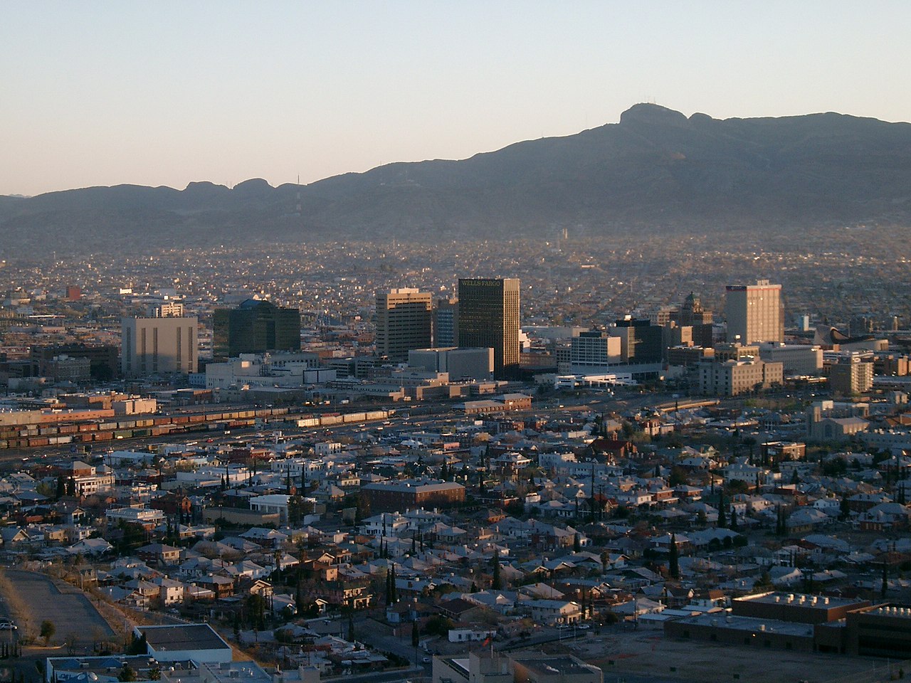
Every photograph in this guide's library is above
This library holds one photograph and the page has already printed it. The credits are in the footer.
About these photographs. Openly licensed images geotagged in or near Upper Valley, found on Wikimedia Commons and served from there with full attribution. Inline photos elsewhere on the page may still come from the site's shared El Paso library.