
Live in Tierra del Este
Not a neighborhood the City draws but 116 recorded plats east of Loop 375, filed one unit at a time from 2001 to 2025, where the residents more than doubled between 2010 and 2020, four in five homes were lived in by their owners, and some lots carry a $200 yearly assessment that no map shows.
Tierra del Este is the name on 116 subdivision plats recorded with the City of El Paso from 2001 to 2025, units 1 to 92 with their replats, amendments and two ponds, east of Joe Battle Boulevard on the far east side. The City's map of neighborhoods has no feature by that name, so this guide takes the plats together as its boundary, less the part inside the City's Sun Ridge neighborhood: about 4,900 acres where the 2020 census counted 48,569 residents and 14,779 homes, more than double the 22,584 residents on the same ground in 2010, and owners lived in 79% of the occupied homes. Every block is in Socorro ISD, whose 2025 rate brings the five units on the bill to 2.501893 per $100 before exemptions, and part of Tierra Del Este III also pays the City's Public Improvement District No. 2 assessment of $200 a lot a year. Zillow's typical value for ZIP code 79938, which holds every resident here, was $255,700 in August 2026; the guide is about half the ZIP's people, which makes the figure closer to a Tierra del Este price than most ZIP figures are, but it is still not one.
A town's worth of houses, filed one plat at a time since 2001
Not a City neighborhood: the 116 plats on the City of El Paso's Subdivisions layer (Planning/Subdivisions layer 72) whose names begin Tierra del Este, units #1 to #92 with their replats and amending plats and two pond plats, recorded from 2001 to 2025, taken together, about 4,891 acres, less the City's Sun Ridge North and Sun Ridge South neighborhoods, whose 781 residents on Tierra del Este plats stay in that guide. A recorded plat is a line the City keeps, not one it draws for a neighborhood. The plats run about 7.6 km from Joe Battle Boulevard, Loop 375, which they reach near Edgemere Boulevard, east past John Hayes Street to the newest units, and about 5.6 km from south to north, touching Montana Avenue at their northwest corner; Edgemere, Pebble Hills and Rich Beem boulevards, Zaragoza Road and John Hayes Street cross them, and other subdivisions, among them Ventanas, Hueco Club Estates, Tierra de Oro and the commercial plats along Zaragoza Road, sit between them. The City's Neighborhood Boundaries layer places 23,972 of the guide's residents in seven neighborhoods (Eastview 6,285, The Points 4,375, El Dorado West 3,746, Las Tierras 3,061, Tierra Humeda 3,039, El Dorado East 2,651 and Tierra Rica 815) and misses the other 24,597. All of it is in El Paso County, Socorro ISD and City Council District 5.
Tierra del Este #1 was recorded with the City in 2001, and 115 more plats of the name followed, the newest in December 2025. The City's map of neighborhoods has no Tierra del Este: it splits 23,972 of these residents among seven neighborhoods with other names and leaves 24,597 in none. So this guide takes the recorded plats together, less the part inside the City's Sun Ridge neighborhood, as its boundary: a patchwork about 7.6 km across east of Joe Battle Boulevard, Loop 375, with other subdivisions between its pieces. It is a set of plats, not a neighborhood the City draws.
It more than doubled in a decade. The 2020 census counted 48,569 residents and 14,779 homes on the plats, against 22,584 residents and 6,598 homes on the same ground in 2010, the largest guide on the site's El Paso list. Owners lived in 79% of the occupied homes. The building has not stopped: units #90 and #91 were recorded in 2024 with 584 and 998 lots, and #92 in December 2025 with 458.
The tax stack is Socorro ISD's, and part of it carries one more line. The five units on a City of El Paso and Socorro ISD address add to 2.501893 per $100 for 2025. Every resident is in ZIP code 79938, where Zillow's typical value was $255,700 in August 2026, up 1.9% on the year: a homestead valued there owes about $5,022 a year, and without the exemption about $6,397. The guide held about half the ZIP's 96,353 people in 2020, so the figure is near, but not, a Tierra del Este price. On top of that, the City's Public Improvement District No. 2, created in 2017 for the Eastside Sports Complex, charges $200 a lot a year for 15 years from the lot's first sale, $3,000 at most, on Tierra Del Este III Phase V and part of Phase IV. No City layer read for this guide draws its line, so which plats pay it is not known here. The arithmetic is on the El Paso page.
Most of the flood map in force is on paper. FEMA's digital effective map covers only 7% of the guide, so most addresses have to be read on the scanned 2006 panel. The preliminary countywide map FEMA issued on 8 August 2025, not yet in force, puts 2.8% of the guide in the 1% annual chance zone, with no resident's block in it, mostly along the Lost Flow Path at the eastern edge, and 2.0% in the 0.2% zone, where 456 residents live. Storm water runs to ponds, two of them recorded as Tierra del Este plats. This guide found no record of where the 2006 flood reached on these plats.
The City's largest park is among the plats. The Eastside Regional Recreation Center, The Beast, opened in 2021 with an indoor 50-meter pool and an outdoor waterpark. Sun Metro's Upper East Side Transit Center is among the plats too, where Montana Brio leaves for Five Points every 30 to 35 minutes. Route 55 runs through on Rich Beem Boulevard about every 45 minutes.
- Ask the seller for the public improvement district notice and check the tax statement
- Read the scanned FEMA panel and the August 2025 preliminary map, especially near the eastern edge
- Run the exact address through Socorro ISD's Street Search: two high school zones and seven elementary zones cross the plats
- File for the homestead exemption with the El Paso Central Appraisal District once you live there
How Tierra del Este got here
- 2001Tierra del Este #1, about 97 acres, and #2 are recorded, the first plats of the name on the City's Subdivisions layer.
- 2006Units #3 to #48 are recorded from 2002 to 2006, eight to twelve a year. The Las Tierras Neighborhood Association starts on 15 June and registers with the City on 10 August.
- 2007El Dorado High School graduates its first senior class; it is now the high school for 19,597 of the guide's residents.
- 2010The census counts 22,584 residents and 6,598 homes on the blocks inside today's plats.
- 2015Pebble Hills High School opens for the 2015-16 school year, among the plats; it is zoned for 28,972 of the guide's residents.
- 2017The City creates Tax Increment Reinvestment Zone 9 on 16 May and, with it, Public Improvement District No. 2, $200 a lot a year for 15 years on Tierra Del Este III Phase V and part of Phase IV, to help pay for the Eastside Sports Complex.
- 2020The census counts 48,569 residents and 14,779 homes; owners live in 11,173 of the 14,219 occupied homes.
- 2021The City's Eastside Regional Recreation Center, The Beast, opens among the plats with an indoor 50-meter pool and an outdoor waterpark, the first phase of a 92-acre park paid for by the 2012 Quality of Life bond.
- 2024Tierra del Este #90, with 584 lots, is recorded on 28 February and #91, with 998, on 19 December.
- 2025FEMA issues its preliminary countywide flood map on 8 August, not yet in force: 2.8% of the guide in the 1% zone, along the Lost Flow Path at its eastern edge and the ponds. Tierra del Este #92, with 458 lots, is recorded on 18 December.
- 2026The Texas Education Agency rates James P. Butler Elementary B (86), SSG Manuel R. Puentes Middle A (92) and Pebble Hills High B (86).


The City's biggest park among the plats, and a park in nearly every unit
Eastside Regional Park, The Beast, is the first phase of a 92-acre master plan: the recreation center, the Eastside Natatorium and an outdoor waterpark. Rainbow Vista Park on Rich Beem Boulevard is the nearest small park, and Salvador Rivas Jr. Park at the western end has a spray park, open from 23 May to 13 September in 2026. Hueco Tanks State Park is about half an hour northeast, by permit.
What the map does not show: the heat and the dust. The 1991 to 2020 normal at El Paso International brings about 117 days a year reaching 32 °C, and dust events, about 22 a year, rise from March to June.
19 places, with real drive times
Road-adjusted distance and drive time from the centre of the community to each destination, nearest first. Filter by category.
Showing 1–12 of 19 places, nearest first.
Method: distances are straight lines from the population-weighted center of the guide's census blocks, multiplied by a road factor, with a tiered speed model for the drive: honest ranges, not routed times.
Every gym within reach
The City's Eastside Regional Recreation Center, The Beast, is among the plats, with a gym, an indoor track and a weight room, and the Eastside Natatorium beside it keeps a 50-meter pool open all year. The nearest YMCA is the Loya Family YMCA on Trawood Drive.
- Eastside Regional Recreation Center and Natatorium: about 2.3 km, $3 a swim for adults
- Marty Robbins Recreation Center: about 9.5 km, closed Sunday
- Loya Family YMCA: about 12.5 km
| Facility | What it is | Drive |
|---|---|---|
| Eastside Regional Recreation Center open | The City's Eastside Regional Recreation Center, The Beast, at 13501 Jason Crandall Drive among the plats: a gym, an indoor track, a weight room, a dance studio and courts for basketball, volleyball and pickleball. Open 6 a.m. to 9 p.m. on weekdays and 6 a.m. to 2 p.m. on Saturday. | 5–8 min |
| Eastside Natatorium open | The indoor pool at The Beast, open all year: a 50-meter competitive pool, a 25-yard leisure pool and diving boards, 5 a.m. to noon and 5 to 9 p.m. on weekdays and 6 a.m. to 2 p.m. on Saturday. Admission is $3 for adults and $2 for children and seniors. | 5–8 min |
| Marty Robbins Recreation Center open | The City's center at 11620 Vista Del Sol Drive, west across Loop 375, with a large gym and a weight room. Open 9 a.m. to 8 p.m. Monday to Thursday and to 2 p.m. on Friday and Saturday. | 11–16 min |
| Loya Family YMCA open | The YMCA of El Paso's eastern branch at 2044 Trawood Drive: open 5 a.m. to 8 p.m. Monday to Thursday, to 7 p.m. on Friday and 8 a.m. to 4 p.m. on Saturday; closed Sunday. | 14–20 min |
| Rainbow Vista Park open | The free option: the City's park of about 10.5 acres on Rich Beem Boulevard, with soccer fields, open from 6 a.m. | 3–4 min |
The free option is Rainbow Vista Park on Rich Beem Boulevard, with soccer fields, open from 6 a.m.
Pebble Hills or El Dorado, and one of seven elementary schools
Every block is in the Socorro Independent School District. Its maps zone 28,972 residents to Pebble Hills High School, among the plats, and 19,597 to El Dorado High School. At the reference point they return James P. Butler Elementary, rated B (86) for 2026, and SSG Manuel R. Puentes Middle, A (92).
| School | Board | Note |
|---|---|---|
| James P. Butler Elementary School | Socorro Independent School District | 14251 Ralph Seitsinger Drive, prekindergarten to grade 5: the elementary zone Socorro ISD's boundary maps return at the reference point, holding 7,371 of the guide's 2020 residents. The Texas Education Agency rated it B, 86, for 2026 after B, 81, for 2025. |
| Cactus Trails Elementary School | Socorro Independent School District | 14701 Ralph Seitsinger Drive, about 0.2 km from the reference point, which is not in its zone: zoned for 8,795 residents. Rated A, 91, for 2026 after A, 92, for 2025. |
| Paso del Norte Fine Arts Academy | Socorro Independent School District | 12300 Tierra Este Road: the largest elementary zone in the guide, 9,667 residents. Rated B, 80, for 2026 after B, 83, for 2025. The other elementary zones are Sgt. Jose Carrasco (6,422), Lujan-Chavez (6,384), Chester Jordan (5,712) and Sgt. Roberto Ituarte (4,218): seven in all. |
| SSG Manuel R. Puentes Middle School | Socorro Independent School District | 3216 Tim Foster Street, grades 6 to 8: zoned for the reference point and for 16,166 residents. Rated A, 92, for 2026 and 2025. The other middle zones are SPC. Rafael Hernando III (13,885), Sun Ridge (12,806) and Hurshel Antwine (5,712). |
| Pebble Hills High School | Socorro Independent School District | On Pebble Hills Boulevard among the plats, grades 9 to 12, opened for 2015-16: zoned for the reference point and for 28,972 residents. Rated B, 86, for 2026 after B, 85, for 2025. |
| El Dorado High School | Socorro Independent School District | 12401 Edgemere Boulevard, grades 9 to 12, which graduated its first seniors in 2007: zoned for the other 19,597 residents. Rated B, 89, for 2026 after B, 87, for 2025. The district's maps state no school year and its zone layers warn that, because of growth, a child may be placed at another school, so run the address through Socorro ISD's Street Search. |
Run your own address. The district's maps state no school year, and its zone layers warn that because of growth a child may be placed at another school than the zone shows. Cactus Trails Elementary, 200 meters from the reference point, is not the school zoned for it.
Month by month, what living here looks like
Not a highlights reel: the actual annual rhythm, including the dates residents have to remember.
- The El Paso Central Appraisal District values every property as of 1 January; last year's bill is due by 31 January
- Highs near 15 °C and lows near 1 °C at El Paso International, with about 15 nights at or below freezing on the 1991 to 2020 normal
- Penalty and interest start on unpaid tax bills on 1 February
- The dust season begins: a Texas Tech study of 21 years counted about 22 dust events a year in El Paso, rising from March to June
- Highs near 18 °C and about 10 mm of rain
- Highs near 22 °C and about 6 mm of rain, with dust events rising toward June
- Highs near 27 °C and about 4 mm of rain, the driest month on the normal
- 15 May, or 30 days after the notice is mailed if that is later, is the deadline to protest a value; the appraisal review board begins hearings around then
- The spray park at Salvador Rivas Jr. Park opened on 23 May in 2026
- Highs near 32 °C, with about 16 days reaching 32 °C
- Highs near 36 °C, the hottest afternoons of the year, with about 11 days reaching 38 °C (100 °F)
- About 19 mm of rain as the first storms build
- Highs near 35 °C and about 40 mm of rain as the monsoon storms arrive; July to September bring more than half the year's 223 mm
- Storm water runs to ponds among the plats and, at the eastern edge, along the Lost Flow Path on FEMA's preliminary map
- About 42 mm of rain, the wettest month on the normal, and highs near 34 °C
- In 2006 the city had a year's rain in two days at the turn of July and August
- Highs near 31 °C and about 39 mm of rain
- The City's spray parks closed for the year on 13 September in 2026
- Highs near 26 °C and about 15 mm of rain as the monsoon ends
- Nights near 12 °C
- Highs near 19 °C and lows near 6 °C, with about five freezing nights
- Highs near 14 °C and lows near 1 °C, with about 14 freezing nights and most of the year's 7 cm of snow
- The Eastside Natatorium, an indoor pool, stays open through the winter
5 more photographs of El Paso and the region
Drawn from the site's shared, freely licensed El Paso photo library, not photographs of Tierra del Este itself. Filter by category.


Showing 1–5 of 5 photographs.
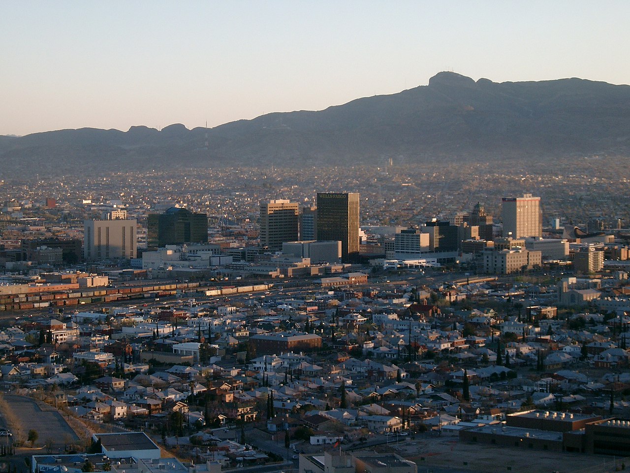
About these photographs. Openly licensed images from the site's shared El Paso library, found on Wikimedia Commons and served from there with full attribution. None of them is presented as a photograph of Tierra del Este.