
Live in Cedar Grove
A 1950s Lower Valley neighborhood a few hundred meters from the Rio Grande, where FEMA's map in force puts more than half the ground in the 1% flood zone and its proposed new map shrinks that to a quarter, and where Ysleta ISD's extra homestead exemption all but erases the school tax on a typical owner-occupied house.
Cedar Grove was laid out in the 1950s on the irrigated farmland of the Lower Valley: the four Cedar Grove Park plats were filed from 1953 to 1959, and the City annexed the whole of it in March 1955. This guide takes the City of El Paso's Cedar Grove neighborhood as its boundary, about 390 acres between Alameda Avenue and the Border Highway, where the 2020 census counted 3,808 residents, down from 4,156 on about the same ground in 2010, and owners lived in 60% of the occupied homes, more than half of those with no mortgage. FEMA's effective map, digital here, puts 54% of the neighborhood in the 1% annual chance flood zone; its preliminary countywide map, issued in August 2025 and not in force, puts 24% there and shows most of the rest as reduced risk behind the river's levee. Zillow's typical value for ZIP code 79915 was $175,225 in August 2026, but the ZIP holds nine times as many people and is not a Cedar Grove price.
A postwar grid on old valley farmland, where the flood map decides more than the house
The City of El Paso's Cedar Grove neighborhood, one feature (FID 56) of the Neighborhood Boundaries layer kept by Community and Human Development, about 390 acres, traced against the Census Bureau's road and water files. Alameda Avenue (State Highway 20) runs along the northeast side; Polo Inn Road runs from Alameda southwest to the Border Highway (Loop 375) at the western tip; Balsam Drive is the southern edge, and the Valley Gate Lateral carries the line back to Alameda in the southeast. The Rio Grande, as the City maps it, is about 140 m beyond the Border Highway, and the Playa Drain crosses the neighborhood. The City's Neighborhoods of Focus layer names the wider area Cedar Grove/Stiles Garden, and the El Paso Lower Valley Association's registered area covers it. All of it is in El Paso County, Ysleta ISD and City Council District 3.
Cedar Grove is the Lower Valley as the 1950s laid it out. The four Cedar Grove Park plats were filed between 1953 and 1959 on irrigated valley land, and the City annexed all of today's neighborhood on 15 March 1955. This guide takes the City's Cedar Grove neighborhood as its boundary: about 390 acres between Alameda Avenue, Polo Inn Road and Balsam Drive, coming to a point at the Border Highway, with the Rio Grande about 140 meters beyond. The 2020 census counted 3,808 residents, down from 4,156 in 2010. Owners lived in 60% of the occupied homes, and 449 of those 805 owners had no mortgage, a sign of long tenure; when the houses were built, this guide could not find on a page it could open.
Two FEMA maps disagree about half the neighborhood. The map in force, the City's digital panel of 16 February 2006, covers every lot: 54.1% of Cedar Grove is in the 1% annual chance flood zone, with 2,071 residents on those blocks, and the reference point is in zone AH, shallow ponding. In that zone flood insurance is mandatory for a federally backed mortgage. The preliminary countywide map, issued on 8 August 2025 and not yet in force, puts 24.0% in the 1% zone and shows 61.3% as reduced risk behind the levee, though the point is in zone AE. The flow path it maps through the neighborhood is the Playa Drain. The National Weather Service's account of the 2006 storms, when the river reached its highest level since 1912, does not name Cedar Grove.
The tax rate is high and the homestead bill is not. The City, the County, El Paso Community College, University Medical Center and Ysleta ISD levy 2.763493 per $100 before exemptions, more than an El Paso ISD address pays. But Ysleta ISD adds its own 20% homestead exemption to the state's $140,000, so on a homestead valued at the ZIP code's $175,225 the school line comes to $2 and the bill to about $2,680 a year, against $3,059 for the same house in El Paso ISD; without the homestead it is about $4,842. Zillow's ZIP 79915 figure was up 3.7% on the year, but the ZIP holds 35,234 people. The neighborhood is also inside El Paso County Water Improvement District No. 1, which bills $30 an acre for 2025 on lots that kept a water right, whether or not they take water. Which lots did was not checked.
The schools and the civic building are inside the line. Riverside Elementary opened on 1 August 2022 on Barker Road, consolidating Cedar Grove and Ascarate elementaries on ground the City's plats record as Cedar Grove Elementary, and feeds Riverside Middle and Riverside High, rated A (91) for 2026. At 7380 Alameda the Valle Bajo Community Center shares a building with the library branch, and the Alameda Brio stops about 600 meters from the reference point, every 20 to 25 minutes on weekdays.
- Look up the lot on FEMA's effective panel 4802140044C and on the preliminary map, and get a flood insurance quote before you offer
- Ask the irrigation district whether the lot carries a water right and an assessment
- File for the homestead exemption, which in Ysleta ISD includes the district's own 20%
- Run your address through Ysleta ISD's SchoolSearch, which says its results do not guarantee placement
How Cedar Grove got here
- 1933Coronado Place, the oldest plat of any size inside today's line, is filed; it covers about 5% of the neighborhood on the City's subdivision layer.
- 1953Cedar Grove Park No. 1 is filed, the first of the four plats that give the neighborhood its name; No. 2 follows in 1956, and Nos. 3 and 4 in 1959. Together they cover about 37% of the ground.
- 1955The City annexes the whole of today's neighborhood on 15 March by Ordinance 1285, in the City's annexation record.
- 2003The El Paso Lower Valley Association, whose registered area takes in Cedar Grove, registers with the City.
- 2006FEMA's digital flood panels for the City take effect on 16 February and cover all of Cedar Grove, putting 54% of it in the 1% zone. That summer the city has a year's rain in two days and the Rio Grande reaches its highest level since 1912.
- 2010The census counts 4,156 residents on the blocks inside today's line.
- 2020The census counts 3,808 residents and 1,469 homes; owners live in 805 of the 1,339 occupied homes, 449 of them free and clear.
- 2021A plat named Cedar Grove Elementary is filed on the old school's ground, where Ysleta ISD is building a consolidated campus.
- 2022Riverside Elementary opens on 1 August, a consolidation of Cedar Grove Elementary and Ascarate Elementary, with parts of the site still under construction.
- 2025FEMA issues its preliminary countywide flood map on 8 August: 24% of Cedar Grove in the 1% zone, 61% shown as reduced risk behind the levee. It is not yet in force.
- 2026Ysleta ISD's proposed budget, with a $15 million deficit, closes César Chávez Academy, an alternative campus, and names no neighborhood school for closure.

A spray park next door and the county's lake a kilometer away
Just past Polo Inn Road, the City's Hidden Valley Park has about nine acres of ball fields, picnic tables and a spray park, open from late May to mid-September. About a kilometer from the neighborhood's edge, El Paso County's Ascarate Park covers 400 acres around a 48-acre lake, with a 27-hole golf course, playgrounds and a 50-meter outdoor pool, and no gate fee on ordinary days.

What the map does not show: the river is close but not a park. The Border Highway stands between the last streets and the Rio Grande, and the City's open space inside the line is small: the Vocational Park Pond on Balsam Drive, with a playground and a soccer field, is also one of the stormwater ponds on FEMA's preliminary map.
Elsewhere in El Paso, not Cedar Grove


16 places, with real drive times
Road-adjusted distance and drive time from the centre of the community to each destination, nearest first. Filter by category.
Showing 1–12 of 16 places, nearest first.
Method: distances are straight lines from the population-weighted center of the neighborhood's census blocks, multiplied by a road factor, with a tiered speed model for the drive: honest ranges, not routed times.
Every gym within reach
The City's Valle Bajo Community Center is inside the neighborhood, with a large gym, a weight room and pickleball courts, and the Officer David Ortiz Recreation Center on North Carolina Drive has a boxing ring. The County's pool at Ascarate is outdoors and seasonal; the nearest City pool open all year is the Hawkins Aquatic Center north of Interstate 10.
- Valle Bajo Community Center: about 0.7 km, inside the neighborhood
- Ascarate Aquatic Center: about 2.9 km, outdoors, summer only
- Hawkins Aquatic Center: about 7.5 km, indoor, $3 for adults
| Facility | What it is | Drive |
|---|---|---|
| Valle Bajo Community Center open | The City's recreation center at 7380 Alameda, inside the neighborhood: a large gym, a weight room, a dance studio, pickleball and outside courts, and the library branch. Open 9 a.m. to 8 p.m. Monday to Thursday and 9 a.m. to 2 p.m. on Friday and Saturday. | 3–4 min |
| Officer David Ortiz Recreation Center open | The City's center at 563 North Carolina Drive, north of Alameda: a basketball gym, a boxing ring and a weight room, on the same hours. | 6–8 min |
| Ascarate Aquatic Center open | El Paso County's outdoor pool complex in Ascarate Park, with a 50-meter competition pool and pools for children: a summer facility, not a year-round one. | 6–9 min |
| Hawkins Aquatic Center open | The nearest of the City's indoor year-round pools, at 1500 Hawkins Boulevard north of Interstate 10: a 25-yard pool, 5 a.m. to noon and 5:30 to 9 p.m. Monday to Thursday, mornings on Friday and Saturday, closed Sunday. $3 for adults, $2 for children and seniors. | 11–16 min |
| Loya Family YMCA open | The nearer of the YMCA of El Paso's two branches, at 2044 Trawood Drive on the east side: 5 a.m. to 8 p.m. Monday to Thursday, to 7 p.m. on Friday, 8 a.m. to 4 p.m. on Saturday, closed Sunday. | 11–16 min |
The free option is Ascarate Park, with no gate fee on ordinary days, open from 5:30 a.m. to 11 p.m. from March to September and 6 a.m. to 10 p.m. in the cooler months.
Riverside at every level, from one district's lookup
Every block is in the Ysleta Independent School District. Its SchoolSearch returns Riverside Elementary on Barker Road, rated C (78) for 2026, Riverside Middle on Mimosa Avenue, B (87), and Riverside High on Midway Drive, A (91), for the reference point and for every populated block.
| School | Board | Note |
|---|---|---|
| Riverside Elementary School | Ysleta Independent School District | 218 Barker Road, prekindergarten to grade 5, inside the neighborhood. Ysleta ISD's SchoolSearch returns it for the reference point and for every populated block; the app states no school year and its address reads 2023. It opened on 1 August 2022 as the consolidation of Cedar Grove Elementary and Ascarate Elementary, on a plat the City records as Cedar Grove Elementary. The Texas Education Agency rated it C, 78, for 2026 after C, 79, for 2025. |
| Riverside Middle School | Ysleta Independent School District | 7615 Mimosa Avenue, grades 6 to 8, just south of the neighborhood: zoned to every populated block. Rated B, 87, for 2026 after B, 82, for 2025. |
| Riverside High School | Ysleta Independent School District | 301 Midway Drive, grades 9 to 12, zoned to every populated block. Rated A, 91, for 2026 and for 2025. Ysleta ISD's 2026-27 budget closes only an alternative campus; a buyer should still run the address, because the district's lookup says its results do not guarantee placement. |
Run your own address. The lookup states no school year and says its results do not guarantee placement. Ysleta ISD's proposed budget for 2026-27 carries a $15 million deficit and closes César Chávez Academy, an alternative campus; it names no closure among the Riverside schools.
Month by month, what living here looks like
Not a highlights reel: the actual annual rhythm, including the dates residents have to remember.
- The El Paso Central Appraisal District values every property as of 1 January; last year's bill is due by 31 January
- Highs near 15 °C and lows near 1 °C at El Paso International, with about 14 nights at or below freezing on the 1991 to 2020 normal
- About 10 mm of rain and 20 mm of snow on the normal
- Penalty and interest start on unpaid tax bills on 1 February
- Highs near 18 °C and lows near 4 °C; high winds and blowing dust are not unheard of this early, the National Weather Service says
- About seven freezing nights on the normal
- The windy season climbs to its peak in March and April; El Paso had 12 dust storms in 2025
- Highs near 22 °C and 6 mm of rain
- Highs near 27 °C and 4 mm of rain, the driest month on the normal
- Still the peak of the dust season
- 15 May, or 30 days after the appraisal notice is mailed if that is later, is the deadline to protest a value
- Highs near 32 °C, with about 16 days reaching 32 °C (90 °F)
- Highs near 36 °C, the hottest afternoons of the year, with about 11 days reaching 38 °C (100 °F)
- 18 mm of rain as the monsoon gathers
- The monsoon arrives: 40 mm of rain on the normal, in short, heavy storms; Cedar Grove's effective flood zone is shallow ponding, zone AH at the reference point
- Highs near 35 °C and the warmest nights, near 23 °C
- 42 mm of rain, the wettest month; the Playa Drain, which crosses the neighborhood, is one of the flow paths on FEMA's preliminary map
- Highs near 34 °C
- 39 mm of rain as the monsoon ends, and highs near 31 °C
- The irrigation district's assessment, $30 an acre for 2025, falls only on lots that carry a water right; check whether yours does
- Highs near 26 °C and 15 mm of rain
- Ascarate Park's winter hours, 6 a.m. to 10 p.m., begin in October
- Highs near 19 °C, lows near 6 °C and about five freezing nights
- 13 mm of snow on the normal, the first of the winter
- Highs near 14 °C and lows near 1 °C, with about 14 freezing nights and 33 mm of snow on the normal
- The tax bill for the year is due by 31 January; penalty and interest start on 1 February
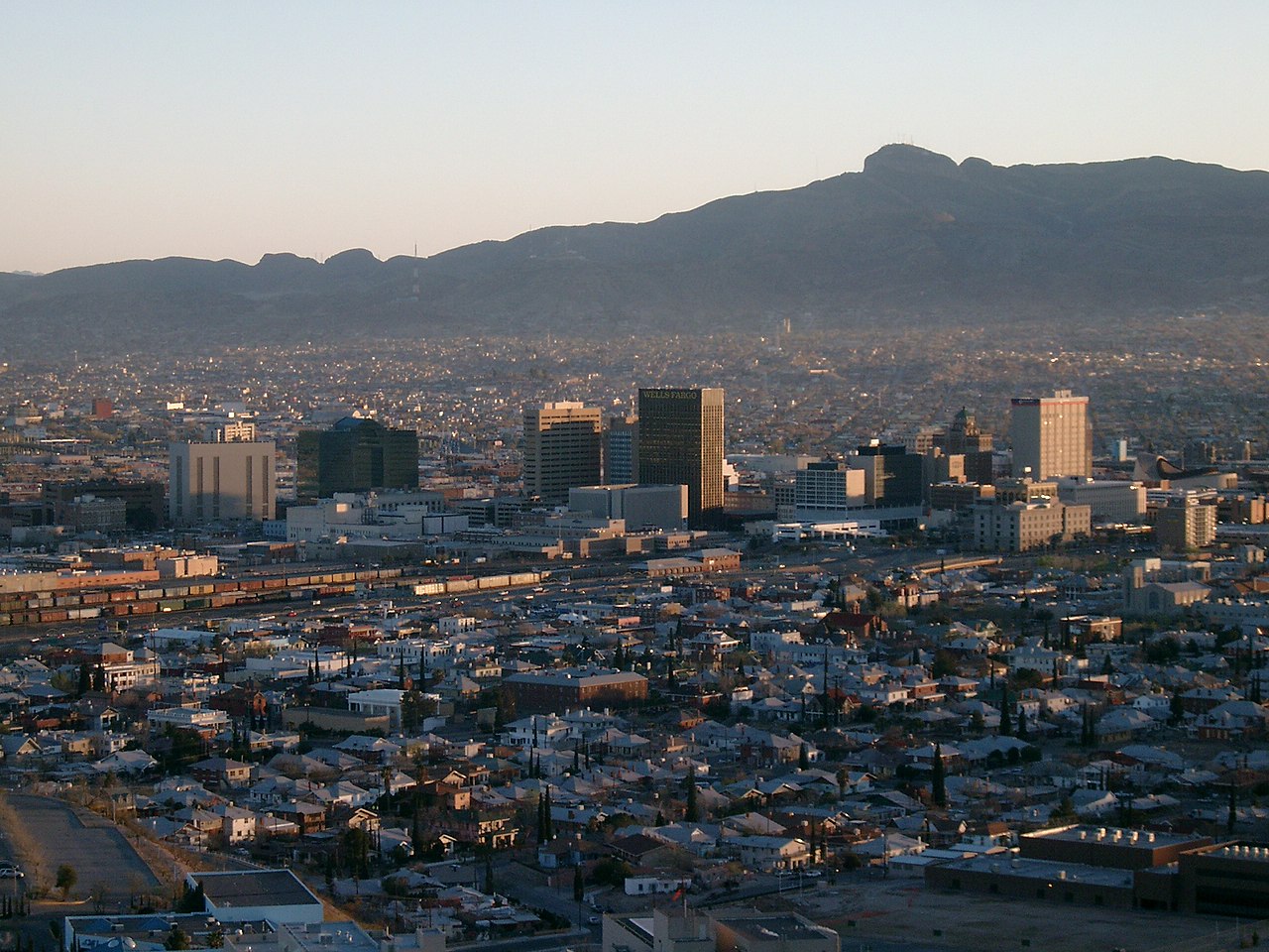
3 more photographs of El Paso and the region
Drawn from the site's shared, freely licensed El Paso photo library, not photographs of Cedar Grove itself. Filter by category.


Showing 1–3 of 3 photographs.
About these photographs. Openly licensed images from the site's shared El Paso library, found on Wikimedia Commons and served from there with full attribution. None of them is presented as a photograph of Cedar Grove.