
Live in Lower Greenville
The blocks between Greenville Avenue and Skillman Street from Ross Avenue to Mockingbird Lane, where owners lived in half the occupied homes in 2020, two conservation districts set the style of a new house on about 231 acres, and on the avenue's southern blocks a business open between midnight and 6 a.m. needs a City permit.
The Lower Greenville Neighborhood Association files about 553 acres on the City's map, from Greenville Avenue east to Skillman Street and from Ross Avenue north to Mockingbird Lane, and the 2020 census counted 6,056 people on its blocks, against 5,462 in 2010. The appraisal roll counts 1,385 single-family houses, 69% of them built before 1950, beside 342 duplex properties. Since 2004 the Belmont Addition and M Streets East conservation districts have governed new houses on about 231 of those acres, and since January 2011 a planned development district on both sides of the avenue between Belmont Avenue and Bryan Street has required a specific use permit for any business open between midnight and 6 a.m. Zillow put the typical home in ZIP code 75206, which holds nearly all of the area and about five times its ground, at $608,484 in August 2026.
Houses from the 1920s to the 1940s beside an avenue whose southern blocks the City rezoned for its late nights
The Lower Greenville Neighborhood Association's area on the City of Dallas's public map of neighborhood and homeowner organizations, whose boundaries neighborhood representatives supply and the City says it does not check: East Mockingbird Lane on the north, Skillman Street on the east down to Live Oak Street, Live Oak Street and Ross Avenue on the south, and the center line of Greenville Avenue on the west, about 553 acres, the lines the association gives on its own site as Mockingbird to Ross and Greenville to Skillman. The west side of the avenue is outside it: on the same map the Glencoe Park, Greenland Hills and Vickery Place associations file the blocks across Greenville from it, from Mockingbird Lane south to about Belmont Avenue, and no association files the west side between Belmont and Ross. The same map files a Belmont Neighborhood Association of about 149 acres wholly inside the area at its southern end. Nearly all of it is in ZIP code 75206.
Greenville Avenue was the Richardson Road until the mid-1920s, and most of the houses east of it went up in the three decades after: the appraisal district dates 390 of today's 1,385 single-family houses to the 1920s, 215 to the 1930s and 326 to the 1940s, and the Belmont Addition at the southern end had houses from as early as 1910. This guide covers the Lower Greenville Neighborhood Association's area as the association files it on the City's map: about 553 acres from the center line of Greenville Avenue east to Skillman Street, and from Ross Avenue north to Mockingbird Lane, with 6,056 residents at the 2020 census against 5,462 in 2010. The City says it does not check those lines, and the west side of the avenue belongs to other associations. The roll also counts 342 duplex properties, among them the fifteen Tudor Revival duplexes of La Vista Court, built in 1929 and 1930 and a City historic district since 1989.
On the avenue's southern blocks, staying open after midnight takes a permit. On 26 January 2011 the Council created PD 842 on both sides of Greenville Avenue from Belmont Avenue south to Bryan Street, about 50.6 acres, 11 of them inside the association's line, to discourage, in its words, an over-proliferation of regional-serving, late-night venues. Any bar, restaurant or shop serving customers between midnight and 6 a.m. needs a specific use permit, no business kept a right to those hours after 23 September 2011, and a permit is weighed against the police citations, arrests and violent crimes tied to the place. The avenue between Ross and Belmont was rebuilt from 2013 with wider sidewalks, lighting and brick pavers. North of Belmont, where the Granada stands, the frontage is community retail zoning and PD 842 does not reach it. This guide found no City list of the late-hours permits in force.
Two conservation districts, and they treat an old house differently. Both date from 2004 and both cap a house at 30 feet. In M Streets East, from Vanderbilt Avenue to McCommas Boulevard, a new house must follow one of six period styles, and a contributing house may come down only if bringing it up to code would cost more than 80% of its appraised value; 14 of its 381 houses date from 2000 or later. Belmont Addition, from Belmont Avenue to Llano Avenue, sets the style of a new house too and has allowed accessory dwelling units since 2019, but its regulations carry no cost test for demolition; 150 of its 367 houses date from 2000 or later. Across the whole area the houses built since 2000 have a median of 3,531 square feet of living space, against 1,766 for those built before 1950. Between the two districts and north of McCommas the base zoning sets no style.
Owners and renters split the occupied homes almost evenly. In 2020 owners lived in 1,545 of the 3,065 and renters in 1,520, and 16% of residents were under 18. The census survey puts median gross rent at $1,418 in the northern tract and $1,853 in the southern. No price index follows the association's line: Zillow's figure for ZIP code 75206, which holds nearly all of it and five times its ground, was $608,484 in August 2026, up 2.9% on the year, and the citywide MLS median single-family sale was $469,900, down 6.0%. On the 2025 rates a homestead at Zillow's figure owes the five taxing units about $10,053 a year and the same house without the exemption about $13,549; the arithmetic is on the Dallas page.
The flood map reaches into the side streets. The City's floodplain layer puts about 15% of the area in zones it calls 1% stormwater hazard areas, touching 448 single-family parcels, the most on Kenwood, Ellsworth and Prospect avenues, and another 22% in a Peak's Branch zone the layer does not define; it shows no AE zone inside the line. DART's Route 3 runs up Matilda Street every 15 minutes at peak and midday, and SMU/Mockingbird Station is about 480 meters west of the northwest corner. On 14 March 2026 the St. Patrick's Day Block Party closed the avenue from McCommas to Belmont for the day; the parade now runs farther north.
- Look the address up on the City's zoning map for CD-11, CD-12 or PD 842 before offering on a house you mean to change
- Near the avenue, visit on a Friday and a Saturday night, and ask the City which nearby businesses hold late-hours permits
- Pull the City's floodplain map for the lot: 448 single-family parcels touch a stormwater hazard zone
- Confirm Geneva Heights or Mockingbird for the exact address with Dallas ISD's school finder
- Work the tax out on your own price, because the seller's capped value ends with the sale
How Lower Greenville got here
- 1910Houses go up in the Belmont Addition from as early as 1910, by the City's account, in an addition named for August Belmont Jr., the financier of the New York subway.
- 1920sThe first big decade of building: the appraisal district dates 390 of today's 1,385 single-family houses inside the association's line to the 1920s, 215 to the 1930s and 326 to the 1940s. Until the mid-1920s Greenville Avenue was known as the Richardson Road.
- 1924The City acquires Keith Park on Skillman Street, just across the association's eastern line; ten years later it is renamed Tietze Park and gets its sandstone pavilion.
- 1929Parks Development Company begins 15 brick and stone veneer rental duplexes on Edison Court, now La Vista Court, finished in 1930.
- 1939Stonewall Jackson Elementary School opens on 13 September on Mockingbird Lane; it has been Mockingbird Elementary since 1 July 2018.
- 1946The Granada Theater opens at 3524 Greenville Avenue as a movie house, designed by Raymond F. Smith.
- 1977The Granada is converted to a concert hall, then reverts to showing films soon afterwards.
- 1989On 29 November the Council designates the Edison/La Vista Court Addition a City historic district, H/47.
- 1997DART's Mockingbird station opens on 10 January, about 480 meters west of the association's northwest corner.
- 2004The Council creates the M Streets East Conservation District on 14 January and the Belmont Addition Conservation District on 24 March. The Granada reopens as a concert hall under new owners.
- 2010Council members Angela Hunt and Pauline Medrano ask for a specific use permit for any Lower Greenville business open past midnight, alongside a plan to narrow the avenue between Belmont and Ross from four lanes to two. The census counts 5,462 residents inside today's line.
- 2011On 26 January the Council passes Ordinance 28109, creating PD 842 on both sides of Greenville Avenue between Belmont Avenue and Bryan Street; every business had to comply with its midnight rule by 23 September.
- 2013The City begins rebuilding the avenue's blocks between Ross and Belmont, widening the sidewalks and adding street lighting, benches, landscaping and brick pavers.
- 2015The City starts the last two stretches, Ross to Alta and Bell to Belmont, a $3.9 million project from the 2012 bond program due to finish in 2016.
- 2018On 1 July Robert E. Lee Elementary becomes Geneva Heights Elementary and Stonewall Jackson Elementary becomes Mockingbird Elementary.
- 2019On 9 January the Council amends the Belmont Addition district to allow accessory dwelling units.
- 2020The census counts 6,056 residents and 3,381 homes inside the line; owners live in 1,545 of the 3,065 occupied homes.
- 2021On 10 November the Council amends both the Belmont Addition district and PD 842, which gains a fourth subdistrict.
- 2022On 12 January the Council amends the M Streets East district, creating a subarea for the commercial lot at Greenville and Marquita avenues.
- 2023Geneva Heights Elementary is rebuilt around its original 1931 building.
- 2026On 14 March the St. Patrick's Day Block Party closes Greenville Avenue from McCommas Boulevard to Belmont Avenue, while the 45th annual parade runs farther north, from Blackwell Street to SMU Boulevard.

Tietze Park across Skillman Street, Glencoe Park across Greenville
The City's parks layer puts no park inside the association's line. Tietze Park, 8.2 acres just across Skillman Street, was bought in 1924 as Keith Park and renamed ten years later for W.R. Tietze, the parks superintendent; it has the nearest City pool, courts, a softball field and trails. Glencoe Park, 14.1 acres on Martel Avenue west of the avenue, dates from 1944 and has softball and rugby fields and a tennis court. The Katy Trail is reached from Mockingbird Station, and White Rock Lake lies east beyond Lakewood.

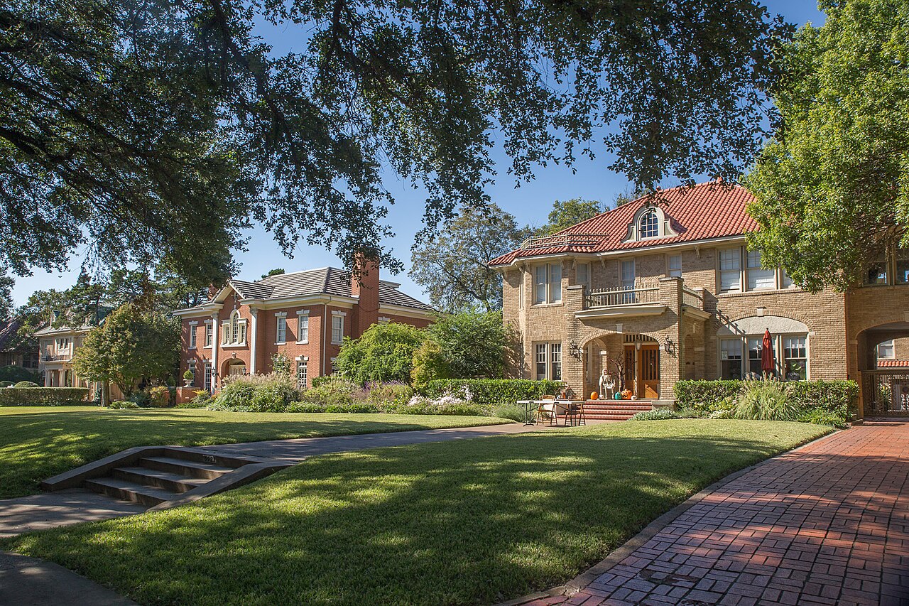
What the map does not show: Tietze's pool hours. The park department's page lists none for 2026 and sends swimmers to Dallas Aquatics. The photographs above are of White Rock Lake, Klyde Warren Park and Fair Park, elsewhere in the city; the library has none of Tietze or Glencoe.
Elsewhere in Dallas, not Lower Greenville


28 places, with real drive times
Road-adjusted distance and drive time from the centre of the community to each destination, nearest first. Filter by category.
Showing 1–12 of 28 places, nearest first.
Method: distances and drive times are computed from the population-weighted center of the census blocks inside the association's line, on Delmar Avenue near Goodwin Avenue, using straight-line distance multiplied by a road factor and a tiered speed model: honest ranges, not routed times.
Every gym within reach
There is no City recreation center inside the line. Tietze Pool is across Skillman Street; the nearest City center, Ridgewood/Belcher on Fisher Road, has a gymnasium and a fitness center, and the White Rock YMCA on Gaston Avenue a pool and a weight room.
- Tietze Pool, 6115 Llano Avenue: about 0.6 km; the City publishes no 2026 hours on its page
- Ridgewood/Belcher Recreation Center, 6818 Fisher Road: about 4.5 km, open to 8 p.m. Monday to Thursday
- White Rock YMCA, 7112 Gaston Avenue: about 4.1 km, from 5 a.m. on weekdays
| Facility | What it is | Drive |
|---|---|---|
| Tietze Pool open | The City's nearest community pool, at 6115 Llano Avenue in Tietze Park, just across Skillman Street. The park department's page lists no 2026 hours or fees and points to Dallas Aquatics for the season. | 3–4 min |
| Ridgewood/Belcher Recreation Center open | The City's nearest recreation center, at 6818 Fisher Road north of Mockingbird Lane: a gymnasium, a fitness center, a sprayground and a tennis court. Open 9 a.m. to 8 p.m. Monday to Thursday, 2 to 7 p.m. Friday and 9 a.m. to 2 p.m. Saturday; closed Sunday. | 7–11 min |
| White Rock YMCA open | The YMCA of Metropolitan Dallas branch at 7112 Gaston Avenue: an outdoor pool, a weight room, a basketball court and pickleball courts. Open 5 a.m. to 10 p.m. Monday to Thursday, with shorter hours from Friday to Sunday. | 6–10 min |
| Katy Trail open | The free option: the trail, reached from Mockingbird Station, or the walking trails in Tietze Park across Skillman Street. | 5–8 min |
The free option is the trails and courts in Tietze Park, or the Katy Trail from Mockingbird Station.
Geneva Heights or Mockingbird, then Long and Woodrow Wilson
Schools are the Dallas Independent School District's, and both elementaries are inside the line. On the 2026-27 boundaries the blocks south of about Monticello Avenue, 3,726 residents in 2020 and every block of the Belmont Addition district, go to Geneva Heights Elementary on Goodwin Avenue, and the blocks north of it, 2,330 residents, to Mockingbird Elementary on Mockingbird Lane; both schools took their names on 1 July 2018. Every block then goes to J.L. Long Middle and Woodrow Wilson High, south of Gaston Avenue. For 2026 the Texas Education Agency rated both elementaries B, Long C and Woodrow Wilson B.
| School | Board | Note |
|---|---|---|
| Geneva Heights Elementary School | Dallas Independent School District | 5895 Goodwin Avenue, inside the line. On the district's 2026-27 attendance boundaries it is the elementary for the 64 populated census blocks south of about Monticello Avenue, 3,726 of the 6,056 residents in 2020, including every block of the Belmont Addition district. Robert E. Lee Elementary until 1 July 2018, it was rebuilt in 2023 around its 1931 building. The Texas Education Agency rated it B, 87, for 2026 and B, 83, for 2025. |
| Mockingbird Elementary School | Dallas Independent School District | 5828 East Mockingbird Lane, inside the line. The elementary for the 46 populated blocks north of about Monticello Avenue, 2,330 residents in 2020, among them 14 of the 22 blocks in the M Streets East district. It opened as Stonewall Jackson Elementary on 13 September 1939 and took its present name on 1 July 2018. Rated B, 89, for 2026 and A, 93, for 2025. |
| J.L. Long Middle School | Dallas Independent School District | 6116 Reiger Avenue, south of Gaston Avenue: the zoned middle school for every block in the area. Rated C, 77, for 2026 and B, 82, for 2025. |
| Woodrow Wilson High School | Dallas Independent School District | 100 South Glasgow Drive: the zoned high school for every block. Rated B, 87, for 2026 and B, 83, for 2025. |
Check the exact address with the district's school finder before you commit. The line between the two elementary zones runs through the M Streets East district, and zones can be redrawn.
Month by month, what living here looks like
Not a highlights reel: the actual annual rhythm, including the dates residents have to remember.
- The Council created the M Streets East district on 14 January 2004, amended the Belmont Addition district on 9 January 2019, and passed PD 842, the avenue's midnight rule, on 26 January 2011
- The appraisal district values every house as it stands on 1 January, and last year's tax bill is delinquent if it is unpaid after 31 January
- Highs near 14 °C and lows near 3 °C at Love Field, with about nine nights at or below freezing on the 1991 to 2020 normal
- Tietze Park, across Skillman Street, kept its community pool in 2011 after residents objected to closing it, by the account of the Friends of Tietze Park, a foundation formed in 2002
- Highs near 17 °C and 71 mm of rain, with four or five nights at or below freezing
- On 14 March 2026 the St. Patrick's Day Block Party filled the 2700 to 3000 blocks of Greenville Avenue; the avenue was closed from McCommas Boulevard to Belmont Avenue from 7 a.m. to 8:15 p.m. and its traffic sent east along Matilda Street
- The 45th annual parade the same day ran farther north, from Blackwell Street south to SMU Boulevard, and the City expected more than 90,000 people across the day's events; DART added Red and Orange Line trains to Mockingbird Station
- The Belmont Addition district was created on 24 March 2004; highs near 21 °C and 88 mm of rain
- The appraisal district's protest season opens around 15 April; a buyer's first value is the market's, because the seller's homestead cap ends with the sale
- Highs near 25 °C and lows near 14 °C, with less than one day reaching 32 °C on the normal
- 15 May is the deadline to protest the appraisal district's value, or 30 days after the notice is delivered if that is later
- 116 mm of rain on the normal, the second wettest month; 448 of the area's 1,385 single-family parcels touch a zone the City's floodplain map calls a 1% stormwater hazard area
- Tietze Pool on Llano Avenue, across Skillman Street, is the nearest City pool; its page points to Dallas Aquatics for the season's hours and fees
- Highs near 34 °C, with about 22 days reaching 32 °C (90 °F) on the normal
- The appraisal district's protest hearings wrap up by 20 July, and the chief appraiser then certifies the roll
- Highs near 36 °C and 43 mm of rain, the driest month, with about 28 days reaching 32 °C
- School starts at Geneva Heights and Mockingbird elementaries, both inside the line, and at J.L. Long and Woodrow Wilson, south of Gaston Avenue
- Highs near 36 °C, with about 10 days reaching 38 °C (100 °F) at Love Field on the normal
- The five taxing units adopt their 2026 rates; this guide's tax arithmetic stays on the 2025 rates, which add to 2.22671 per $100 before exemptions
- Stonewall Jackson Elementary, now Mockingbird Elementary, opened on 13 September 1939, and PD 842's midnight rule reached every business on the avenue's southern blocks on 23 September 2011
- Highs near 32 °C and 79 mm of rain as the storms come back
- Dallas County mails the tax statements in October; they are due on receipt and delinquent after 31 January
- 122 mm of rain at Love Field, the wettest month on the normal
- The Council amended both the Belmont Addition district and PD 842 on 10 November 2021, and designated the Edison/La Vista Court duplexes a historic district on 29 November 1989
- Highs near 20 °C and lows near 9 °C
- Appraisal districts value property at market value as of 1 January, so a house finished or torn down before the new year is appraised as it stands then
- Highs near 15 °C, with six or seven nights at or below freezing on the normal
5 more photographs of Dallas and the region
Drawn from the site's shared, freely licensed Dallas photo library, not photographs of Lower Greenville itself. Filter by category.


Showing 1–5 of 5 photographs.
About these photographs. Openly licensed images from the site's shared Dallas library, found on Wikimedia Commons and served from there with full attribution. None of them is presented as a photograph of Lower Greenville.