
Live in Bowness
A former town on the Bow with its own famous park, amalgamated into Calgary in 1964 and still carrying the bones of an independent town.
Bowness is older than most of Calgary's northwest. Established in 1896, incorporated as a village in 1948, a town in 1951, and only amalgamated into the city in 1964. That history shows: it has its own main street, its own park, and its own high school. It is also honest, working Calgary: 48% of households rented at the 2021 census, median household income was $72,000 in 2020 against $98,000 citywide, and the June 2013 flood put the community under a mandatory evacuation order.
A town that joined the city, and never quite stopped being a town
Bounded north and east by the Bow River, south by 16 Avenue and the Trans-Canada, and west by Stoney Trail, which the community association records as 101 Street. Ward 1.
Bowness is older than most of Calgary's northwest. Established in 1896, it incorporated as a village in 1948, became a town in 1951, and only joined Calgary by amalgamation on 15 August 1964. It still has the bones of an independent town: a real main street on Bowness Road, its own high school, and a park people cross the city for.
It is also honest, working Calgary: 48% of households rented at the 2021 census, and median household income was $72,000 in 2020 against $98,000 citywide. The draw is river, park, mountains and character per dollar, not uniform curb appeal.
The river is the geography. The Bow wraps the community's north and east; the regional pathway runs the whole edge. In June 2013 Bowness was one of 26 neighbourhoods near the Bow and Elbow placed under mandatory evacuation orders, and flood risk remains the single most important due-diligence item here. Check the maps for any specific address.
The west is the horizon. Stoney Trail is the western boundary, WinSport's ski hill is across the Trans-Canada, and Banff is an hour and ten minutes from your driveway.
- The whole community was ordered evacuated in June 2013: check the flood maps for any specific address before you buy
- 27% of the stock predates 1961 and 5% went up between 2016 and 2021: condition varies more here than in the suburban northwest
- 48% of households rent, which means more turnover and more mixed streets than the suburban northwest
- Train and Trans-Canada noise reach the southern streets
- Main Street was commercially revitalised between 2006 and 2010, and Bowness Road is still changing
How Bowness got here
- 1896Bowness is established on the Bow, well outside the young city of Calgary.
- 1911James Hextall, who owned the area and planned to develop it, donates land to Calgary including Bowness Park and a three span steel bridge.
- 1948Incorporated as a village on 14 February.
- 1951Incorporated as a town on 5 November.
- 1964Amalgamated into the City of Calgary on 15 August: the last of the independent-town years.
- 2013Bowness is one of 26 neighbourhoods near the Bow and Elbow rivers placed under mandatory evacuation orders on 20 and 21 June.
- 2021Federal census records 10,770 residents in 5,055 private households, 48% of them renting, with a 2020 median household income of $72,000.
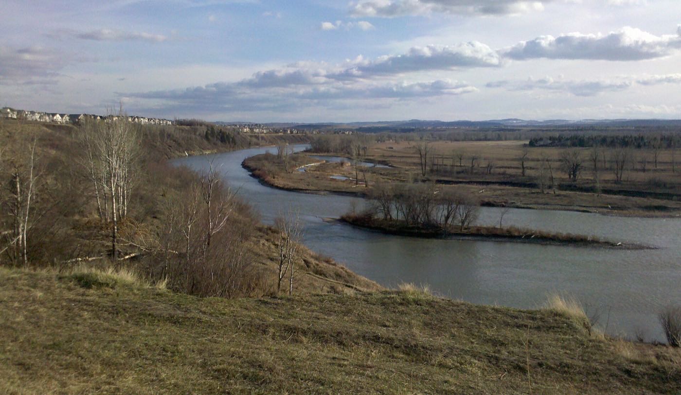
The park people cross the city for is your local
Bowness Park sits on islands James Hextall donated to the city in 1911, and carries boating in summer and skating in winter. The community association counts Bowmont Park, Edworthy Park and Shouldice Pool and Athletic Park alongside it, all linked by the city pathway system.
What the map does not show: the park you visit twice a year becomes something else when it is a short walk. Early mornings before the crowds, weekday skates in winter. That daily ownership of a city landmark is rare.
Elsewhere in Calgary, not Bowness
17 places, with real drive times
Road-adjusted distance and drive time from the centre of the community to each destination, nearest first. Filter by category.
Showing 1–12 of 17 places, nearest first.
Method: distances and drive times are estimated from the centre of the community to each destination using Calgary's road grid, and are rounded to honest ranges rather than presented as precise figures. The west numbers are the story: WinSport across the highway, Stoney Trail as the boundary, and a short run to the mountains from the city's western edge.
Every gym within reach
Facilities here are athletic-park and Olympic-legacy rather than big-box. Confirm hours before you count on any of them.
- Skiing and snowboarding on the doorstep hill, mountain biking in summer, climbing and ice year-round
- Shouldice Pool and Athletic Park carries pools and field sports, east along the river
- The community association's indoor and outdoor rinks are at 7904 43 Avenue NW
- The river pathway and Bowness Park are the free option, including the winter skating
| Facility | What it is | Drive |
|---|---|---|
| Shouldice Aquatic Centre open | City pool at the Shouldice Athletic Park complex, with the field sports alongside. | 4–6 min |
| WinSport Performance Training Centre open | Olympic-legacy gym, ice houses and year-round training facilities at Canada Olympic Park. | 4–7 min |
| University of Calgary Active Living open | Fitness centre, pools, climbing wall and the Olympic Oval, with public memberships. | 8–11 min |
| Bowness Park and the river pathway open | Free option: the lagoon loop, the park and the regional pathway along the Bow, and the skating in winter costs nothing. | 1–3 min |
| Bowness Sportsplex open | Community arena and recreation programming in the heart of the old town. | 4–6 min |
WinSport is not a novelty. A season pass on the doorstep hill means weeknight skiing for children who would otherwise get four mountain days a year. It is the cheapest vertical in the region.
All three levels inside the community
Wikipedia's community article names Belvedere Parkway for elementary, Thomas B. Riley for junior high and Bowness High School for senior, plus Bowcroft Elementary and Our Lady of the Assumption, a Catholic kindergarten to grade 9 school. Few Calgary communities keep all three public levels inside their own boundaries.
| School | Board | Note |
|---|---|---|
| Belvedere Parkway School | Calgary Board of Education | Public elementary, one of the Bowness schools Wikipedia's community article names. |
| Thomas B. Riley School | Calgary Board of Education | Public junior high, named in the same article. |
| Bowness High School | Calgary Board of Education | The community's own senior high: few Calgary communities keep all three levels inside their boundaries. |
| Our Lady of the Assumption School | Calgary Catholic | Catholic kindergarten to grade 9. The Calgary Catholic School District's website refuses automated requests, so this entry rests on Wikipedia's community article. |
The Calgary Catholic School District's website refuses automated requests, so the Our Lady of the Assumption entry rests on that article rather than the district's own page. Confirm designations for a specific address anyway. Boundary streets can map to neighbouring communities.
Month by month, what living here looks like
Not a highlights reel: the actual annual rhythm, including the dates residents have to remember.
- Bowness Park lagoon skating: the classic Calgary winter picture, and it is yours
- Priority snow routes keep the main roads clear
- Indoor recreation carries the season
- Long dark evenings, but rarely for weeks at a stretch
- Ski traffic west on the Trans-Canada peaks on Friday and Sunday
- Coldest snaps usually break with a chinook
- Noticeably longer light by month end
- Indoor pools at their busiest
- Melt and refreeze on the side streets: ice cleats weather
- Pathways reopen as the snow goes
- First patio afternoons on the warm chinook days
- Street sweeping begins late in the month
- Last hard frosts: planting waits for the May long weekend
- Pathway and park season opens properly
- Garden centres open across the quadrant
- Migratory birds return to the parks
- Lagoon boating and the park's miniature railway open for the season
- Lilacs and crabapples through the older streets
- Field sport seasons start on the community greens
- First genuinely warm stretches
- Peak daylight at the solstice: over 16 hours
- School year ends and the parks fill
- Evening thunderstorms begin building over the foothills
- Farmers' markets open for the season
- The Bow runs high early in the month. Flood watch is part of life here
- Hottest month, with cool nights at this elevation
- Evening thunderstorms roll off the foothills
- Canada Day events in the parks
- Folk Festival on Prince's Island mid-month
- Kananaskis and Banff at their best, straight west
- Quietest weeks before school returns
- Smoke from western wildfires is possible
- School year restarts and morning traffic thickens
- First frost typically arrives late in the month
- Poplar and aspen colour begins
- Evenings shorten fast
- River colour along the Bow pathway is the best in the city
- First snow is normal, and normally melts
- Snow tires go on across the quadrant
- Nose Hill's grasses turn gold
- Ski season opens west on the Trans-Canada
- Dark by 5pm
- Freeze sets in for good
- Holiday retail season begins
- Chinook arches over the western skyline on clear days
- Holiday lights through the community streets
- Outdoor rinks open when the freeze holds
- Quiet, short days between the holidays
7 more photographs of the community and its surroundings
All freely licensed, via Wikimedia Commons. Filter by category.


Showing 1–7 of 7 photographs.
About these photographs. Openly licensed images geotagged in or near Bowness, found on Wikimedia Commons and served from there with full attribution. Inline photos elsewhere on the page may still come from the site's shared Calgary library.