
Live in Banff Trail
An inner-city community with a university, a stadium, a technical institute and its own CTrain station on the doorstep.
Banff Trail was established in 1952 on land Calgary annexed in 1910, and was originally called West Capitol Hill. It is small, it is close in, and almost everything that defines it sits just outside its own boundary: the University of Calgary and McMahon Stadium to the west, SAIT to the south, and a Red Line station inside the community. Fifty-eight per cent of households here rent, nearly double the city rate, and the average household is 2.3 people.
Small, close in, and surrounded by institutions
Northeast of the Crowchild Trail and Trans-Canada Highway interchange, in Ward 7. The University of Calgary grounds and McMahon Stadium sit immediately west, SAIT is to the south, and Brentwood, Charleswood, Collingwood, Capitol Hill and St. Andrews Heights are the neighbouring communities.
Banff Trail was established in 1952 on land the city had annexed back in 1910, and it spent its first decades under a different name: West Capitol Hill. The rename to Banff Trail came around the 1970s or 1980s, at a date nobody seems to have recorded, to tell it apart from neighbouring Capitol Hill. Crowchild Trail used to carry the Banff Trail name.
The community itself is modest: 1.4 km² and 3,805 residents in 1,650 private households at the 2021 census. What makes it distinctive is entirely a matter of what it borders. The University of Calgary and McMahon Stadium sit immediately west, SAIT is south along 16 Avenue, and the Banff Trail CTrain station is inside the community, at 2374C Banff Trail NW.
Housing mix. This is one of the most rental-heavy communities on this site: 58% of households rent against 31% across Calgary, and the average household is 2.3 people, with 32% of them living alone. That is the direct consequence of sitting between a university and a technical institute, and it shapes the street life in both directions: cheaper entry, more turnover, more noise in September. 22% of census families here are common-law couples, against 13% city-wide.
Getting around. The Red Line, running through the station here since 7 September 1987, puts downtown roughly fifteen minutes away without a car, and Crowchild Trail and the Trans-Canada meet at the community's southwest corner, which is convenient and loud in equal measure.
- 37% of the occupied stock dates from 1960 or before and another 30% from 1961 to 1980. Expect wiring, plumbing and asbestos questions on anything unrenovated
- 58% of households rent, and turnover concentrates at the start and end of each academic term
- McMahon Stadium seats 35,400, or 46,020 with temporary seating, a block west. Game days fill the surrounding streets: check the Stampeders schedule before you view
- Crowchild Trail and the Trans-Canada carry real traffic noise on the western and southern edges
- Median household income was $84,000 in 2020, against $98,000 city-wide. This is not an affluent community by inner-city standards
How Banff Trail got here
- 1910The land is annexed by the City of Calgary, decades before anything is built on it.
- 1952The community is established under the name West Capitol Hill.
- 1960McMahon Stadium opens on 15 August at 1817 Crowchild Trail NW, immediately west. It is owned by the University of Calgary and operated by the McMahon Stadium Society, and holds 35,400 for Canadian football.
- 1970sThe community is renamed Banff Trail, at a date Wikipedia calls unknown, to distinguish it from neighbouring Capitol Hill. Crowchild Trail used to carry the Banff Trail name.
- 1987Two openings within three weeks: Banff Trail station on 7 September at 2374C Banff Trail NW, on the Red Line's original route, and the Olympic Oval on 27 September on the university campus.
- 2019The City's last civic census counts 4,151 residents in 1,949 dwellings, 1,726 of them occupied and only 649 owner-occupied.
- 2021The federal census counts 3,805 residents in 1,650 private households, 58 per cent of them renting, with a median household income of $84,000 in 2020.
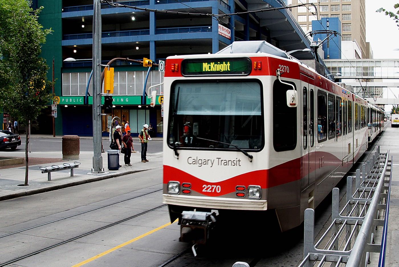
Confederation Park, Nose Hill and the Bow, all within ten minutes
The community has no lake and no river frontage of its own, but it is unusually well placed for open space. Confederation Park is a few minutes east: golf course, coulee and pathway, and the city's best-known Christmas lights walk. Nose Hill Park, 11.27 km² of native grassland and the fourth-largest urban park in Canada, is a ten-minute drive north.
What the map does not show: the real open-space advantage here is the Bow. Edworthy Park and the Douglas Fir Trail are eight to twelve minutes south, and from there the regional pathway network runs unbroken into downtown. If you cycle, this is one of the best-connected communities in the city.
Elsewhere in Calgary, not Banff Trail


19 places, with real drive times
Road-adjusted distance and drive time from the centre of the community to each destination, nearest first. Filter by category.
Showing 1–12 of 19 places, nearest first.
Method: distances and drive times are estimated from the centre of the community to each destination using Calgary's road grid, and are rounded to honest ranges rather than presented as precise figures. The numbers here skew short: this is an inner-city community, and several of the destinations below are genuinely walkable rather than drives.
Every gym within reach
This community is served by institutional facilities rather than commercial clubs, and they are unusually good ones. Public access rules vary by facility and by affiliation, so confirm before you count on any of them.
- Active Living offers public memberships alongside student access. Fitness centre, gymnasiums and climbing wall
- The Olympic Oval, open since 27 September 1987, holds a 400 m long track rink, a 450 m running track, an ice hockey rink and a short track rink, and the university calls it Calgary's premier public skating facility
- MNP Community & Sport Centre at 2225 Macleod Trail South, known as Repsol Sport Centre until spring 2022, adds aquatics, diving and a track ten to fifteen minutes south
- Confederation Park's pathways are the free option, and they connect several kilometres of coulee and golf course
| Facility | What it is | Drive |
|---|---|---|
| University of Calgary Active Living open | Fitness and recreation on the main campus immediately west, alongside the Olympic Oval. Confirm the public membership terms with the university. | 4–6 min |
| Olympic Oval open | 288 Collegiate Boulevard NW on the university campus, open since 27 September 1987 and run by the Faculty of Kinesiology: a 400 m long track rink, a 450 m running track, an ice hockey rink and a short track rink. The university calls it Calgary's premier public skating facility. | 4–7 min |
| Foothills Aquatic Centre open | City-run pool at 2915 24 Avenue NW, south of the community, listed by the City with weights and cardio. | 3–5 min |
| Confederation Park pathways open | Free option: several kilometres of maintained pathway through the golf course and coulee. | 4–7 min |
| SAIT Campus Centre fitness open | Gym and fitness facilities on the SAIT campus; access rules depend on affiliation, so confirm before relying on it. | 4–7 min |
| MNP Community & Sport Centre open | The old Lindsay Park Sports Centre at 2225 Macleod Trail South, renamed Talisman Centre in 2002, Repsol Sport Centre in 2016 and MNP Community & Sport Centre in spring 2022. Aquatics, diving, a track and courts. | 11–16 min |
Check the access rules first. University and SAIT facilities price and restrict access differently for students, staff, alumni and the general public, and the rules change between terms. Ask specifically about a public membership before you assume the facility next door is available to you.
An elementary inside, two bilingual schools nearby, and two campuses next door
Banff Trail School, styled École Banff Trail on its own CBE site, is the elementary inside the community and runs a French immersion programme. Branton Bilingual Junior High and William Aberhart Bilingual Senior High are the schools Wikipedia names as serving the community, both with bilingual programming. The CBE does not publish grade ranges to non-browser clients, so this guide states none. The unusual part is post-secondary: the University of Calgary and SAIT are each within a few minutes.
| School | Board | Note |
|---|---|---|
| Banff Trail School | Calgary Board of Education | Also styled École Banff Trail. Elementary inside the community, with a French immersion programme. The CBE does not publish the grade range to non-browser clients. |
| Branton Bilingual Junior High | Calgary Board of Education | The junior high Wikipedia names as serving the community, with bilingual programming. |
| William Aberhart Bilingual Senior High | Calgary Board of Education | The senior high Wikipedia names as serving the community, with bilingual programming. Confirm the designation for a specific address with the board. |
| University of Calgary | Post-secondary | Immediately west, with McMahon Stadium and the Olympic Oval on its grounds. |
| SAIT | Post-secondary | Southern Alberta Institute of Technology, immediately south along 16 Avenue. |
Alberta funds Catholic education the same way it funds public education, so there is no tuition for a resident student at either board. Designations change: confirm the current designation for a specific address with the board before you buy, particularly for elementary, where catchments in the inner-city northwest have been reviewed repeatedly.
Month by month, what living here looks like
Not a highlights reel: the actual annual rhythm, including the dates residents have to remember.
- Chinooks arrive here early and strong: the northwest gets them first
- Confederation Park's lights walk runs through the first week
- Olympic Oval and the university pools carry the indoor season
- Crowchild and 16 Avenue are priority snow routes, so access stays good
- Dinos and university sport at their midseason peak
- Reading week empties the campus and the parking pressure with it
- Ski traffic on the Trans-Canada is heaviest on Friday and Sunday
- Longer light by month end
- Melt and refreeze on the side streets: the coulee slopes stay icy longest
- Nose Hill's grassland comes out from under the snow
- Pathway network reopens through Confederation Park
- Convocation and end-of-term traffic builds
- Bow River pathways at Edworthy dry out and get busy
- Spring convocation brings visitor parking pressure near the university
- Last hard frosts: gardens go in late in this part of the city
- Migratory birds return to the Confederation Park ponds
- Nose Hill's crocuses and grassland flowers come out
- Cycling on the Bow pathway becomes the fastest way downtown
- Student population drops sharply for the summer
- Long evenings: sunset past 9pm by month end
- Bowness Park lagoon and paddle boats open
- Stampeders pre-season starts at McMahon
- Rental turnover peaks as student leases end
- Peak daylight: the solstice brings 16-plus hours
- Calgary Stampede: ten days, a Red Line ride away
- Stampeders home games fill McMahon and the surrounding streets
- Canada Day at Prince's Island, straight down the Red Line
- Evening thunderstorms build over the foothills to the west
- Quietest month on campus and the streets around it
- Kananaskis and Banff at their best, straight west
- Folk Festival on Prince's Island mid-month
- Back-to-school retail pressure begins at Market Mall
- Students return: traffic, transit and parking all step up in the first week
- Dinos football season opens at McMahon
- First frost typically arrives late in the month
- Nose Hill's grasses turn
- Peak colour along the Bow at Edworthy and Bowness
- First snow is normal, and normally melts
- Homecoming weekend at the university
- Snow tires go on across the northwest
- Ski season opens west on the Trans-Canada
- Confederation Park lights go up
- Exam period quiets the campus streets
- Dark by 5pm
- Confederation Park lights walk at its busiest
- Campus closes down between terms
- Chinook arches over the western skyline are common
- Olympic Oval public skating through the holidays
4 more photographs of the community and its surroundings
All freely licensed, via Wikimedia Commons. Filter by category.


Showing 1–4 of 4 photographs.
About these photographs. Openly licensed images geotagged in or near Banff Trail, found on Wikimedia Commons and served from there with full attribution. Inline photos elsewhere on the page may still come from the site's shared Calgary library.