
Live in Rosemont
Half a square kilometre of 1958 streets on Confederation Park's northern rim.
Rosemont is a pocket: 0.45 km² by the City's boundary polygon, and 1,155 residents in 515 private households at the 2021 census. The lands were annexed in 1910 and the community was established in 1958, on the northern rim of what was then the North Hill Coulee and became Confederation Park in 1967. Its whole story is position: the park below, 14 Street beside, and the inner north's pools and parks within minutes. The stock is old, 61 per cent of it built in 1960 or before, and a third of households rent.
The pocket on the park's rim
Bounded by Northmount Drive to the north, Cambrian Drive to the east, 23 Avenue N and Confederation Park to the south, and 14 Street W to the west. Ward 4 on the City's current map; Wikipedia still gives Ward 7, which predates the 2021 boundaries.
Rosemont is one of the city's smallest communities: 0.45 km² by the City's boundary polygon, and 1,155 residents in 515 private households at the 2021 census. The land was annexed in 1910 and sat undeveloped until the community was established in 1958.
The park is the address, though it arrived nine years after the houses did. The coulee below the southern edge was still called the North Hill Coulee when Rosemont was built; it opened as Confederation Park in 1967, 162 hectares for Canada's centennial, with the golf course below and the Lions Festival of Lights each December and early January.
Housing mix. The stock is old: 61% of occupied dwellings date from 1960 or before and another 25% from 1961 to 1980. It is also less uniform than the size suggests. Only 53% are single-detached; 23% are semi-detached and 17% are flats in a duplex. A third of households rent, and median household income was $107,000 in 2020, against $98,000 across Calgary. Owners here pay a median $1,060 a month in shelter costs, the lowest end of the city's range, while renters pay $1,450.
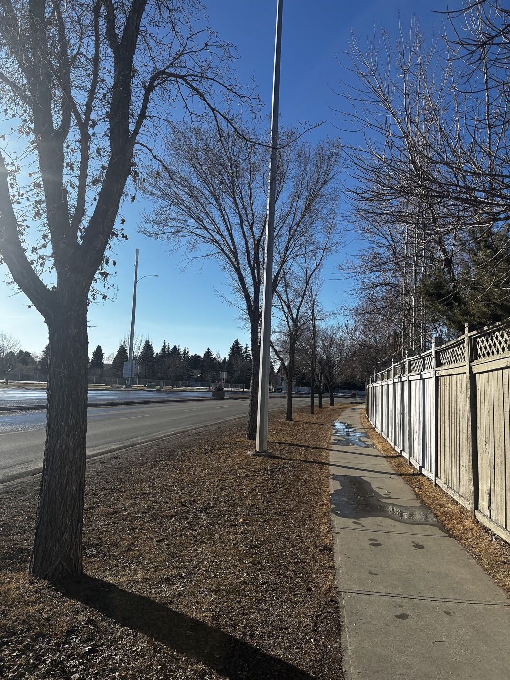
- 61% of occupied dwellings were built in 1960 or before: the era's full inspection list applies
- Tiny inventory: 515 private households in the whole community
- 14 Street carries real traffic on the western edge
- Ward 4, not the Ward 7 Wikipedia still prints: that number predates the 2021 boundaries
- The community association has one hall room for 120 and no kitchen, gym or stage. It runs a rink and playfields instead
How Rosemont got here
- 1910The land is annexed by the City of Calgary. Nothing is built on it for almost fifty years.
- 1958Rosemont is established on the rim of what Calgarians then called the North Hill Coulee.
- 1960The Rosemont Community Association is registered as an Alberta society on 24 November. Its hall, at 2807 10 Street NW, is a single licensed room for 120 with no kitchen, stage or gym.
- 1967The coulee below the rim opens as Confederation Park, 162 hectares built for Canada's centennial, its jagged walls remoulded into contoured hillsides.
- 2019The City's last civic census counts 1,254 residents in 569 dwellings, 546 of them occupied and 314 owner-occupied.
- 2021The federal census counts 1,155 residents in 515 private households, 33 per cent of them renting, with a median household income of $107,000 in 2020 against $98,000 across Calgary.
The rim as a property line
The community's southern boundary is the park: 162 hectares opened in 1967 on the old North Hill Coulee, its jagged walls deliberately remoulded into contoured hillsides. Rim streets walk straight down into it, with the golf course, tobogganing slopes, about eight hectares of managed wetland and the Lions Festival of Lights below.
What the map does not show: rim-backing lots are the product, and everything else in a 0.45 km² community is a two-minute walk to the same rim. The park runs from 24 Avenue and 14 Street NW to 30 Avenue and 10 Street NW, so the walk down is short from any street in the pocket.
Elsewhere in Calgary, not Rosemont


10 places, with real drive times
Road-adjusted distance and drive time from the centre of the community to each destination, nearest first. Filter by category.
Showing 1–10 of 10 places, nearest first.
Method: distances and drive times are estimated from the centre of the community to each destination using Calgary's road grid, and are rounded to honest ranges rather than presented as precise figures. Pocket-scale list: 14 Street carries everything further.
Every gym within reach
Two City aquatic centres and the park below. Confirm hours before you count on anything.
- 6715 Centre St. N.W.: pool, dive tank, hot tub, steam room, weights and cardio, fitness studio
- Sir Winston Churchill Aquatic & Recreation Centre at 1520 Northmount Dr. N.W. is on the community's own northern boundary road, with the same list of amenities
- The park's pathways are the free option, and the golf course fills the shoulder seasons
- The community association runs a skating rink and playfields, not a gym
| Facility | What it is | Drive |
|---|---|---|
| Thornhill Aquatic & Recreation Centre open | City-run at 6715 Centre St. N.W.: pool, dive tank, hot tub, steam room, weights and cardio, fitness studio and a universal change room. | 8–12 min |
| Confederation Park below the rim open | Free option: the park's pathways drop from the community's own southern edge, with tobogganing slopes and the Lions Festival of Lights each December and early January. | 1–2 min |
| Triwood and area programs open | The neighbouring associations' programmes. Rosemont's own association runs a skating rink and sports fields, and its hall at 2807 10 Street NW is one licensed room for 120 with no gym or kitchen. | 3–5 min |
The park does the daily work. The paid options are for water and weights, and the City lists two of them within a few minutes: Thornhill on Centre Street and Sir Winston Churchill on Northmount Drive. Nothing this audit could open publishes a gym at SAIT open to the public, so do not plan around one.
One school in the pocket
Rosemont School carries kindergarten through grade 6 inside the community, and both Wikipedia and the Federation of Calgary Communities name it as the community's school. Its own page notes a student population small enough that staff know every child by name. Everything after grade 6 designates outside the pocket.
| School | Board | Note |
|---|---|---|
| Rosemont School | Calgary Board of Education | Public elementary through grade 6 inside the community. Its own page notes that the small student population means staff know every student, and it prints no attendance area. |
| Ladder designations | Both boards | Junior and senior years designate outside the community. Nothing this audit could open prints the designation, so confirm it for a specific address. The Calgary Catholic School District's site refuses automated clients. |
Alberta funds Catholic education the same way it funds public education, so there is no tuition for a resident student at either board. Confirm the designation for a specific address before you buy: nothing this audit could open prints an attendance area for any school here, and the Calgary Catholic School District's site refuses automated clients.
Month by month, what living here looks like
Not a highlights reel: the actual annual rhythm, including the dates residents have to remember.
- The Lions Festival of Lights runs in Confederation Park through early January
- Priority snow routes keep the main roads clear
- Indoor recreation carries the season
- Long dark evenings, but rarely for weeks at a stretch
- Ski traffic west on the Trans-Canada peaks on Friday and Sunday
- Coldest snaps usually break with a chinook
- Noticeably longer light by month end
- Indoor pools at their busiest
- Melt and refreeze on the side streets: ice cleats weather
- Pathways reopen as the snow goes
- First patio afternoons on the warm chinook days
- Street sweeping begins late in the month
- Last hard frosts: planting waits for the May long weekend
- Pathway and park season opens properly
- Garden centres open across the quadrant
- Migratory birds return to the parks
- Long evenings: sunset past 9pm by month end
- Lilacs and crabapples through the older streets
- Field sport seasons start on the community greens
- First genuinely warm stretches
- Peak daylight at the solstice: over 16 hours
- School year ends and the parks fill
- Evening thunderstorms begin building over the foothills
- Farmers' markets open for the season
- Calgary Stampede: ten days across the city
- Hottest month, with cool nights at this elevation
- Evening thunderstorms roll off the foothills
- Canada Day events in the parks
- Folk Festival on Prince's Island mid-month
- Kananaskis and Banff at their best, straight west
- Quietest weeks before school returns
- Smoke from western wildfires is possible
- School year restarts and morning traffic thickens
- First frost typically arrives late in the month
- Poplar and aspen colour begins
- Evenings shorten fast
- Peak autumn colour through the older tree-lined streets: 61% of the occupied stock dates from 1960 or before
- First snow is normal, and normally melts
- Snow tires go on across the quadrant
- Nose Hill's grasses turn gold
- Ski season opens west on the Trans-Canada
- Dark by 5pm
- Freeze sets in for good
- Holiday retail season begins
- Chinook arches over the western skyline on clear days
- Holiday lights through the community streets
- The community association's skating rink opens when the freeze holds
- Quiet, short days between the holidays
4 more photographs of the community and its surroundings
All freely licensed, via Wikimedia Commons. Filter by category.


Showing 1–4 of 4 photographs.
About these photographs. Openly licensed images geotagged in or near Rosemont, found on Wikimedia Commons and served from there with full attribution. Inline photos elsewhere on the page may still come from the site's shared Calgary library.