
Live in Point McKay
A riverside enclave on the Bow with no detached houses at all: 61% row houses, 36% high-rise apartments, and the pathway as the front street.
Point McKay is a planned riverside enclave on the Bow's north bank, west of Parkdale, and it is its own community district in the City's records rather than part of Parkdale. It is also the most unusual housing stock in this batch: at the 2021 census not one of its 795 occupied dwellings was a single-detached house. Sixty-one per cent are row houses and 36% are apartments in buildings over five storeys, 97% of them built between 1961 and 1990. It held 1,330 residents on 0.4 km², with 53% of households one person and 27% of residents 65 or over.
The riverside enclave
On the Bow's north bank west of Parkdale, below Memorial Drive, in the City's Centre sector. Ward 7.
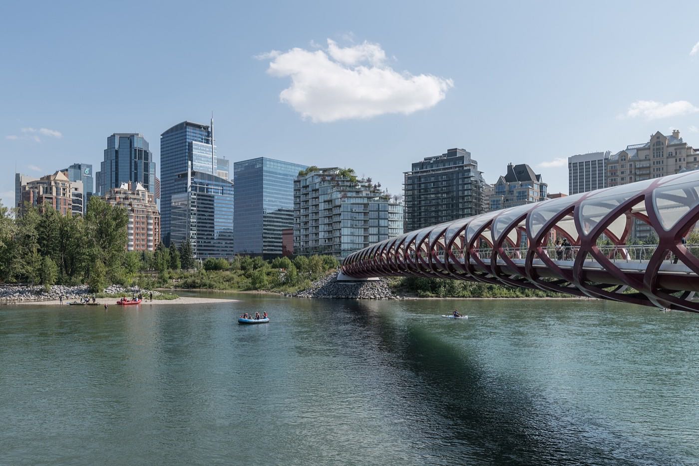
Point McKay is a purpose-built riverside enclave on the Bow's north bank with the pathway as its front street. It is its own community district in the City's records, not a corner of Parkdale, and it has its own community profile: 1,330 residents in 795 private households on 0.4 km² at the 2021 census.
The housing is the story. Not one occupied dwelling here is a single-detached house. 61% are row houses and 36% are apartments in buildings above five storeys, with 97% of the stock built between 1961 and 1990 and nothing at all since 2000. Seventy-seven per cent of households own, and median household income was $92,000 in 2020.
Who lives here. 53% of households are one person, against 26% citywide, average household size is 1.7 against 2.6, and 27% of residents are 65 or over against 13%. Eleven per cent of employed residents walk to work, with Foothills Medical Centre, the largest hospital in Alberta, minutes up the hill. It is almost entirely condominium: the buy-in decision is as much about boards, reserves and documents as about the address.
- Entirely row house and apartment: reserve funds and board minutes are the real diligence
- 97% of the stock was built between 1961 and 1990, and nothing since 2000. Ask what has been replaced, not what is planned
- River flat: know the flood story for a specific building
- Memorial Drive borders the north: orientation decides the noise
How Point McKay got here
- 1961–1980Sixty-seven per cent of the enclave's occupied dwellings go up in these two decades, per the 2021 census.
- 1981–1990Another 30% follows. After 1990 the census records only 15 more dwellings, and none at all after 2000.
- 2021The federal census records 1,330 residents in 795 private households: 61% row houses, 36% apartments above five storeys, no single-detached houses at all, and 77% of households owning.
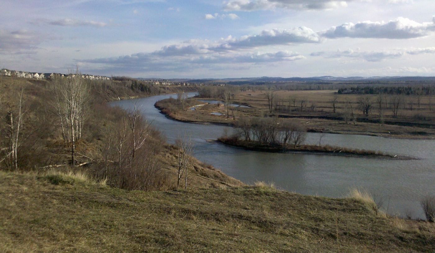
Edworthy across the water
The pathway is the enclave's spine. Edworthy Park sits across the Bow: 1.27 km² with over 5 km of trails that are part of the Bow River pathway, and the Douglas Fir Trail in its natural area, where the City is running a slope repair and safety study. Neither the City's park page nor Wikipedia describes a river crossing at Point McKay, so this guide does not claim one.
What the map does not show: this is the closest thing Calgary has to pathway-front living. Judge a unit by its river orientation first.
Elsewhere in Calgary, not Point McKay
9 places, with real drive times
Road-adjusted distance and drive time from the centre of the community to each destination, nearest first. Filter by category.
Showing 1–9 of 9 places, nearest first.
Method: distances and drive times are estimated from the centre of the community to each destination using Calgary's road grid, and are rounded to honest ranges rather than presented as precise figures. Everything near is walkable; everything far starts with Memorial Drive.
Every gym within reach
The club inside, the neighbours' facilities around. Confirm terms before you count on anything.
- West Hillhurst's association, 1940 6 Avenue NW, is minutes east: its own site lists a fitness centre, ice arena, squash courts and gymnasium, though the Federation of Calgary Communities lists only rinks and courts
- University of Calgary Active Living, up the hill, is open to the general public: fitness centres, an aquatic centre, climbing walls and the Olympic Oval
- The pathway is the standing free option
- Edworthy Park's 5 km of trails are the hill workout, across the water
| Facility | What it is | Drive |
|---|---|---|
| Riverside club facilities open | The private club at the enclave's centre. No publisher we could open sets out its facilities or membership terms. | 1–2 min |
| West Hillhurst Community Fitness open | The association's own site lists a fitness centre, ice arena, squash courts and gymnasium at 1940 6 Ave NW. The Federation of Calgary Communities lists only rinks, tennis and playfields, and neither lists a pool. | 4–7 min |
| University of Calgary Active Living open | Fitness centres, gymnasiums, an aquatic centre, climbing and bouldering walls, a racquet centre and the Olympic Oval, open to the general public and communities. | 5–8 min |
| The Bow pathway open | Free option: flat kilometres of the regional pathway east toward downtown, and Edworthy Park's 5 km of trails across the water. | 1–2 min |
Most residents' real gym is the pathway. The paid options fill the winter.
No school inside, and no published catchment
No school sits inside Point McKay. The nearest school building, in neighbouring Parkdale, is Westmount Charter School's elementary campus at 728 32 Street NW, a charter school for gifted students rather than a Calgary Board of Education community school.
| School | Board | Note |
|---|---|---|
| No school inside the community | Both boards | No school sits inside Point McKay. The nearest building in neighbouring Parkdale is Westmount Charter School's elementary campus, not a Calgary Board of Education community school. Neither board publishes an attendance area we could read; confirm the designation for a specific address. |
| Catholic designations | Calgary Catholic | The Calgary Catholic School District's site refuses automated clients, and nothing else we opened names a Catholic school serving Point McKay. |
Alberta funds Catholic education the same way it funds public education, so there is no tuition for a resident student at either board. Confirm the designation for a specific address before you buy: neither board publishes an attendance area we could read, and the Calgary Catholic School District's site refuses automated clients.
Month by month, what living here looks like
Not a highlights reel: the actual annual rhythm, including the dates residents have to remember.
- The river steams on cold mornings: the enclave's private weather show
- Priority snow routes keep the main roads clear
- Indoor recreation carries the season
- Long dark evenings, but rarely for weeks at a stretch
- Ski traffic west on the Trans-Canada peaks on Friday and Sunday
- Coldest snaps usually break with a chinook
- Noticeably longer light by month end
- Indoor pools at their busiest
- Melt and refreeze on the side streets: ice cleats weather
- Pathways reopen as the snow goes
- First patio afternoons on the warm chinook days
- Street sweeping begins late in the month
- Last hard frosts: planting waits for the May long weekend
- Pathway and park season opens properly
- Garden centres open across the quadrant
- Migratory birds return to the parks
- Long evenings: sunset past 9pm by month end
- Lilacs and crabapples through the older streets
- The pathway fills through the long evenings along the enclave's river edge
- First genuinely warm stretches
- Peak daylight at the solstice: over 16 hours
- School year ends and the parks fill
- Evening thunderstorms begin building over the foothills
- Farmers' markets open for the season
- Calgary Stampede: ten days across the city
- Hottest month, with cool nights on the river flat at 1,062 m
- Evening thunderstorms roll off the foothills
- Canada Day events in the parks
- Folk Festival on Prince's Island mid-month
- Kananaskis and Banff at their best, straight west
- Quietest weeks before school returns
- Smoke from western wildfires is possible
- School year restarts and morning traffic thickens
- First frost typically arrives late in the month
- Poplar and aspen colour begins
- Evenings shorten fast
- Peak autumn colour through the older tree-lined streets
- First snow is normal, and normally melts
- Snow tires go on across the quadrant
- Nose Hill's grasses turn gold
- Ski season opens west on the Trans-Canada
- Dark by 5pm
- Freeze sets in for good
- Holiday retail season begins
- Chinook arches over the western skyline on clear days
- Holiday lights through the community streets
- Outdoor rinks open when the freeze holds
- Quiet, short days between the holidays
6 more photographs of the community and its surroundings
All freely licensed, via Wikimedia Commons. Filter by category.


Showing 1–6 of 6 photographs.
About these photographs. Openly licensed images geotagged in or near Point McKay, found on Wikimedia Commons and served from there with full attribution. Inline photos elsewhere on the page may still come from the site's shared Calgary library.