
Live in Monte Vista
A City historic district since 1975, where any change to the outside of a house needs the City's certificate of appropriateness before a permit, no mapped flood zone touches the ground, and owners live in half the occupied homes.
Monte Vista grew from 1890, when Jay E. Adams platted Adam's Laurel Heights on land north of San Pedro Springs Park that San Antonians had called a goat pasture, and was largely built by the 1930s; in 1975, after more than 1,600 adult residents signed petitions, the City made it a historic district. This guide takes that district as its boundary: about 546 acres from Ashby Place north to Hildebrand Avenue and from San Pedro Avenue east toward Trinity University, where the 2020 census counted 3,473 residents on 89 blocks, 8% fewer than on about the same ground in 2010. It is all San Antonio ISD, whose only published attendance map is drawn for 2021-22. Zillow put the typical home in ZIP code 78212, which holds every resident here and more than 23,000 others, at $281,984 in August 2026.
A goat pasture of 1890 that its residents petitioned into a historic district
The City of San Antonio's Monte Vista Historic District (OBJECTID 13 on the Office of Historic Preservation's district layer, about 546 acres), designated on 17 July 1975. Traced against the City's street layer, its lines are West and East Hildebrand Avenue on the north; San Pedro Avenue on the west; Ashby Place on the south, from San Pedro Avenue east to McCullough Avenue; and on the east McCullough Avenue north to about Magnolia Avenue, then a stepped line by Trail Street and Kings Court to the U.S. 281 frontage road near Huisache and Mulberry avenues, and Shook Avenue and Ledge Lane up to Hildebrand beside Trinity University. The Handbook of Texas gives the lines as San Pedro, Hildebrand, Stadium Drive, and McCullough from Huisache south to Ashby. All of it is in Bexar County and San Antonio ISD.
In 1890 Jay E. Adams of Colorado platted Adam's Laurel Heights north of San Pedro Springs Park, on ground the historian Donald Everett says San Antonians knew as Mrs. Kampmann's goat pasture. Other developers followed a few blocks at a time, and building went on into the 1930s. This guide covers the City's Monte Vista Historic District, about 546 acres from Ashby Place north to Hildebrand Avenue and from San Pedro Avenue east to McCullough and the edge of Trinity University, where the 2020 census counted 3,473 residents, 8% fewer than on about the same blocks in 2010.
Every change to the outside of a house here is reviewed before it is permitted. Residents organized in 1973 against what the Handbook of Texas calls commercial intrusion, and after more than 1,600 adults signed petitions the City made the district on 17 July 1975. Under the Unified Development Code a certificate of appropriateness has to be secured before a permit for work on a property in a historic district, and demolition and relocation are reviewed too. Ordinary repairs and minor alterations that follow the Historic Design Guidelines can be approved by the Office of Historic Preservation's staff; new construction, additions and anything outside the guidelines go to the eleven-member Historic and Design Review Commission, which meets on the first and third Wednesdays. Private interiors are exempt. Nine parcels inside the line are also individually designated landmarks.
Half the homes are owner-occupied, and the price figure is not Monte Vista's own. In 2020 owners lived in 876 of the 1,761 occupied homes and 341 more stood vacant. Nobody publishes a price for the district. Zillow's value for ZIP code 78212, which holds all 3,473 residents and 23,265 more beyond the line, was $281,984 in August 2026, down 0.8% on the year, against a Bexar County median sale of $280,999. The index mixes houses and condominiums across the whole ZIP, so it says little about the large houses on Belknap Place or any other one street.
The tax bill is a San Antonio ISD bill. On Bexar County's official 2025 table the seven units on a Monte Vista address, San Antonio ISD among them, come to 2.440474 per $100 before exemptions. On the 78212 figure a homesteaded owner would owe about $4,566 a year and the same house without the exemption about $6,882. The San Antonio page works the arithmetic for a Northside ISD address, which is not this one.
The ground is high, and the map shows no flood zone. FEMA's effective map puts none of the district in its 1% or 0.2% annual chance zones, and no named creek crosses it; the San Antonio River is about 1.5 km east and Martinez Creek 1.7 km west. That is not the same as dry streets: Hildebrand at Kendall, on the northern line, is one of the City's low-water crossings, and flash floods reach beyond any mapped line.

- Ask the Office of Historic Preservation which work on this house staff can approve and which goes to the HDRC
- Check whether the parcel is also an individually designated landmark
- Confirm the zoned schools with San Antonio ISD's enrollment office for the exact address
- Price a flood policy even outside the mapped zone
How Monte Vista got here
- 1878Colonel Augustus Belknap's street railway reaches San Pedro Springs Park from Main Plaza, opening the land north of the park to building.
- 1889Real estate developers take an interest in a goat pasture about two miles north of downtown.
- 1890Jay E. Adams of Colorado plats Adam's Laurel Heights, between Magnolia and Woodlawn and between Howard and San Pedro, which the Midtown Neighborhoods Plan's history calls the first modern subdivision officially platted in San Antonio.
- 1901In a spring building boom across the city's suburbs, Laurel Heights exceeds them all in popularity, in historian Donald E. Everett's account.
- 1913Herbert L. Kokernot's Renaissance Revival mansion goes up at 114 East Kings Highway.
- 1929Harry and Hannah Landa build their Italian-style house on Bushnell Avenue; Harry Landa gives it and its grounds to the city in 1946, and it opens as a public library in 1947.
- 1973Residents form the Monte Vista Historical Association in response to commercial intrusion and deterioration.
- 1975On 17 July the City designates the Monte Vista Historic District, after more than 1,600 adult residents sign petitions for it.
- 1998The district is listed on the National Register of Historic Places.
- 2010The census counts 3,774 residents on the blocks inside today's district line.
- 2020The census counts 3,473 residents and 2,102 homes inside the line; owners live in 876 of the 1,761 occupied homes.
- 2021San Antonio ISD last edits the attendance zones it still publishes, drawn for the 2021-22 school year.
- 2026The association's 5K through the district and its Holiday Market are set for 14 November.


A library garden and a pocket park inside, the big parks just beyond
Inside the line the City keeps Landa Library Park, the grounds of the house Harry Landa gave the city in 1946, and Woody Tucker Park, a small park at Huisache Avenue and Kings Court. The large parks are just outside. Brackenridge Park, 343.7 acres with the zoo, the Witte Museum and the Japanese Tea Garden, lies across U.S. 281; San Pedro Springs Park, public land since 1852, is south of Ashby Place; and Olmos Basin Park stretches north of Hildebrand Avenue.


What the map does not show: how much rain the ground north of the district can take. Over the Memorial Day weekend of 2013 the Olmos basin, where the park lies, took more than 17 inches, in a flood that killed two people.

22 places, with real drive times
Road-adjusted distance and drive time from the centre of the community to each destination, nearest first. Filter by category.
Showing 1–12 of 22 places, nearest first.
Method: distances and drive times are computed from the population-weighted center of the district's 2020 census blocks, near Summit Avenue between San Pedro Avenue and McCullough, using straight-line distance multiplied by a road factor and a tiered speed model: honest ranges, not routed times.
Every gym within reach
There is no City recreation center inside the line. The nearest YMCA is D.R. Semmes on North St. Mary's by Brackenridge Park, which lists weights, classes and a climbing wall but no pool, and the nearest City pool is in San Pedro Springs Park, which was on weekend hours at the end of September.
- D.R. Semmes Family YMCA: about 2.1 km, 5 a.m. to 9 p.m. on weekdays
- San Pedro Springs Park Pool: about 2.1 km, weekends only on the City's 2026 layer
- Woodlawn Lake Park Pool: about 4.5 km
| Facility | What it is | Drive |
|---|---|---|
| D.R. Semmes Family YMCA open | The nearest YMCA, at 3233 North St. Mary's by Brackenridge Park: free weights, cardio machines, group exercise, cycling, an indoor rock wall and child watch, open 5 a.m. to 9 p.m. on weekdays. No pool is listed. | 5–7 min |
| San Pedro Springs Park Pool open | The nearest City pool, at 2200 North Flores Street in San Pedro Springs Park; on the City's 2026 pools layer it was open 1 p.m. to 8 p.m. on Saturdays and Sundays. | 5–7 min |
| Woodlawn Lake Park Pool open | The City pool at 221 Alexander Avenue, open the same weekend hours on the 2026 layer. | 7–11 min |
| Brackenridge Park open | The free option: the park's paths and the river across U.S. 281, 343.7 acres in all. | 5–8 min |
The free option is Brackenridge Park's paths along the river, across U.S. 281.
One school district, and a map drawn for 2021-22
Every block is in the San Antonio Independent School District. On the district's 2021-22 attendance map, the most recent it publishes, 68% of residents were zoned to Agnes Cotton Academy on Blanco Road, then a PK-8 campus and now grades 3 to 8, rated A (90) for 2026, and 32% to Hawthorne PK-8 Academy on West Josephine Street, rated D (66). The map has no middle school zone here, and every block goes to Edison High School on Santa Monica Street, rated B (85) for 2026. Wikipedia still names Mark Twain Middle School; TEA now lists Twain as a PK-8 dual language academy.
| School | Board | Note |
|---|---|---|
| Agnes Cotton Academy | San Antonio Independent School District | 1616 Blanco Road, west of the district in Beacon Hill. On the district's 2021-22 attendance map, the most recent it publishes, Cotton was a PK-8 campus and the zone at the reference point and for 2,357 of the 2020 residents, 68%. TEA's September 2026 list has it teaching grades 3 to 8, and TEA rates it paired with Beacon Hill Primary (PK to 2), so the younger grades may now be taught there. Rated A, 90, for 2026 and B, 86, for 2025; 87.6% of its students counted as economically disadvantaged. |
| Hawthorne PK-8 Academy | San Antonio Independent School District | 115 West Josephine Street, south of the district: the zone on the 2021-22 map for the other 1,116 residents, 32%. Rated D, 66, for 2026 and D, 69, for 2025; 78.2% of its students counted as economically disadvantaged. |
| Edison High School | San Antonio Independent School District | 701 Santa Monica Street, north of Hildebrand Avenue: the high school zone for every block on the 2021-22 map. Rated B, 85, for 2026 after C, 79, for 2025, with a graduation rate component of 98.6; 88.4% of its students counted as economically disadvantaged. No middle school zone covers the district on that map, because both elementary zones were PK-8 campuses. |
Treat every one of these assignments as unconfirmed. The only map San Antonio ISD publishes predates changes such as Cotton's move to grades 3 to 8, and its website refused this guide's requests; call its enrollment office with the exact address before relying on a zone.
Month by month, what living here looks like
Not a highlights reel: the actual annual rhythm, including the dates residents have to remember.
- The appraisal district values every property as of 1 January; last year's bill is due by 31 January
- Highs near 17 °C and lows near 5 °C at San Antonio International, with about five nights at or below freezing on the 1991 to 2020 normal
- The Monte Vista Historical Association holds its I Love Monte Vista party at a neighbor's house on a Sunday afternoon
- Penalty and interest start on unpaid tax bills on 1 February
- Highs near 20 °C and 44 mm of rain, the driest month on the normal
- The Monte Vista Historical Association holds its Easter egg hunt at Landa Library on the Saturday before Easter
- Highs near 23 °C and lows near 11 °C, with 59 mm of rain
- Fiesta San Antonio runs from 15 to 25 April 2027, citywide
- Highs near 27 °C and 61 mm of rain
- 15 May, or 30 days after the appraisal district mails its notice if that is later, is the deadline to protest a value
- 112 mm of rain, the wettest month on the normal, and about 12 days reaching 32 °C (90 °F)
- Over the Memorial Day weekend of 2013 the Olmos basin, north of Hildebrand Avenue, took more than 17 inches of rain
- Highs near 34 °C, with about 24 days reaching 32 °C and 83 mm of rain
- Flash flooding killed 13 people in San Antonio in June 2025
- The association's Fourth of July parade starts at Lynwood Avenue and Howard Street and ends with a picnic at Landa Library
- Highs near 35 °C and lows near 24 °C, with about 29 days reaching 32 °C
- Highs near 36 °C, the hottest month on the normal, with about nine days reaching 38 °C (100 °F)
- About 29 days reach 32 °C (90 °F) on the normal
- 99 mm of rain, the second wettest month on the normal, and highs near 32 °C
- Hildebrand at Kendall, on the district's northern line, is one of the City's mapped low-water crossings
- The association gathers neighbors for its updates on a Sunday in October at Laurel Heights Methodist Church
- Muertos Fest fills Hemisfair from 23 to 25 October 2026
- 95 mm of rain and highs near 28 °C
- The association's 5K through the district and its Holiday Market are both on 14 November 2026
- The 45th Ford Holiday River Parade is on the River Walk on 27 November 2026
- Highs near 22 °C and lows near 10 °C, with 53 mm of rain
- The San Antonio Marathon runs from 4 to 6 December 2026
- Highs near 18 °C and lows near 6 °C, with about four nights at or below freezing
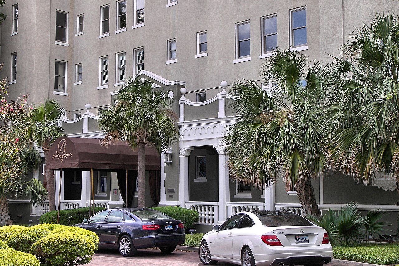
Every photograph in this guide's library is above
This library holds 4 photographs and the page has already printed all of them, each once. The credits are in the footer.
About these photographs. Openly licensed images geotagged in or near Monte Vista, found on Wikimedia Commons and served from there with full attribution. Inline photos elsewhere on the page may still come from the site's shared San Antonio library.