
Live in Hamilton Park
The subdivision a citizens' association built for Black families, dedicated in October 1953 and opened in May 1954, where 57% of residents were Black in 2020 and every coded tax account is in Richardson ISD.
This guide covers the area the Hamilton Park Civic League files on the City's map: about 208 acres east of Central Expressway and north of Forest Lane, with the LBJ Freeway at its northern corner and TI Boulevard along its eastern side. The Handbook of Texas records that the Dallas Citizens' Interracial Association bought a 233-acre site with money from the Hoblitzelle Foundation after Black homes in South Dallas were bombed in 1950, and that the addition was virtually complete by 1961 with 742 houses. The 2020 census counted 2,141 residents in the league's blocks, 57% of them Black and 33% Hispanic, and owners lived in about half of the 680 occupied homes. The appraisal district's 2026 roll puts every coded account in the City of Dallas and in Richardson ISD, not Dallas ISD.
Built by a citizens' association for Black families, now zoned to Richardson ISD
The Hamilton Park Civic League's area on the City of Dallas's public map of neighborhood and homeowner organizations, whose boundaries neighborhood representatives supply and the City says it does not check: Willowdell Drive and Schroeder Road on the west, from Forest Lane at the southern tip north to the LBJ Freeway's eastbound service road at the northeast corner; on the north, east and southeast the line runs behind the houses on Bunche Drive, Hallum Street and Oberlin Drive, with TI Boulevard and DART's Red and Orange Line tracks beyond it. About 208 acres, all in ZIP code 75243 and, on the Census Bureau's school district map, in Richardson ISD. Central Expressway passes about 260 m west of the line. The Handbook of Texas puts the original purchase at 233 acres.
Hamilton Park is the subdivision east of Central Expressway and north of Forest Lane that a citizens' association built for Black families in the segregated city. The Handbook of Texas sets its origin against a housing crisis: Karl Hoblitzelle told his foundation's trustees in May 1949 of the "desperate need" for housing, several Black homes in South Dallas were bombed in 1950, and a January 1953 bond election approved clearing Black neighborhoods for the expansion of Love Field. The Dallas Citizens' Interracial Association, formed in October 1951, bought a 233-acre site with $216,872.93 from the Hoblitzelle Foundation, a loan in the Handbook and a gift in Wikipedia, and three banks lent $423,619.99 for infrastructure. It was dedicated in October 1953, named for the physician Richard T. Hamilton, and formally opened in May 1954. The City annexed two thirds of the land in August 1953 and the rest in July 1955.
This guide covers the civic league's line, not the original purchase. It takes the area the Hamilton Park Civic League files on the City's map, about 208 acres from Willowdell Drive and Schroeder Road east to the lots behind Hallum Street, and the City says it does not check those lines. The Handbook counts 742 houses, an apartment complex, a shopping center, a park and a twelve-grade school by 1961; the appraisal district's 2026 roll counts 645 single-family parcels inside the line, on a median lot of 7,767 square feet, and the census survey dates half the homes in the two block groups over it to the 1950s. The Handbook also records that the Civic League worked to enforce the deed restrictions; this guide has not found their text or how they are enforced today.
The census still found a majority-Black neighborhood. Its blocks held 2,141 people in 2020, the Handbook's 1990 count was 2,148, and 57% were Black against 23% citywide, with 33% Hispanic. Owners lived in 344 of the 680 occupied homes, 51% against 40% for Dallas, and 112 homes, 14%, stood empty, 45 of them for reasons other than being for rent or sale, against 8.5% vacancy citywide.
The school district, and so the tax bill, is Richardson's. All 655 coded accounts inside the line are in the City of Dallas and Richardson ISD, whose 2025 rate was 1.1052 per $100 against Dallas ISD's 0.993835, with the same $140,000 and 10% homestead exemptions but $60,000 for owners aged 65 or older where Dallas ISD gives $95,000. Zillow's typical home in ZIP code 75243, about 28 times the area, was $295,914 in August 2026, down 1.2% on the year; the citywide MLS median single-family sale was $469,900, down 6.0%. On the 2025 rates a homestead at Zillow's figure owes Dallas County about $510, the City $1,654, Richardson ISD $1,396, Dallas College $252 and Parkland $502, or $4,315 a year, and about $6,919 without the exemption; a Dallas ISD address would owe $141 less, and no improvement district applies. The sources disagree on what a house here is worth: Zillow's single-family figure for the ZIP code is $421,202, and owners' own estimates in the census survey give block group medians of $151,000 and $250,400. The city's own arithmetic is on the Dallas page.
The freeways and the rail line close it in. Central Expressway runs about 260 m west of the line and the LBJ Freeway touches its northeast corner. Forest Lane Station on the Red and Orange Lines is just past the southern tip, and LBJ/Central Station, about 220 m east, mainly serves two Texas Instruments campuses by employee shuttle, by Wikipedia's account; TI Boulevard runs along the eastern side. Medical City Dallas is about 770 m away on Forest Lane, and the City's flood map puts only 1.2% of the area in the 1% annual chance zone.

- Confirm the junior high and high school for the exact address with Richardson ISD's School Finder
- Read the school district on the appraisal district's account for the address; every coded account inside the line says Richardson ISD
- Ask the Civic League which deed restrictions bind the lot before you plan an addition
- File for the homestead exemption before 1 May; at Zillow's figure it is worth about $2,600 a year
- Work the tax out on your own price, because the seller's capped value ends with the sale
How Hamilton Park got here
- 1949In May the theater owner and philanthropist Karl Hoblitzelle tells his foundation's trustees of the desperate need for housing for Black Dallas residents and proposes a large development, by the Handbook of Texas's account.
- 1950Several Black residences in South Dallas are bombed.
- 1951The Dallas Citizens' Interracial Association is established in October.
- 1953A January bond election approves demolishing Black neighborhoods for the expansion of Love Field. The Hoblitzelle Foundation provides $216,872.93 for a 233-acre site, a loan in the Handbook and a donation in Wikipedia, and three Dallas banks lend $423,619.99 for infrastructure.
- 1953Ordinance 5909, effective on 24 August, brings about 142 acres of today's civic league area, two thirds of it, inside the city limits; the addition is dedicated in October and named for Dr. Richard T. Hamilton, a Black physician and civic leader.
- 1954Hamilton Park formally opens in May.
- 1955Ordinance 6626, effective on 18 July, annexes the remaining 66 acres.
- 1956The City establishes Hamilton Park, the 18.7-acre park on Willowdell Drive, and Willie B. Johnson and her family move to the neighborhood.
- 1961The addition is virtually complete: 742 single-family houses, an apartment complex, a shopping center, a park, a twelve-grade school and several churches.
- 1975The Pacesetter program opens at the Hamilton Park School, a Richardson ISD campus, as a magnet and a desegregation program; the Civic League was among the groups involved.
- 1983The recreation center named for Willie B. Johnson is built, by the parks department's page; the City's facilities layer gives 1984.
- 1985Residents oppose a developer's proposal to buy part or all of Hamilton Park for high-rise buildings, by Wikipedia's account.
- 1990The Handbook counts 2,148 residents.
- 2002DART opens Forest Lane and LBJ/Central stations on 1 July, just south and east of the neighborhood.
- 2020The census counts 2,141 residents and 792 homes in the civic league's blocks; 680 homes are occupied, 344 of them by their owners.
- 2022The Willie B. Johnson Recreation Center is renovated and expanded from 6,400 to 28,400 square feet, with an indoor gymnasium, a technology center and a senior center.
- 2026The Texas Education Agency's ratings, updated in September, give Hamilton Park Pacesetter Magnet a D (67).


Hamilton Park, the Willie B. Johnson center and the Cottonwood Trail
The neighborhood's park is the City's Hamilton Park, 18.7 acres on Willowdell Drive established in 1956, just outside the civic league's western line: a softball field, a tennis court, a pavilion, a playground and trails. The Willie B. Johnson Recreation Center beside it is named for a resident who moved to Hamilton Park in 1956 and worked for its young people's sports and recreation. South of the tip, the Cottonwood Trail follows Cottonwood Creek from Central Expressway and Forest Lane.
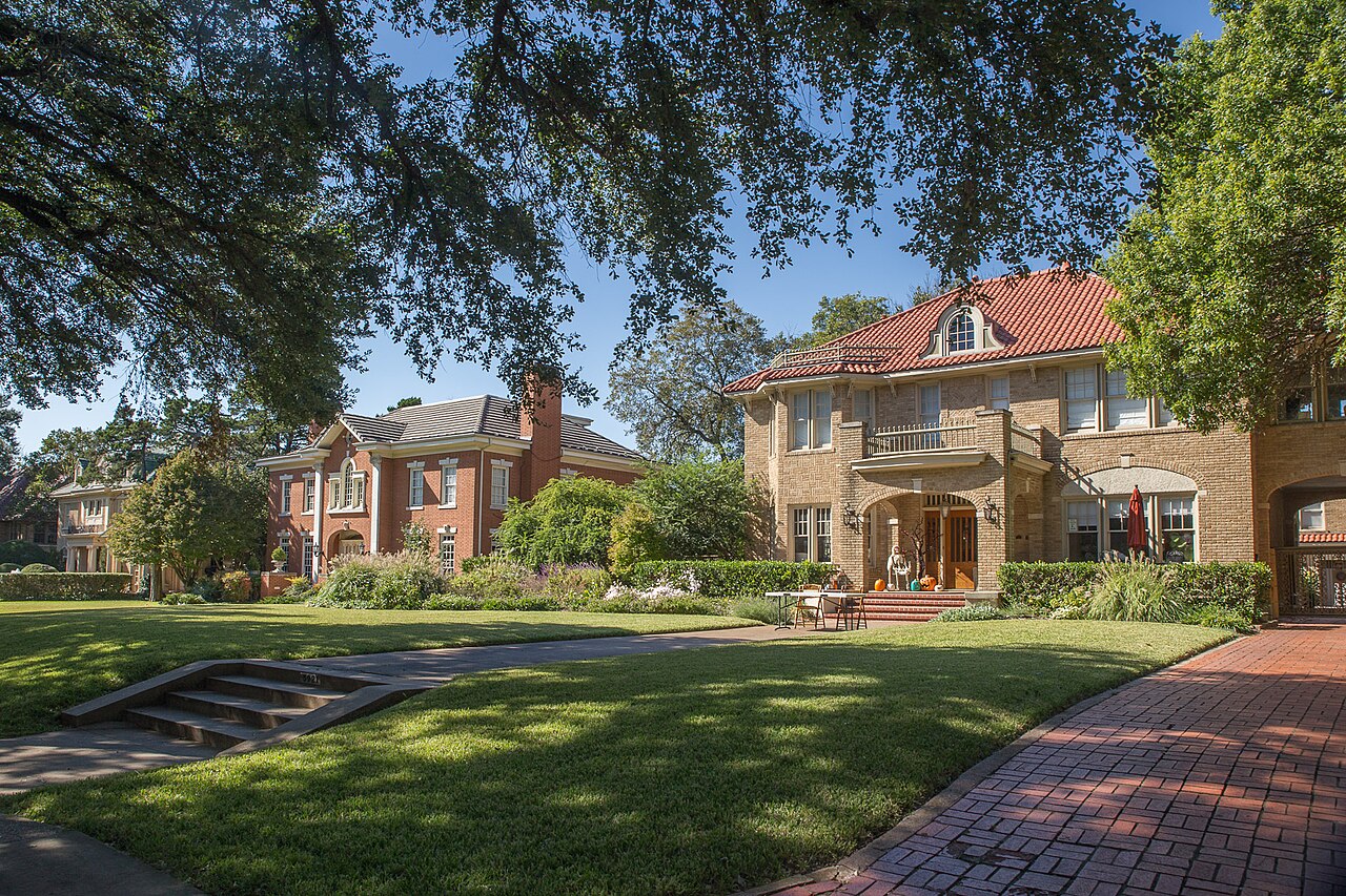
What the map does not show: how big or how old the recreation center is. Its own page says it was built in 1983 and expanded to 28,400 square feet in 2022, and the City's facilities layer still lists 13,219 square feet built in 1984. The photographs below are of Klyde Warren Park, Munger Place and the Bishop Arts District, elsewhere in the city.
Elsewhere in Dallas, not Hamilton Park



29 places, with real drive times
Road-adjusted distance and drive time from the centre of the community to each destination, nearest first. Filter by category.
Showing 1–12 of 29 places, nearest first.
Method: distances and drive times are computed from the population-weighted center of the civic league's 2020 census blocks, near Hamilton Park Pacesetter Magnet, using straight-line distance multiplied by a road factor and a tiered speed model: honest ranges, not routed times.
Every gym within reach
The Willie B. Johnson Recreation Center, just across Willowdell Drive, has a fitness center, an indoor gymnasium and a senior center, but it is open weekdays only. The Lake Highlands Family YMCA on Stults Road, to the southeast, has indoor and outdoor pools and opens at 5:30 a.m.
- Willie B. Johnson Recreation Center, 12225 Willowdell Drive: about 0.6 km, open to 8 p.m. Monday to Thursday
- Lake Highlands Family YMCA, 8920 Stults Road: about 2.1 km, with indoor and outdoor pools
- Lake Highlands North Recreation Center, 9940 White Rock Trail: about 6.0 km, open Saturday mornings, with a pool
| Facility | What it is | Drive |
|---|---|---|
| Willie B. Johnson Recreation Center open | The City's center at 12225 Willowdell Drive, in Hamilton Park just across the western boundary, expanded in 2022 to 28,400 square feet: a fitness center, an indoor gymnasium, a technology center, a senior center and a baseball field. Open 9 a.m. to 8 p.m. Monday to Thursday and 2 to 7 p.m. Friday; closed Saturday and Sunday. | 3–4 min |
| Lake Highlands Family YMCA open | The YMCA of Metropolitan Dallas branch at 8920 Stults Road, to the southeast: indoor and outdoor pools, a basketball court, pickleball, a weight room and a cycle studio. Open from 5:30 a.m. on weekdays. | 5–7 min |
| Churchill Recreation Center open | The City's center at 6906 Churchill Way, at Hillcrest Road west of Central Expressway, with a fitness center; closed on weekends. | 5–8 min |
| Lake Highlands North Recreation Center open | The City's center at 9940 White Rock Trail, with a gymnasium, a fitness center and a City community pool. Open Saturday mornings. | 9–13 min |
| Hamilton Park on Willowdell Drive open | Free: a tennis court, a softball field and trails in the City park beside the recreation center. | 1–2 min |
| Cottonwood Trail open | The free option for a longer walk or ride: the City's creekside trail at Central Expressway and Forest Lane. | 3–4 min |
The free option is the tennis court and trails in Hamilton Park, or the Cottonwood Trail south of Forest Lane.
Pacesetter for everyone, then three feeder patterns
Schools are the Richardson Independent School District's. In the study-area data behind its School Finder, the whole neighborhood is zoned to Hamilton Park Pacesetter Magnet on Towns Street, pre-K to grade 6, the campus whose Pacesetter magnet and desegregation program the Handbook dates to 1975. After that it splits: 1,011 of the 2,141 residents of 2020 go to Westwood Junior High and Richardson High, 576 to Apollo or Liberty Junior High and Berkner High, and 554 to Forest Meadow Middle and Lake Highlands High. The Texas Education Agency rated Pacesetter D, 67, for 2026, with 72.7% of its students economically disadvantaged; Richardson High A, 91; Berkner B, 86; Lake Highlands B, 88.
| School | Board | Note |
|---|---|---|
| Hamilton Park Pacesetter Magnet | Richardson Independent School District | 8301 Towns Street, inside the line, pre-K to grade 6. In the study-area data behind Richardson ISD's school finder it is the zoned elementary for all 208 acres and all 2,141 residents of 2020. It began as the addition's twelve-grade school, later a six-grade one by Wikipedia's account, and its Pacesetter magnet and desegregation program opened in 1975. The Texas Education Agency rated it D, 67, for 2026, with 582 students and 72.7% counted as economically disadvantaged. |
| Westwood Junior High School and Richardson High School | Richardson Independent School District | The largest of three feeder patterns inside the line: about 90 acres and 1,011 residents go on to Westwood Math, Science and Leadership Magnet on Arapaho Road (rated A, 91, for 2026) and Richardson High on Belt Line Road in Richardson (A, 91). |
| Apollo or Liberty Junior High and Berkner High School | Richardson Independent School District | About 66 acres and 576 residents, for which the data names both Apollo Junior High in Richardson (B, 85) and Liberty Junior High STEM Academy on Lawler Road (D, 69), then Berkner High on Spring Valley Road (B, 86). |
| Forest Meadow Middle School and Lake Highlands High School | Richardson Independent School District | About 53 acres and 554 residents, zoned to Forest Meadow Middle on Whitehurst Drive, grades 6 to 8 (B, 80), and Lake Highlands High on Church Road (B, 88). |
Check the exact address with Richardson ISD's School Finder before you commit. The data behind it is filed under 2024-25 and these study areas were last edited in 2021, and one of the three patterns names two junior highs without saying how a family is sorted between them.
Month by month, what living here looks like
Not a highlights reel: the actual annual rhythm, including the dates residents have to remember.
- The appraisal district values every house as of 1 January, and last year's tax bill is due by 31 January; a bond election in January 1953 approved clearing Black neighborhoods for Love Field, the year the land here was bought
- Highs near 14 °C at Love Field, with about nine nights at or below freezing on the 1991 to 2020 normal
- The Forest Green Branch Library on Greenville Avenue, the nearest branch, opened on 28 February 1976
- Highs near 17 °C and 71 mm of rain
- The Cottonwood Trail runs along Cottonwood Creek from Central Expressway and Forest Lane, a short walk from the neighborhood's southern tip
- Highs near 21 °C and 88 mm of rain as the spring storms begin
- The general deadline to apply for a homestead exemption is before 1 May; on a house at Zillow's ZIP code figure it is worth about $2,600 a year across the five units
- Highs near 25 °C and lows near 14 °C
- Hamilton Park formally opened in May 1954; 15 May is the deadline to protest the appraisal district's value, or 30 days after the notice if that is later
- 116 mm of rain on the normal, the wettest month but one
- There is no City pool inside the line; the Lake Highlands Family YMCA on Stults Road has indoor and outdoor pools, and the nearest City community pools are at Fretz Park and Lake Highlands North
- Highs near 34 °C, with about 22 days reaching 32 °C (90 °F)
- Forest Lane and LBJ/Central stations opened on 1 July 2002; the second 66 acres of today's civic league area were annexed on 18 July 1955
- Highs near 36 °C and 43 mm of rain, the driest month, with about 28 days reaching 32 °C
- Ordinance 5909 brought about two thirds of the neighborhood inside the city limits on 24 August 1953, two months before the dedication
- The hottest month: highs near 36 °C and about 10 days reaching 38 °C (100 °F) at Love Field
- The Texas Education Agency's 2026 ratings, updated in September, gave Hamilton Park Pacesetter Magnet D (67); the Forest Green branch's current building opened on 25 September 2021
- The taxing units adopt their 2026 rates; highs near 32 °C and 79 mm of rain
- The addition was dedicated in October 1953, two years after the Dallas Citizens' Interracial Association was established in October 1951
- 122 mm of rain at Love Field, the wettest month on the normal
- The Willie B. Johnson Recreation Center, with its indoor gymnasium, senior center and technology center, is open weekdays only and closed on major holidays
- Highs near 20 °C, with about two nights at or below freezing
- A buyer who closed this year and has not filed for a homestead exemption has until before 1 May of next year; the prorated exemption for the year of purchase applies only if the seller had none
- Highs near 15 °C and six or seven nights at or below freezing on the normal
4 more photographs of Dallas and the region
Drawn from the site's shared, freely licensed Dallas photo library, not photographs of Hamilton Park itself. Filter by category.


Showing 1–4 of 4 photographs.
About these photographs. Openly licensed images from the site's shared Dallas library, found on Wikimedia Commons and served from there with full attribution. None of them is presented as a photograph of Hamilton Park.