
Live in Killarney/Glengarry
A 1906 bungalow grid rebuilding lot by lot since 2002, with the West LRT's underground Westbrook station on its own doorstep and a long-vacant school site beside it.
Killarney/Glengarry's first subdivision plan was registered in 1906 and the land was formally annexed by the City in 1910, filling out after the Second World War with hundreds of small stucco and clapboard bungalows. At the 2021 census it held 7,920 residents in 3,620 private households across 1.8 km², 40 per cent of them renting, with a median household income of $99,000 in 2020, a shade above the city's $98,000. Only 26 per cent of its occupied dwellings are still single-detached houses, and a quarter of them have gone up since 2011: the infill is doing exactly what it looks like it is doing. The Killarney Aquatic & Recreation Centre anchors the interior, and Westbrook station, Calgary's first underground CTrain station, sits on the community's northern edge on the site of the Ernest Manning High School that closed in June 2011.
A 1906 bungalow grid rebuilding itself one lot at a time
Bounded by 17 Avenue SW to the north, 37 Street SW to the west, Richmond Road SW to the south, and 25A Street SW to the east. Ward 8, in the City's Centre sector.
Killarney's first subdivision plan was registered in 1906, but the community didn't fill in until after the Second World War, when developers put up hundreds of small stucco and clapboard bungalows. At the 2021 census: 1.8 km², 7,920 residents in 3,620 private households, with 40% of households renting and a median household income of $99,000 in 2020, a shade above the city's $98,000.
The infill era. Since roughly 2002, those original bungalows have been coming down in a steady, piecemeal way: one lot, then the next, rather than a single coordinated redevelopment. The result is a streetscape where a mid-century original and a 2020s infill sit shoulder to shoulder on the same block, block after block. The census puts numbers on it: 23% of occupied dwellings date from 1960 or before, 24% from 2011 or later, and only 26% of the stock is still single-detached.
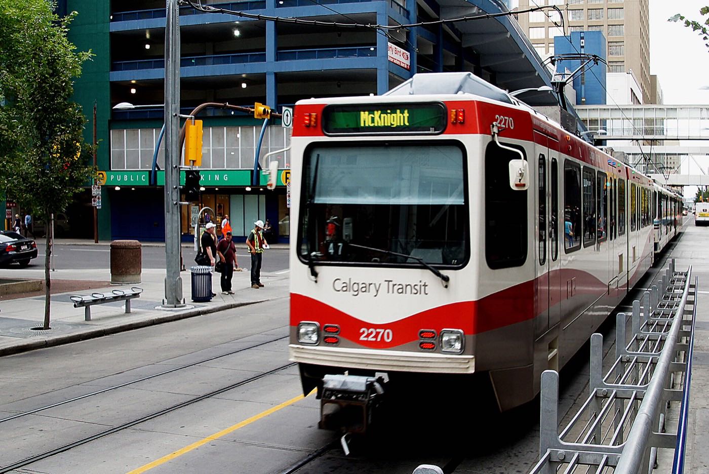
Westbrook's unfinished business. Westbrook station, Calgary's first operational underground CTrain station, opened on 10 December 2012 beside 33 Street SW, on land that had held Ernest Manning High School until it closed that June and a Petro-Canada service station that closed in 2009. The replacement Ernest Manning opened 3.5 km away near 69 Street station in September 2011. Whatever eventually goes up next to the station will be Killarney's biggest change since the LRT itself arrived; this guide could not open a publisher describing the current plan, so it makes no prediction about it.
What holds it together. The Killarney Aquatic & Recreation Centre at 1919 29 St. S.W. is a genuine neighbourhood anchor: pool, dive tank, teaching pool, hot tub, steam room, weights and cardio and a fitness studio. The community association, registered in 1950, runs its hall at 2828 28 Street SW and the fitness and community programmes inside it. Neither the association nor the Federation of Calgary Communities lists an outdoor rink, so do not count on one.
- 23% of occupied dwellings date from 1960 or before and 24% from 2011 or later, often on the same block: condition varies enormously
- The Westbrook station lands are an open question, and no publisher this guide could open describes the current plan for them
- 40% of households rent and a third are one person: real annual turnover
- 17 Avenue and Westbrook Mall parking gets tight on weekends and during Stampede
- Ongoing infill construction means noise, dust and street parking pressure on many blocks
How Killarney/Glengarry got here
- 1906The first subdivision plan for Killarney is registered.
- 1910The land is formally annexed by the City of Calgary.
- 1950The Killarney-Glengarry Community Association is registered as a provincial society on 21 September. Its hall at 2828 28 Street SW carries a main hall seating 184, meeting rooms, a kitchen and a lounge.
- 1950sPost-war development fills the grid with hundreds of small stucco and clapboard bungalows, after the one-storey clapboard houses of the early 1900s.
- 2002Infill redevelopment begins replacing older structures on a piecemeal basis. A quarter of the community's occupied dwellings now date from 2011 or later.
- 2011Ernest Manning High School closes in June on its original campus north of the community. A new school of the same name opens that September, 3.5 km away near 69 Street station.
- 2012The West LRT opens on 10 December, with Westbrook station beside 33 Street SW between Bow Trail and 17 Avenue SW: Calgary's first operational underground CTrain station, 4 km from the 7 Avenue and 9 Street SW interlocking, built on the old high school site and a Petro-Canada station that closed in 2009.
- 2021The federal census counts 7,920 residents in 3,620 private households, 40 per cent renting, with a median household income of $99,000 in 2020.
The pool, the hall, and the community's own green space
The Killarney Aquatic & Recreation Centre at 1919 29 St. S.W. anchors the interior with a pool, dive tank, teaching pool, hot tub, steam room, weights and cardio and a fitness studio. The Killarney-Glengarry Community Association hall at 2828 28 Street SW seats 184 and rents at $99 an hour, with fitness and ongoing programmes run out of it.
What the map does not show: the community's green space is not documented by any publisher this guide could open. Walk it before you assume what is described anywhere online is what is actually built.
Elsewhere in Calgary, not Killarney/Glengarry



15 places, with real drive times
Road-adjusted distance and drive time from the centre of the community to each destination, nearest first. Filter by category.
Showing 1–12 of 15 places, nearest first.
Method: distances and drive times are estimated from the centre of the community to each destination using Calgary's road grid, and are rounded to honest ranges rather than presented as precise figures. The West LRT gives this community a genuine transit option that several of its neighbours don't have.
Every gym within reach
The Aquatic Centre is the community's one large facility. Everything else within easy reach is either a golf course, a commercial club near Westbrook Mall, or the community association's own hall programmes.
- Pool, dive tank, teaching pool, hot tub, steam room, weights and cardio, a fitness studio and a universal change room
- Shaganappi Point Golf Course covers the shoulder seasons, east of the community
- Commercial clubs cluster around Westbrook Mall
- Mount Royal publishes no recreation page this guide could open, so treat its facilities as unconfirmed
| Facility | What it is | Drive |
|---|---|---|
| Killarney Aquatic & Recreation Centre open | The anchor facility, city-run at 1919 29 St. S.W.: pool, dive tank, hot tub, teaching pool, steam room, weights and cardio, a fitness studio and a universal change room. | 3–5 min |
| Shaganappi Point Golf Course open | City golf east of the community. No publisher this guide could open confirms the hole count. | 5–7 min |
| Westbrook-area commercial gyms open | Commercial clubs around Westbrook Mall. No publisher lists them by name, so treat this as a category rather than a booking. | 2–4 min |
| Mount Royal University Recreation open | Mount Royal publishes no recreation page this guide could open. Treat the facilities and any public membership as unconfirmed. | 8–12 min |
| Killarney-Glengarry Community Association open | The association's hall at 2828 28 Street SW seats 184 and rents at $99 an hour, with a 20 per cent member discount, and it runs fitness and ongoing programmes. Neither the association nor the Federation lists an outdoor rink, so do not count on one. | 1–2 min |
Confirm current hours directly: city recreation centres adjust schedules seasonally and around maintenance closures.
Two schools inside, both under 1 km of each other
The board lists the public school here as Killarney School; it runs a Montessori programme and extra support for English language learners, developing writers and Resource students. Holy Name Elementary carries the Catholic bilingual side. Wikipedia places both inside the community; neither page prints a grade range.
| School | Board | Note |
|---|---|---|
| Killarney School | Calgary Board of Education | The public school inside the community, listed by the board as Killarney School rather than Killarney Elementary. It runs a Montessori programme and extra support for English language learners, developing writers and students needing Resource support, and does not print a grade range. |
| Holy Name Elementary School | Calgary Catholic School District | Wikipedia places this bilingual separate-board elementary inside the community. The district's site refuses automated clients, so nothing here was read from it, and the claim that it serves over fifty southwest communities could not be sourced. |
| A.E. Cross and Vincent Massey | Calgary Board of Education | Wikipedia lists both junior highs as adjacent to Killarney rather than as its designated schools. No board page this guide could open prints an attendance area, so confirm the designation for a specific address. |
| Ernest Manning High School | Calgary Board of Education | The original campus north of the community closed in June 2011, and a new school of the same name opened that September 3.5 km away near 69 Street station. Wikipedia says the school serves the area; no board page prints the attendance area. |
Alberta funds Catholic education the same way it funds public education, so there is no tuition for a resident student at either board. Confirm the current designation for a specific address before you buy: no board page this guide could open prints an attendance area, Wikipedia lists A.E. Cross and Vincent Massey only as adjacent junior highs, and nothing here was read from the Calgary Catholic School District, whose site refuses automated clients.
Month by month, what living here looks like
Not a highlights reel: the actual annual rhythm, including the dates residents have to remember.
- The Killarney pool's steam room and teaching pool carry the coldest weeks
- Westbrook Station's underground platform stays warmer than the bus stops feeding it
- The Aquatic Centre's dive tank pool deck fogs over on the coldest mornings
- Stucco-and-clapboard originals along the grid show their age in the January heating bill
- A chinook can clear 17 Avenue's shop-front snowbanks in an afternoon
- Shaganappi Point's fairways sit under snow, silent until the reopening
- The coldest week of the year often lands here rather than in January
- The community garden beds south of the Aquatic Centre stay frozen and empty
- Meltwater runs off Westbrook Mall's roofline into the vacant LRT lands beside it
- Greenskeepers walk Shaganappi Point assessing winterkill ahead of the season
- Cleats are the right footwear on the grid's shaded sidewalks
- Infill crews restart work on the community's 25- and 50-foot lots
- Shaganappi Point reopens for the season, fairways filling on the first mild weekend
- The community garden beds are turned and planted for the year
- 17 Avenue's sidewalk patios expand block by block
- Last hard frosts pass before the grid's oldest lots go back under construction
- Tee times at Shaganappi Point book out days ahead on the first warm weekends
- West LRT evening ridership through Westbrook climbs with the longer light
- The community's post-war ash and spruce canopy fills back in
- Long evenings put the 17 Avenue strip back in daylight past 9pm
- School lets out and Killarney Elementary's playground empties into the grid
- Shaganappi Point's tee sheet runs solid from dawn to dusk
- 17 Avenue's patios run at full capacity most evenings
- Thunderstorms building over the foothills are visible from the Westbrook Station plaza
- Stampede riders fill Westbrook Station's platform for the run downtown
- 17 Avenue's strip turns into one of the loudest stretches in the inner southwest
- Post-war bungalow stock without air conditioning gets genuinely uncomfortable on the hottest days
- The Aquatic Centre's outdoor deck and dive tank see their heaviest use of the year
- Shaganappi Point sees its peak play before the school-return rush
- Westbrook Mall's back-to-school traffic fills the lot
- Renters start touring in earnest for September leases across the grid
- The community garden's harvest comes in before the first cool nights
- September's lease turnover moves trucks through the grid's narrow lots
- Killarney Elementary's morning drop-off thickens 26 Avenue's side streets
- Shaganappi Point's late-season rates start once the school run returns
- Westbrook Station's morning platform crowds thicken again after summer's lull
- Peak colour runs through the grid's mature post-war street trees
- Shaganappi Point shuts down for the year on the first hard frost
- The association's autumn fitness programmes restart at the hall on 28 Street SW
- Snow tires go on before the first real snowfall sticks
- Indoor recreation shifts to the Killarney Aquatic & Recreation Centre for the season
- Westbrook Mall's holiday displays go up along the parking court
- The vacant Westbrook Station lands sit quiet under the season's first real snow
- Rental turnover slows once the September leases have settled in
- A chinook arch over Shaganappi Point can flip a −20 morning into a +5 afternoon
- Holiday lights along 17 Avenue's strip are visible from the grid's northern blocks
- The community hall's holiday bookings fill through the last two weeks of the year
- West LRT ridership through Westbrook drops as downtown empties out
3 more photographs of the community and its surroundings
All freely licensed, via Wikimedia Commons. Filter by category.


Showing 1–3 of 3 photographs.
About these photographs. Openly licensed images geotagged in or near Killarney/Glengarry, found on Wikimedia Commons and served from there with full attribution. Inline photos elsewhere on the page may still come from the site's shared Calgary library.